Cottrell Corners, New Jersey
| Cottrell Corners, New Jersey | |
|---|---|
| Unincorporated community | |
|
Intersection of CR 516 and Cottrell Road | |
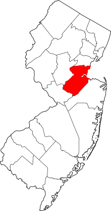
 Cottrell Corners, New Jersey  Cottrell Corners, New Jersey  Cottrell Corners, New Jersey Location of Cottrell Corners in Middlesex County Inset: Location of county within the state of New Jersey | |
| Coordinates: 40°24′11″N 74°17′46″W / 40.40306°N 74.29611°WCoordinates: 40°24′11″N 74°17′46″W / 40.40306°N 74.29611°W | |
| Country |
|
| State |
|
| County | Middlesex |
| Township | Old Bridge |
| Elevation[1] | 95 ft (29 m) |
| GNIS feature ID | 875665[1] |

Cottrell Corners is an unincorporated community located within Old Bridge Township in Middlesex County, New Jersey, United States.[2] Located at the corner of Old Bridge-Matawan Road (County Route 516) and Cottrell Road, the area is named for the Cottrell Family who owned an apple farm at the crossroads since before the United States was founded.[2][3] Though the last parcel of the farmland had originally been sold to a developer in 2002, the Middlesex County Freeholder Board purchased the property and intends to preserve it.[3] In addition to the farm, the area contains stores, a townhouse development, and is the seat of the Old Bridge municipal offices and library.[2]
References
- 1 2 "Cottrell Corners". Geographic Names Information System. United States Geological Survey.
- 1 2 3 Google (August 11, 2015). "Cottrell Corners, New Jersey" (Map). Google Maps. Google. Retrieved August 11, 2015.
- 1 2 Haydon, Tom (August 17, 2010). "Middlesex County, Old Bridge to spend $10.6M to preserve 58 acres as open space". NJ Advance Media for NJ.com. Retrieved August 11, 2015.