Moerls Corner, New Jersey
| Moerls Corner, New Jersey | |
|---|---|
| Unincorporated community | |
 | |
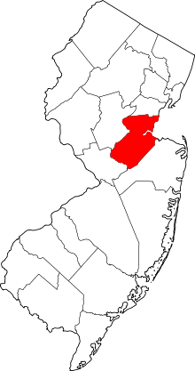
 Moerls Corner, New Jersey  Moerls Corner, New Jersey  Moerls Corner, New Jersey Location of Moerls Corner in Middlesex County Inset: Location of county within the state of New Jersey | |
| Coordinates: 40°21′38″N 74°19′03″W / 40.36056°N 74.31750°WCoordinates: 40°21′38″N 74°19′03″W / 40.36056°N 74.31750°W | |
| Country |
|
| State |
|
| County | Middlesex |
| Township | Old Bridge |
| Elevation[1] | 92 ft (28 m) |
| GNIS feature ID | 878425[1] |
Moerls Corner or Moerle Corner is an unincorporated community located within Old Bridge Township in Middlesex County, New Jersey, United States.[2] The intersection for which the corner is named is at Marlboro Road and Texas Road (which carries County Routes 520 and 690). The eastern quadrant of the intersection contains condominium units while the other three quadrants are sparsely-populated forest.[3]
References
- 1 2 "Moerls Corner". Geographic Names Information System. United States Geological Survey.
- ↑ Locality Search, State of New Jersey. Accessed February 10, 2015.
- ↑ Google (March 31, 2016). "Aerial view of Moerls Corner" (Map). Google Maps. Google. Retrieved March 31, 2016.
This article is issued from Wikipedia - version of the 6/9/2016. The text is available under the Creative Commons Attribution/Share Alike but additional terms may apply for the media files.