Shaw, Washington, D.C.
| Shaw, Washington, D.C. | |
|---|---|
| Neighborhood of Washington, D.C. | |
|
The Phillis Wheatley YWCA, built in 1920, is listed on the National Register of Historic Places | |
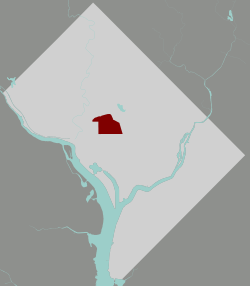 Shaw within the District of Columbia | |
| Country | United States |
| District | Washington, D.C. |
| Ward | Wards 1, 2, and 6 |
| Named for | Robert Gould Shaw |
| Government | |
| • Councilmember |
Brianne Nadeau (Ward 1) Jack Evans (Ward 2) Charles Allen (Ward 6) |
| Area | |
| • Total | .73 sq mi (1.9 km2) |
| Population (2010) | |
| • Total | 17,639 |
| • Density | 24,163.0/sq mi (9,329.4/km2) |

Shaw is a small neighborhood located in the Northwest quadrant of Washington, D.C. Named after Shaw Junior High School, a black junior high school located at Seventh and Rhode Island Avenue NW, the Shaw neighborhood has been home to the largest urban population of African-Americans in Washington, D.C. since the 1920s. Shaw, centered around U Street NW, has been the hub for African-American social, cultural, and economic progress in the nation's capital, seeing on its own streets, Martin Luther King, Jr., Malcolm X, and many riots, marches, and protests that fought to achieve racial equality in Shaw and the entirety of America.[1]
Geography
Shaw is bounded by M Street NW and Massachusetts Avenue NW to the South; New Jersey Avenue NW to the East; Florida Avenue NW to the North; and 11th Street NW to the West. The area also includes the U Street Corridor, which is the commercial hub of the Shaw, that extends westward to 16th Street NW.[2]
Florida Avenue marks the northern boundary with the adjacent neighborhoods of Columbia Heights and LeDroit Park. The area consists of gridded streets lined with small Victorian row houses. Howard University is located in the Pleasant Plains neighborhood, just north of Shaw. Shops and theatres are located along U Street and centered along 7th Street NW, the original commercial hub of the area prior to the redevelopment in the wake of the 1968 riots and Green Line Metrorail construction.
Shaw continues its historical identity as a community supporting social and cultural development (new housing options and many new restaurants) and as a home for several demographic groups, including a wide range of ethnicities and a growing youth population. This continued growth in diversity has led to the recognition of communities within the community by both Shaw residents and visitors. For example, Logan Circle, Truxton Circle, Randolph Square and other neighborhoods east of 16th St. are often referenced by their specific names.
History
Shaw emerged from freed slave encampments in the rural outskirts of Washington, D.C. It was originally called "Uptown," in an era when the city's boundary ended at "Boundary Street" (now Florida Avenue).[3] In the Urban Renewal Era, the neighborhood became known as Shaw because the neighborhood Junior High School was named after the commander of the 54th Massachusetts Volunteer Infantry, Civil War Colonel Robert Gould Shaw.[4]
The neighborhood thrived in the late 19th and early 20th centuries as the pre-Harlem center of African American intellectual and cultural life. During this time, President Andrew Johnson signed Howard University’s founding charter.[5] Furthermore, in 1925, Professor Alain LeRoy Locke advanced the idea of "The New Negro”[6] while Langston Hughes descended from LeDroit Park to hear the "sad songs" of 7th Street. Another famous Shaw native to emerge from this period—sometimes called the Harlem Renaissance—was Duke Ellington.[7]
Following the assassination of Martin Luther King, Jr. on April 4, 1968, riots erupted in many D.C. neighborhoods, including Shaw, Columbia Heights, and the H Street, NE corridor.[8] The 1968 Washington, D.C. riots marked the beginning of a decline in population and development that condemned much of the inner city to a generation of economic decay.[9] After the riots, Shaw was left without electricity and with burnt down buildings. Crime and fear increased.[10] Succeeding the riots, Shaw civic leaders Walter Fauntroy and Watha T. Daniel led grassroots community renewal projects with the Model Inner City Community Organization (MICCO). MICCO used federal grant money to employ African American architects, engineers, and urban planners in inner-city Washington D.C.[11]
Shaw is a residential neighborhood dominated by 19th century Victorian row houses. The architecture of these houses, Shaw's central location, and the stability of D.C.'s housing market have transformed the neighborhood through gentrification.[12] Gentrification beginning in the late 1970s and early 1980s generated new discussions between the inhabitants of the Shaw neighborhood and the Dupont Circle Conservancy organization. Preservation advocates in the Dupont Circle neighborhood began to propose the expansion of the neighborhood. The advocates were members of the Dupont Circle Conservancy, an organization predominantly led by white people. As a response to this proposal, the 14th and U Street Coalition, which called itself the representative of African-American interests and historical identity in neighboring Shaw, began protesting that the Dupont Circle preservationists were trying to occupy their neighborhood and its history.[13]
Discussions as such still have present day implications. Gentrification in the 2010s is transforming the neighborhood into an upscale retail hub.[14] But the mix of upscale newcomers and very poor, long-time residents have been linked to social implications that vary from cultural to political within the community. In Shaw, wealthy newcomers and lower class, long-term residents have shown differences in tastes, preferences, and values. Gentrification has also brought about a greater spectrum of political views in Shaw. Because the population has become more diversified, an influx of differing views, ideas, and outlooks has become more prominent.[15] The newcomers seek to renew and refresh the neighborhood. They want Shaw to prosper and surpass its racial difficulties. On the other hand, older residents cannot forget their past, since they consider their history essential for their neighborhood’s character and identity. An example can be the great amount of security installed in the neighborhood after the 1968 riots in certain establishments and public areas. These are the same areas newcomers walk around in, unaware of what happened there in the past.[16]
Infrastructure and landmarks
Public transportation

Shaw neighborhood is served by Shaw-Howard University Metro System, nearby U Street and Mount Vernon Square Metro stations. There is a bus service within Shaw, which has several routes that connects the area with the Waterfront and Silver Spring via 7th Street. Also, the G2 bus connects Georgetown University and Howard University. Freeway access allows cars to maneuver through the streets of Shaw.[17] Transit Score Methodology, which is a patented measure of how well a location is served by public transit on a scale from 0 to 100, measures the Shaw neighborhood with a score of 80. A score of 80 concludes that Shaw has "excellent transit", meaning transit is convenient for most trips. The White House, via public transit, is on average 10 minutes away from Shaw. Reagan National Airport, via public transit, is on average 28 minutes away from Shaw. Dulles International Airport, via cab, is on average 40 minutes away from Shaw.[18]
Cultural institutions
Shaw's neighborhood offers different cultural landmarks consisting of:
- Ben's Chili Bowl, staying open during the 1968 riots, Ben's Chili Bowl continues to host customers and serve local residents.[19]
- Lincoln Theatre , originally opened in 1922 as one of the largest integrated movie houses and ballrooms, it closed due to race-related riots in 1968. Later it was reopened in 1994 after being renovated and placed on the National Register of Historic Places in 1993, it continues to host performances and events today.[20]
- Howard Theatre , owned by Abe Lichtman, a white owner of theaters that catered to African Americans, it was billed the "largest color theater in the World" in the 70's. After restoration, it still hosts artists and performers in today's entertainment industry.[21]
- Dunbar Theater , currently know as the Southern Aid Society, the Dunbar Theater holds nearly 350 seats and was a popular venue for live entertainment, including many jazz and blues artists as well as movies. Originally opening in the 1920's, it was added to the National Register of Historic Places in 1968, shortly after closing in 1960.
- Whitelaw Hotel , served well-known entertainers who were performing near U Street as well as African American visitors drawn to Washington for meetings of national black organizations, all of whom were unable to rent rooms in the city's luxury hotels because of discrimination and segregation. The Hotel was built by the same Architect of the Southern Aid Society in 1919, later being added to the National Register of Historic Places as well.[22]
- CityMarket at O (named " O Street Market" until 2008) is a Gothic Revival historic landmark, being one of the three public market buildings from 19th century in DC; it won several awards for its design;
- the Shiloh Baptist Church , originally located in Fredericksburg (VA), plays an active part in helping, spiritually and economically, the Shaw's community. President Barack Obama and his family attended its Easter Sunday mass in 2011;[23]
- The Watha T. Daniel/Shaw Neighborhood Library is a three-level library of which design was renovated in 2010 and received several awards for its excellence; it was also named as one of the top buildings of 2010 by Wall Street Journal;[24]
- the Thurgood Marshall Center is a community center that displays and preserves the stories of African American leaders and communities that faced discrimination through history; it is also a historic structure originally named Twelfth Street YMCA Building and used to be the office of the first African American YMCA;
- the Walter E. Washington Convention Center, whose north portion is located in Shaw, has 703,000 square feet of exhibition space: it has hosted several official events including some hosted by President Barack Obama. It is also famous for its eco-friendly features. From 2017 to 2024, the WEWCC will be hosting Otakon.[25]
Demographics
| Historical population | |||
|---|---|---|---|
| Census | Pop. | %± | |
| 1950 | 34,208 | — | |
| 1960 | 25,749 | −24.7% | |
| 1970 | 19,994 | −22.4% | |
| 1980 | 15,901 | −20.5% | |
| 1990 | 15,044 | −5.4% | |
| 2000 | 14,997 | −0.3% | |
| 2010 | 17,639 | 17.6% | |
Shaw has grown dramatically since the mid-to-late 20th century, with a 2010 population of 17,639. In 1950, the area's population had reached over 34,000 people, around double its current level.[26] Like many neighborhoods throughout Washington, D.C., Shaw hit a population low point in the 1980s and 1990s, rebounding considerably at the turn of the 21st century.[27] The lack of investment and limited power in the area created a barrier in the neighborhood’s development and urbanization during the early 1800’s. Further growth was hindered by increasing racial tensions as more African-Americans settled in the region; by the 1850's, Washington D.C. had the largest African-American population of any city in the United States. The increasing costs of housing also decreased the availability of affordable housing, generating further racial tensions citywide and neighborhood segregation.[28] One such neighborhood was Shaw, which continues to be populated by many African-Americans, but also Shaw is now experiencing an increase prices. The current forecast for the price of housing expects a steady increase of about 2.5% over the few years, which could lead to further displacement among the black community and a phenomenon known as root shock.[29] According to the latest census of the Logan Circle/Shaw area, majority (71%) of residents is single, college-educated (67%) and has a median income of $84,875.[30]
As of 2015, Shaw’s population has reached 12,901 individuals, a significant decrease from the population recorded in the 1950’s as around 34,000 people. A historically black neighbourhood, Shaw’s population today remains around 50% black. Even so, Shaw has become more differentiated and multicultural. Statistics show that 30% people living in Shaw are white, 11% are Hispanic and 7% are Asian.[31]
The majority of residents in Shaw are between the ages of 22 and 39; they constitute 44.5% of the population. This is greater than the average District of Columbia percentage of 34.5% for this age group. Children between the ages of 0-17 make up 15.4% of the population. The percentages of genders within each age group is generally equal except for 85+ which has 94.4% female to only 5.6% male and 20 year olds which is 84.9% female to 15.1% male.[32]
Little Ethiopia
Since the 1980s, Ethiopian-born business owners have been purchasing property in the neighbourhood of Shaw, specifically Thirteenth and Ninth Streets.[33] The area has since gained distinctive popularity in Washington even outside of the Ethiopian community. According to restaurant owner Tefera Zwedie: "I remember it was if I'm not mistaken somewhere between 2000, 2001 it was something big for us to see one non-Ethiopian coming to the restaurant. Now 95 percent of them are non-Ethiopian." The food has become a main attraction and reason for locals and tourists to commute to Shaw and experience the many local Ethiopian restaurants.This influx of Ethiopians has revitalized the area, prompting members of the Ethiopian American community to lobby the city government to officially designate the block as "Little Ethiopia". Although no legislation was proposed, Shaw residents have expressed opposition to the idea, concerned that such a designation would isolate that area from the historically African-American Shaw.[34]
Education
District of Columbia Public Schools operates public schools.
District of Columbia Public Library operates the Watha T. Daniel/Shaw Community Library.[35]
References
- ↑ Smith, Kathryn S. (1997-01-01). "Remembering U Street". Washington History. 9 (2): 28–53.
- ↑ Ninth Street Business and Property Owners Asociation (06/19/2001). D.C. Shaw community et al.: expand your mind through fresh experiences, visit our Shaw community et al. (Map) (Print). 1:4,750. Library of Congress: Ninth Street Business and Property Owners Asociation.
- ↑ D.C. zone unit loses its fight on apartment. (1937, Jan 05). The Washington Post (1923-1954) Retrieved
- ↑ D.C. Neighborhood Names Rekindle History: Neighborhood Names Are Clues to Past By Linda Wheeler Washington Post Staff Writer. The Washington Post (1974-Current file) [Washington, D.C] 20 Oct 1983: C1
- ↑ Howard University: A Vital Place A S DOC YOUNG Special To The Sentinel. Los Angeles Sentinel (1934-2005) [Los Angeles, Calif] 06 Sep 1990: A4.
- ↑ Prof. Locke To Return To Howard Next Term The Pittsburgh Courier (1911-1950), City Edition [Pittsburgh, Pa] 09 July 1927: 11.
- ↑ The Riots: Fifteen Years Later: Civic Leaders Cite Changes Since Riots By LaBarbara Bowman and Kenneth Bredemeier Washington Post Staff Writers. The Washington Post (1974-Current file) [Washington, D.C] 04 Apr 1983: D1
- ↑ The Riots: Fifteen Years Later: Civic Leaders Cite Changes Since Riots By LaBarbara Bowman and Kenneth Bredemeier Washington Post Staff Writers. The Washington Post (1974-Current file) [Washington, D.C] 04 Apr 1983: D1
- ↑ By Robert L Asher and Robert G Kaiser Washington Post,Staff Writers. (1968, Dec 29). Broken promises line riot area streets. The Washington Post, Times Herald (1959-1973) Retrieved
- ↑ The Lights Are Still Out From Riots: First in a Series Washington Post Staff Writers; By Claudia Levy and Leonard Downie Jr.. The Washington Post, Times Herald (1959-1973) [Washington, D.C] 05 Apr 1970: A1
- ↑ "Oxford AASC: Home". www.oxfordaasc.com. Retrieved 2016-12-01.
- ↑ Schwartzman, Paul (2006-02-23). "A Bittersweet Renaissance". The Washington Post. ISSN 0190-8286. Retrieved 2016-12-01.
- ↑ Logan, Cameron (2012-01-01). "Beyond a Boundary: Washington's Historic Districts and Their Racial Contents". Urban History Review / Revue d'histoire urbaine. 41 (1): 57–68.
- ↑ "What a new shopping hub in D.C. shows us about the future of retail". Washington Post. Retrieved 2016-12-01.
- ↑ Hyra, Derek. "The Back-to-the-City Movement: Neighbourhood Redevelopment and Processes of Political and Cultural Displacement." Urban Studies 52 (August 2015): 1753-1775.
- ↑ Carol, Morello. "Through teenagers' eyes, a fresh view of the new - and old - Shaw." Washington Post, The June 0007: Regional Business News. Web. 30 Nov. 2016.
- ↑ whiteside@acm.org. "Where We Live: Shaw". We Love DC. Retrieved 2016-12-01.
- ↑ "Shaw, Washington DC Guide - Airbnb Neighborhoods". Airbnb. Retrieved 2016-12-01.
- ↑ "About Us – Ben's Chili Bowl". benschilibowl.com. Retrieved 2016-12-01.
- ↑ Smith, Kathryn S. (1997-01-01). "Remembering U Street". Washington History. 9 (2): 28–53.
- ↑ "Howard Theatre: A history". Greater Greater Washington. Retrieved 2016-12-01.
- ↑ "Whitelaw Hotel, African American Heritage Trail - www.culturaltourism.org". www.culturaltourismdc.org. Retrieved 2016-12-01.
- ↑ "Shiloh Baptist Church DC". www.shilohbaptist.org. Retrieved 2016-12-01.
- ↑ "New Shaw (Watha T. Daniel) Library". District of Columbia Public Library. Retrieved 2016-12-01.
- ↑ http://www.dcconvention.com/Venues/ConventionCenter.aspx
- ↑ "Government Census".
- ↑ "Government Census".
- ↑ "The History of Washington, DC". Washington.org. 2016-03-15. Retrieved 2016-12-01.
- ↑ Inc., Zillow,. "Shaw Washington DC Home Prices & Home Values | Zillow". Zillow. Retrieved 2016-12-01.
- ↑ "Real Estate Overview for Logan Circle/ Shaw, Washington, DC - Trulia". www.trulia.com. Retrieved 2016-12-01.
- ↑ "Race and Ethnicity in Shaw, Washington, District of Columbia (Neighborhood) - Statistical Atlas". statisticalatlas.com. Retrieved 2016-12-01.
- ↑ "Age and Sex in Shaw, Washington, District of Columbia (Neighborhood) - Statistical Atlas". statisticalatlas.com. Retrieved 2016-12-01.
- ↑ David, Nieves, Angel (2008-06-15). "Revaluing Places: Hidden Histories from the Margins". Places. 20 (1). ISSN 0731-0455.
- ↑ Showalter, Mistry. "Inside Washington D.C.'s 'Little Ethiopia'" CNN. Cable News Network, 22 Oct. 2010. Web. 12 Oct. 2016
- ↑ "Hours & Locations." District of Columbia Public Library. Retrieved on October 21, 2009.
External links
| Wikimedia Commons has media related to U Street/Shaw. |
| Wikimedia Commons has media related to Shaw, Washington, D.C.. |
 Washington, D.C./Shaw travel guide from Wikivoyage
- Shaw DC
- Shaw Main Streets
- Advisory Neighborhood Commission 2C
- Cardozo-Shaw Neighborhood Association
- Washington, D.C. Beyond the Monuments: U Street/Shaw
Coordinates: 38°54′40.1″N 77°1′18.9″W / 38.911139°N 77.021917°W