Mayfair, Washington, D.C.
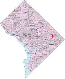
Map of Washington, D.C., with Mayfair highlighted in red
Mayfair is a residential neighborhood in Northeast Washington, D.C, United States., on the eastern bank of the Anacostia River. It is bounded by Jay Street NE on the north, Foote Street on the south, Kenilworth Terrace and Anacostia Avenue on the west, and Kenilworth Avenue on the east. Mayfair is encircled by Jay Street and Hayes St., which met at the back of the neighborhood.
Nearby schools include Neval Thomas Elementary, located on Anacostia Avenue, Cesar Chavez Public Charter School For Public Policy (Parkside middle and high school), located on Hayes Street NE, and just over the bridge crossing I-295, Friendship Collegiate Academy, Carter G. Woodson Campus.
Notable residents
- Marvin Gaye, singer
- Clifton Powell, actor
 |
Kenilworth Aquatic Gardens | Eastland Gardens | | |
| Anacostia River | |
Central Northeast/Mahaning Heights | ||
| ||||
| | ||||
| River Terrace | Benning |
Coordinates: 38°54′06″N 76°57′07″W / 38.9017°N 76.9520°W
This article is issued from Wikipedia - version of the 12/1/2016. The text is available under the Creative Commons Attribution/Share Alike but additional terms may apply for the media files.