Sepulcher Mountain
| Sepulcher Mountain | |
|---|---|
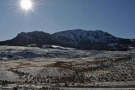 Sepulcher Mountain, 2009 | |
| Highest point | |
| Elevation | 9,642 ft (2,939 m) [1] |
| Coordinates | 44°59′25″N 110°46′01″W / 44.99028°N 110.76694°WCoordinates: 44°59′25″N 110°46′01″W / 44.99028°N 110.76694°W [1] |
| Geography | |
 Sepulcher Mountain Northeast Mammoth Hot Springs, Yellowstone National Park, Park County, Wyoming, U.S. | |
| Parent range | Gallatin Range |
| Topo map | Quadrant Mountain |
Sepulcher Mountain el. 9,642 feet (2,939 m) is a moderate mountain peak in northwest Yellowstone National Park halfway between the summit of Electric Peak and Mammoth Hot Springs. The peak was named Sepulcher by Captain John W. Barlow, U.S. Army in 1871 because of it resemblance to a crypt when viewed from Gardiner, Montana.[2]
The summit of Sepulcher Mountain can be reached by a 7.2 miles (11.6 km) trail from the mouth of Clematis Creek at Mammoth Hot Springs.[3]
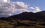
| Images of Sepulcher Mountain | ||||
|---|---|---|---|---|
|

See also
References
- 1 2 "Sepulcher Mountain". Geographic Names Information System. United States Geological Survey. Retrieved 2009-12-27.
- ↑ Haines, Aubrey L. (1996). Yellowstone Place Names-Mirrors of History. Niwot, Colorado: University of Colorado Press. p. 226. ISBN 0-87081-383-8.
- ↑ Schneider, Bill (2003). Hiking Yellowstone National Park. Guilford, CT: Falcon Press. pp. 132–134. ISBN 0-7627-2539-7.
Yellowstone National Park - Mammoth Hot Springs | ||
|---|---|---|
Historic structures and other attractions in the Mammoth Hot Springs area | ||
| Structures and history |  | |
| Geography and geology | ||
| ||
Cheyenne (capital) | |
| Topics |
|
| Society |
|
| Regions | |
| Cities | |
| Counties | |
This article is issued from Wikipedia - version of the 1/1/2016. The text is available under the Creative Commons Attribution/Share Alike but additional terms may apply for the media files.