Savernake, New South Wales
| Savernake New South Wales | |
|---|---|
 The entry to Savernake approaching from Berrigan. | |
|
Savernake | |
| Coordinates | 35°44′0″S 146°03′0″E / 35.73333°S 146.05000°ECoordinates: 35°44′0″S 146°03′0″E / 35.73333°S 146.05000°E |
| Postcode(s) | 2646 |
| Location | |
| LGA(s) | Federation Council |
| County | Denison |
| State electorate(s) | Albury |
| Federal Division(s) | Farrer |
Savernake (/ˈsævərnæk/ SAV-ər-nak) is a village and rural community in the southern Riverina region of New South Wales, Australia. The village is located on the Riverina Highway, east of Berrigan, and in the Federation Council local government area.
History
The first Savernake Post Office opened on 1 January 1890 and was renamed Warmatta in 1892 (and closed in 1927). The second Savernake Post Office opened in 1895 and closed in 1994.[1]
Today
The village consists of a hall, primary school, a now abandoned shop and a few houses. The hall is used from time to time by the HotHouse theatre group, based in Albury-Wodonga, for small touring theatrical productions.[2]
The main agricultural products of the area include sheep (for meat and wool), beef cattle, dryland cropping and pig production as well as some irrigated rice production.[3]
The Savernake area has been part of a CSIRO project to understand the role of remnant woodlands in agricultural landscapes.[4]
External links
![]() Media related to Savernake, New South Wales at Wikimedia Commons
Media related to Savernake, New South Wales at Wikimedia Commons
 The School of Arts Hall at Savernake
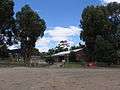 Savernake Public School
 The Catholic Church at Savernake
References
- ↑ Premier Postal History, Post Office List, retrieved 2009-06-11
- ↑ HotHouse Theatre – Touring. Retrieved 19 January 2007.
- ↑ CSIRO – SAND research project - Agriculture in the Savernake region. Retrieved 19 January 2007.
- ↑ CSIRO SAND research project. Retrieved 19 January 2007.