Sandigo, New South Wales
| Sandigo New South Wales | |
|---|---|
 Sandigo Hall | |
|
Sandigo | |
| Coordinates | 34°54′52″S 146°38′6″E / 34.91444°S 146.63500°ECoordinates: 34°54′52″S 146°38′6″E / 34.91444°S 146.63500°E |
| Population | 171 (2006 census)[1] |
| Postcode(s) | 2700 |
| Elevation | 144 m (472 ft) |
| Location |
|
| LGA(s) | Narrandera Shire |
| County | Mitchell |
| State electorate(s) | Cootamundra |
| Federal Division(s) | Riverina |
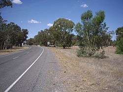
Sandigo is a locality situated on Sandy Creek in the central part of the Riverina. It is situated along the Sturt Highway, about 11 kilometres north west from Kywong and 21 kilometres south east from Narrandera. At the 2006 census, Sandigo had a population of 171 people.[1]
Sandigo
Notes and references
- 1 2 Australian Bureau of Statistics (25 October 2007). "Sandigo (State Suburb". 2006 Census QuickStats. Retrieved 17 November 2009.
| Wikimedia Commons has media related to Sandigo, New South Wales. |
This article is issued from Wikipedia - version of the 4/7/2015. The text is available under the Creative Commons Attribution/Share Alike but additional terms may apply for the media files.