Savant Lake
| Savant Lake | |
|---|---|
 Savant Lake Location of Savant Lake in Ontario | |
| Coordinates: 50°14′19″N 90°42′31″W / 50.23861°N 90.70861°W[1] | |
| Country |
|
| Province |
|
| Region | Northwestern Ontario |
| District | Thunder Bay |
| Government | |
| • Type | local services board |
| • MP | Greg Rickford (Kenora, CPC) |
| • MPP | Sarah Campbell (Kenora—Rainy River, NDP) |
| Elevation | 430 m (1,410 ft) |
| Time zone | CST (UTC-6) |
| • Summer (DST) | CDT (UTC-5) |
| Postal Code | P0V 2S0 |
| Area code(s) | 807 |
Savant Lake is an unincorporated place and community in Unorganized Thunder Bay District in northwestern Ontario, Canada.[1]
History
Town was originally named after a civil engineer in charge of building the railroad, Bucke. In 1928, another town of the same name was discovered in Ontario, Canada. At that time, the name of the lake north of the town, “Lake Savant”, became the town’s official name.
In 1901, Gold was discovered on Lake Savant. Therefore, in 1905, the Saint Anthony Goldmine located south of the town opened. It serviced the town until it was closed in 1941.
In 1913, CN Savant Lake railroad station was built. Until 1959, the main form of transportation was dog teams until Ontario Highway 599 was completed. In 1973, Hydro (electricity) was brought in.[2]
Transportation
Savant Lake is on Ontario Highway 599, roughly halfway between Ignace and Pickle Lake. The community is also connected to Sioux Lookout via Ontario Highway 516, and is the proposed northern terminus of an extension of Ontario Highway 811, if the extension is ever built.
Savant Lake is on the Canadian National Railway transcontinental main line,[3] between Fowler to the west and Staunton to the east. Savant Lake railway station is on the line and is served by Via Rail transcontinental Canadian trains.
Savant Lake (Sturgeon Lake) Water Aerodrome is located 3.5 nautical miles (6.5 km) southeast of the community.
Local media
Television
References
- 1 2 "Savant Lake". Geographical Names Data Base. Natural Resources Canada. Retrieved 2011-08-13.
- ↑ Wildewood on Lake Savant
- ↑ Map 13 (PDF) (Map). 1 : 1,600,000. Official road map of Ontario. Ministry of Transportation of Ontario. 2010-01-01. Retrieved 2011-08-13.
| Cities | 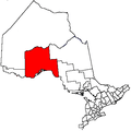 | |
|---|---|---|
| Towns | ||
| Townships | ||
| First Nations |
| |
| Indian reserves |
| |
| Indian settlements | ||
| Unorganized areas | ||
| Local services boards | ||
| Ghost towns | ||
| ||