Pays Plat First Nation
| Pays Plat 51 | |
|---|---|
| Indian reserve | |
| Pays Plat Indian Reserve No. 51 | |
 | |
 Pays Plat 51 | |
| Coordinates: 48°53′N 87°34′W / 48.883°N 87.567°WCoordinates: 48°53′N 87°34′W / 48.883°N 87.567°W | |
| Country |
|
| Province |
|
| District | Thunder Bay |
| First Nation | Pays Plat |
| Area[1] | |
| • Land | 2.19 km2 (0.85 sq mi) |
| Population (2011)[1] | |
| • Total | 75 |
| • Density | 34.3/km2 (89/sq mi) |
| Website | |
Pays Plat First Nation is a small First Nation reserve community located near Rossport, Ontario, Canada, about 175 kilometres (109 mi) northeast of Thunder Bay. The Pays Plat 51 Reserve is in the boundaries of the territory described in the Robinson-Superior Treaty of 1850. The community is located along Highway 17.
History
The Ojibway people living on the North Shore of Lake Superior (ancestors of Pays Plat First Nations people) survived by hunting, trapping, fishing, and gathering food. The area was heavily involved in the fur trade, and the ancestors living near what is now called Pays Plat were key in trapping for furs. Pays Plat was named by French traders and means flat land, named after the fact that it is flat land between two mountains.
External links
References
- 1 2 "Pays Plat 51 census profile". 2011 Census of Population. Statistics Canada. Retrieved 17 June 2015.
 |
Unorganized Thunder Bay | | ||
| Unorganized Thunder Bay | |
Unorganized Thunder Bay | ||
| ||||
| | ||||
| Lake Superior |
| Cities | 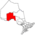 | |
|---|---|---|
| Towns | ||
| Townships | ||
| First Nations |
| |
| Indian reserves |
| |
| Indian settlements | ||
| Unorganized areas | ||
| Local services boards | ||
| Ghost towns | ||
| ||
This article is issued from Wikipedia - version of the 10/11/2016. The text is available under the Creative Commons Attribution/Share Alike but additional terms may apply for the media files.