Lappe, Ontario
| Lappe | |
|---|---|
| Unincorporated place | |
 Lappe Location of Lappe in Ontario | |
| Coordinates: 48°34′44″N 89°21′31″W / 48.57889°N 89.35861°WCoordinates: 48°34′44″N 89°21′31″W / 48.57889°N 89.35861°W[1] | |
| Country | Canada |
| Province | Ontario |
| District | Thunder Bay |
| Elevation[2] | 421 m (1,381 ft) |
| Population (2006)[3] | |
| • Total | 1,465 |
| Time zone | Eastern Time Zone (UTC-5) |
| • Summer (DST) | Eastern Time Zone (UTC-4) |
| Postal code FSA | P7G |
| Area code(s) | 807 |
Lappe is a community in the Unorganized part of Thunder Bay District, Ontario, Canada.[1] It is within and at the southern border of geographic Gorham Township,[4] and lies approximately 20 kilometres northwest of Thunder Bay at the junction of Ontario Highway 589 and Ontario Highway 591.
A unincorporated designated place served by the East Gorham local services board, Lappe had a population of 1,465 in the Canada 2006 Census, an increase of 4.2% since 2001. It is the most populated designated place in Ontario.[3]
Pioneer settlers reported that the community received its name in the following way. As they travelled north from the small community of Kivikoski they were called Laplanders (northerners) and the community they settled called "Lappi", the Finnish word for Lapland. When the community acquired postal service in the 1930s, a bureaucratic error distorted the spelling to the present "Lappe".[5]
References
- 1 2 "Lappe". Geographical Names Data Base. Natural Resources Canada. Retrieved 2015-07-06.
- ↑ Elevation taken from Google Earth at coordinates given in the Infobox. Accessed 2015-07-06.
- 1 2 Statistics Canada Population and dwelling counts, for Canada, provinces and territories, and designated places, 2006 and 2001 censuses. Retrieved 27 August 2008.
- ↑ "Gorham" (PDF). Geology Ontario - Historic Claim Maps. Ontario Ministry of Northern Development, Mines and Forestry. Retrieved 2015-07-06.
- ↑ Kouhi, Christine (1976). A Chronicle of Finnish Settlements in Rural Thunder Bay. The Thunder Bay Finnish Canadian Historical Society; Department of the Secretary of State for the Government of Canada. p. 48. OCLC 4466985.
Other map sources:
- Map 13 (PDF) (Map). 1 : 1,600,000. Official road map of Ontario. Ministry of Transportation of Ontario. 2014. Retrieved 2015-07-06.
- Restructured municipalities - Ontario map #2 (Map). Restructuring Maps of Ontario. Ontario Ministry of Municipal Affairs and Housing. 2006. Retrieved 2015-07-06.
| Cities | 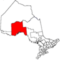 | |
|---|---|---|
| Towns | ||
| Townships | ||
| First Nations |
| |
| Indian reserves |
| |
| Indian settlements | ||
| Unorganized areas | ||
| Local services boards | ||
| Ghost towns | ||
| ||