Sainte-Colombe, Ille-et-Vilaine
| Sainte-Colombe Santez-Koulm | |
|---|---|
|
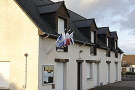
The town hall of Sainte-Colombe | |
 Sainte-Colombe | |
|
Location within Brittany region  Sainte-Colombe | |
| Coordinates: 47°53′19″N 1°27′18″W / 47.8886°N 1.4550°WCoordinates: 47°53′19″N 1°27′18″W / 47.8886°N 1.4550°W | |
| Country | France |
| Region | Brittany |
| Department | Ille-et-Vilaine |
| Arrondissement | Fougères-Vitré |
| Canton | Retiers |
| Intercommunality | Pays de la Roche-aux-Fées |
| Government | |
| • Mayor (2014–2020) | Étienne Petitbon |
| Area1 | 7.58 km2 (2.93 sq mi) |
| Population (2009)2 | 305 |
| • Density | 40/km2 (100/sq mi) |
| Time zone | CET (UTC+1) |
| • Summer (DST) | CEST (UTC+2) |
| INSEE/Postal code | 35262 / 35134 |
| Elevation | 47–106 m (154–348 ft) |
|
1 French Land Register data, which excludes lakes, ponds, glaciers > 1 km² (0.386 sq mi or 247 acres) and river estuaries. 2 Population without double counting: residents of multiple communes (e.g., students and military personnel) only counted once. | |
Sainte-Colombe (Breton: Santez-Koulm) is a commune in the Ille-et-Vilaine department in Brittany in northwestern France.
Population
Inhabitants of Sainte-Colombe are called colombins in French.
| Historical population | ||
|---|---|---|
| Year | Pop. | ±% |
| 1962 | 285 | — |
| 1968 | 296 | +3.9% |
| 1975 | 277 | −6.4% |
| 1982 | 276 | −0.4% |
| 1990 | 262 | −5.1% |
| 1999 | 272 | +3.8% |
| 2009 | 305 | +12.1% |
See also
References
External links
| Wikimedia Commons has media related to Sainte-Colombe (Ille-et-Vilaine). |
This article is issued from Wikipedia - version of the 2/11/2016. The text is available under the Creative Commons Attribution/Share Alike but additional terms may apply for the media files.