La Couyère
| La Couyère Ar Gouer | ||
|---|---|---|
|
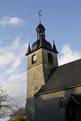
The bell tower of the church in La Couyère | ||
| ||
 La Couyère | ||
|
Location within Brittany region  La Couyère | ||
| Coordinates: 47°53′17″N 1°30′13″W / 47.8881°N 1.5036°WCoordinates: 47°53′17″N 1°30′13″W / 47.8881°N 1.5036°W | ||
| Country | France | |
| Region | Brittany | |
| Department | Ille-et-Vilaine | |
| Arrondissement | Redon | |
| Canton | Le Sel-de-Bretagne | |
| Intercommunality | Moyenne Vilaine et du Semnon | |
| Government | ||
| • Mayor (2014–2020) | Jacqueline Sollier | |
| Area1 | 11.72 km2 (4.53 sq mi) | |
| Population (2008)2 | 494 | |
| • Density | 42/km2 (110/sq mi) | |
| Time zone | CET (UTC+1) | |
| • Summer (DST) | CEST (UTC+2) | |
| INSEE/Postal code | 35089 / 35320 | |
| Elevation | 44–109 m (144–358 ft) | |
|
1 French Land Register data, which excludes lakes, ponds, glaciers > 1 km² (0.386 sq mi or 247 acres) and river estuaries. 2 Population without double counting: residents of multiple communes (e.g., students and military personnel) only counted once. | ||

La Couyère (Breton: Ar Gouer) is a commune in the Ille-et-Vilaine department of Brittany in northwestern France.
The commune is home to a small Solar System model established in 2011.
Population
Inhabitants of La Couyère are called in French coverois.
| Historical population | ||
|---|---|---|
| Year | Pop. | ±% |
| 1962 | 457 | — |
| 1968 | 472 | +3.3% |
| 1975 | 437 | −7.4% |
| 1982 | 383 | −12.4% |
| 1990 | 360 | −6.0% |
| 1999 | 350 | −2.8% |
| 2008 | 494 | +41.1% |
See also
References
External links
| Wikimedia Commons has media related to La Couyère. |
This article is issued from Wikipedia - version of the 3/15/2016. The text is available under the Creative Commons Attribution/Share Alike but additional terms may apply for the media files.