Romagné
| Romagné Rovenieg | ||
|---|---|---|
|
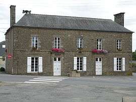
The town hall in Romagné | ||
| ||
 Romagné | ||
|
Location within Brittany region  Romagné | ||
| Coordinates: 48°20′35″N 1°16′34″W / 48.3431°N 1.2761°WCoordinates: 48°20′35″N 1°16′34″W / 48.3431°N 1.2761°W | ||
| Country | France | |
| Region | Brittany | |
| Department | Ille-et-Vilaine | |
| Arrondissement | Fougères-Vitré | |
| Canton | Fougères-Sud | |
| Intercommunality | Fougères | |
| Government | ||
| • Mayor (2014–2020) | Pierre Gautier | |
| Area1 | 26.93 km2 (10.40 sq mi) | |
| Population (2009)2 | 2,087 | |
| • Density | 77/km2 (200/sq mi) | |
| Time zone | CET (UTC+1) | |
| • Summer (DST) | CEST (UTC+2) | |
| INSEE/Postal code | 35243 / 35133 | |
| Elevation | 57–171 m (187–561 ft) | |
|
1 French Land Register data, which excludes lakes, ponds, glaciers > 1 km² (0.386 sq mi or 247 acres) and river estuaries. 2 Population without double counting: residents of multiple communes (e.g., students and military personnel) only counted once. | ||
.svg.png)
Romagné (Breton: Rovenieg, Gallo: Romanyaé) is a commune in the Ille-et-Vilaine department in Brittany in northwestern France.
Population
Inhabitants of Romagné are called Romagnéens in French.
| Historical population | ||
|---|---|---|
| Year | Pop. | ±% |
| 1962 | 1,077 | — |
| 1968 | 1,113 | +3.3% |
| 1975 | 1,311 | +17.8% |
| 1982 | 1,581 | +20.6% |
| 1990 | 1,591 | +0.6% |
| 1999 | 1,605 | +0.9% |
| 2009 | 2,087 | +30.0% |
See also
References
External links
| Wikimedia Commons has media related to Romagné. |
This article is issued from Wikipedia - version of the 11/5/2015. The text is available under the Creative Commons Attribution/Share Alike but additional terms may apply for the media files.