Rural Municipality of La Broquerie
| RM of La Broquerie | |
|---|---|
 RM of La Broquerie Location of La Broquerie in Manitoba | |
| Coordinates: 49°23′58″N 96°30′37″W / 49.39944°N 96.51028°WCoordinates: 49°23′58″N 96°30′37″W / 49.39944°N 96.51028°W | |
| Country | Canada |
| Province | Manitoba |
| Region | Eastman |
| Government | |
| • MP (Provencher) | Vic Toews (CPC) |
| • MLA (La Verendrye) | Dennis Smook (PC) |
| • Reeve | Claude Lussier |
| Area | |
| • Total | 578.20 km2 (223.24 sq mi) |
| • Water | 9.0 km2 (3.5 sq mi) |
| Elevation | 268 m (879 ft) |
| Population (2011 Census[1]) | |
| • Total | 5,198 |
| Time zone | CST (UTC-6) |
| • Summer (DST) | CDT (UTC-5) |
| Website | http://www.labroquerie.com/ |
La Broquerie is a rural municipality in the province of Manitoba in Western Canada, located in the southeastern part of the province, just south and east of the city of Steinbach. The municipality consists of 6 townships. La Broquerie is a fast-growing community consisting of a wide range of cultural backgrounds including English, French and Mennonite. The 2011 Census reported a population of 5,198 persons, a 42.1% increase from the 3,659 reported in 2006.[2]
The unincorporated community of La Broquerie to the north, and the general development zones of Marchand to the east and Zhoda to the south form the urban centres of the municipality. Besides the urban areas, the municipality mainly consists of agricultural production and rural residential developments in the northern half to hog production facilities and vastly undeveloped areas in the south.
Communities
Geography
According to Statistics Canada, the rural municipality has an area of 578.20 km² (223.24 sq mi). There are no separately incorporated cities, towns or villages within the municipality. Provincial Highways #12 and #52 run through the southwest and north portions of the municipality respectively. Provincial Roads #301 and #302, both gravel highways, bisect the municipality. The municipality is located in the plant hardiness zone of 3a/3b.[3] The municipality straddles the aspen parkland, the traditional tallgrass prairie and the Manitoba lowlands regions.[4]
Adjacent rural municipalities
- R.M. of Hanover - (west)
- Steinbach (city) - (northwest)
- R.M. of Ste. Anne - (north)
- R.M. of Reynolds - (northeast)
- R.M. of Piney - (southeast)
- R.M. of Stuartburn - (south)
 |
Steinbach (city) | R.M. of Ste. Anne | R.M. of Reynolds | |
| R.M. of Hanover | |
R.M. of Reynolds / R.M. of Piney | ||
| ||||
| | ||||
| R.M. of Stuartburn | R.M. of Piney |
References
- ↑ "Population data for La Broquerie". Statistics Canada. Retrieved February 8, 2012.
- ↑ "Focus on Geography Series, 2011 Census - Census subdivision of La Broquerie, RM (Manitoba)". 2.statcan.ca. 2012-02-02. Retrieved 2012-02-09.
- ↑ http://www.plantmaps.com/interactive-manitoba-plant-zone-hardiness-map.php
- ↑ http://www.gov.mb.ca/conservation/pai/images/maps/natural_region_map.pdf
External links
| Cities | 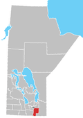 | |
|---|---|---|
| Towns | ||
| Villages | ||
| Rural municipalities | ||
| First Nations | ||
| Indian reserves | ||
| Unincorporated communities | ||