Rural Municipality of Franklin
For the community west of Neepawa, Manitoba (hwy #16) see Franklin, Manitoba.
The Rural Municipality of Franklin is a former rural municipality (RM) in the Canadian province of Manitoba. It was originally incorporated as a rural municipality on December 22, 1883.[1] It ceased on January 1, 2015 as a result of its provincially mandated amalgamation with the Town of Emerson to form the Municipality of Emerson – Franklin.[2]
The RM was located in the southeastern part of the province, along the border with the state of Minnesota in the United States. The 2006 Census reported a population of 1,768 persons, a slight decrease from the 1,781 reported in the 2001 Census. The Roseau River Anishinabe First Nation Indian reserve lied between the RM of Franklin and the neighbouring RM of Montcalm.
Historic buildings in the RM of Franklin included the All Saints Anglican Church in Dominion City. It is now the Franklin Museum.
Communities
Unincorporated
- Arnaud
- Carlowrie
- Dominion City
- Fredensthal
- Green Ridge
- Ridgeville
- Rosa
- Roseau River
- Senkiw
- Tolstoi
- Woodmore
Geography
According to Statistics Canada, the former RM had an area of 953.34 km² (368.09 sq mi).
Adjacent municipalities
- Rural Municipality of Montcalm - (west, northwest)
- Rural Municipality of De Salaberry - (north)
- Rural Municipality of Stuartburn - (east)
- Kittson County, Minnesota - (south)
- Emerson (town) - (southwest)*
 |
R.M. of Montcalm | R.M. of De Salaberry | | |
| R.M. of Montcalm | |
R.M. of Stuartburn | ||
| ||||
| | ||||
| Emerson (town) | Kittson County, Minnesota |
External links
References
- ↑ "Manitoba's Municipal History: Rural Municipalities and Local Government Districts". The Manitoba Historical Society. September 21, 2014. Retrieved January 2, 2015.
- ↑ "Manitoba's Municipal History: Municipal Amalgamations (2015)". The Manitoba Historical Society. December 1, 2014. Retrieved January 2, 2015.
- Geographic Names of Manitoba (pg. 86) - the Millennium Bureau of Canada
- Map of Franklin R.M. at Statcan
| Cities | 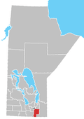 | |
|---|---|---|
| Towns | ||
| Villages | ||
| Rural municipalities | ||
| First Nations | ||
| Indian reserves | ||
| Unincorporated communities | ||
Coordinates: 49°08′00″N 97°01′59″W / 49.13333°N 97.03306°W