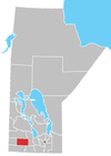
Rivers, Manitoba
Rivers is an unincorporated urban community in the Riverdale Municipality within the Canadian province of Manitoba that held town status prior to January 1, 2015. It is located 40 kilometres northwest of Brandon. Rivers had a population of 1,193 people in the 2006 census.[1] Rivers was named in 1908 after Sir Charles Rivers Wilson, Chairman of the Board of the Grand Trunk Pacific Railway.[2] It is 473 metres above sea level, and is within the Westman Region (Southwestern Manitoba). Agriculture, health and related businesses provide economics for the community and area.
The local schools fall under the Rolling River School Division, with a Nursery School, Rivers Elementary school (Kindergarten - Grade 6), and Rivers Collegiate Institute (Grade 7 - Grade 12). New playground equipment was installed in 2010 at the Rivers Elementary School and is put to good use by the whole community. The high school is a "Pay It Forward" school and works on programs to do just that. For decades Rivers Collegiate has been praised for its outstanding sports programs, including volleyball, basketball, and baseball.
Nearby is Lake Wahtopanah. This lake is a part of the Rivers Provincial Park and provides good fishing both summer and winter. There are many campsites to be rented and walking trails, miniature golf or a delicious ice cream help pass those summer vacation days. Depending on the season, you will see a variety of users on the lake from swimming, waterskiing, sailing, to snowmobiling and ice fishing. There are permanent cottages and homes on both sides of the lake. With its length of 13 km, there is room for everyone.
With the number of businesses the community has, you can find something for everyone. Whether it involves summer events such as parades or fairs, or winter events such as curling, hockey, snowmobiling or more, there is lots to do. The choice is yours. A new multi use community complex is under construction and will be completed in the fall of 2011. Rivers is working hard to be recreation destination community.
During World War II, Rivers became one of the sites in Canada which helped to fix the positions of German U-boats using High Frequency Direction Finding. This site, along with Portage la Prairie increased the "fix" accuracy on the U-boats.
CFB Rivers, an abandoned military base, is located four miles west of the community. It was decommissioned in 1971.[3]
The Rivers railway station is a station stop for Via Rail's The Canadian.
Demographics
The population of Rivers in 2011 was 1,189 people, a 0.3% decrease from the prior 2006 census.[4] The size of Rivers in land area is 7.97 km2, equating to a population density of 149.3 per km2. There are 526 private dwellings in Rivers, 503 which are occupied by usual residence.
All of Rivers residents are either White (86.9%) or Aboriginal (13.1%).
References
- ↑ Community Profile: Rivers, Manitoba; Statistics Canada (2006)
- ↑ Douglas R 1933 Place-Names of Manitoba Geographic Board of Canada
- ↑ Johhnie Bachusky, "Into the Void", Canadian Geographic Travel, Fall 2009. p. 62
- ↑ NHS Profile, Rivers, T, Manitoba, 2011. Retrieved December 7th, 2013
External links
- Former Town of Rivers official website
- Rivers Banner
- Manitoba community Profiles
- Map of Rivers at Statcan
Coordinates: 50°01′51″N 100°14′22″W / 50.03083°N 100.23944°W
