Raith, Ontario
| Raith | |
|---|---|
|
dispersed rural community unincorporated area | |
 Raith Location in Ontario | |
| Coordinates: 48°49′19″N 89°55′09″W / 48.82194°N 89.91917°WCoordinates: 48°49′19″N 89°55′09″W / 48.82194°N 89.91917°W[1] | |
| Country | Canada |
| Province | Ontario |
| District | Thunder Bay |
| Geographic township | Golding |
| Elevation[2] | 488 m (1,601 ft) |
| Time zone | Eastern Time Zone (UTC-5) |
| • Summer (DST) | Eastern Time Zone (UTC-4) |
| Postal Code | P0T |
| Area code(s) | 807 |
Raith is a dispersed rural community and unincorporated area in geographic Golding Township in the Unorganized Part of Thunder Bay District in Northwestern Ontario, Canada.[1]
Geography
The community lies at the watershed divide between the Great Lakes Basin/Saint Lawrence River drainage basin and the Hudson Bay drainage basin, a fact highlighted by a Ontario Heritage Trust Blue Plaque.[3][4] The Oskondaga River, on the Great Lakes basin side of the divide, begins at Raith.
Transportation
The community is Ontario Highway 17, at this point part of the Trans-Canada Highway, between Upsala to the northwest and Shabaqua Corners to the south. There are also two railway lines: the Canadian Pacific Railway transcontinental main line, in operation; and the Canadian National Railway Graham Subdivision main line, originally built as part of the National Transcontinental Railway, now abandoned.
References
- 1 2 "Raith". Geographical Names Data Base. Natural Resources Canada. Retrieved 2014-09-02.
- ↑ Taken from Google Earth at geographic coordinates, accessed 2014-09-02.
- ↑ "The Arctic Watershed". Ontario's Historical Plaques. Retrieved 2014-09-02.
- ↑ "Arctic Watershed, The". Online Plaque Guide. Ontario Heritage Trust. Retrieved 2014-09-02.
Other map sources:
- Map 13 (PDF) (Map). 1 : 1,600,000. Official road map of Ontario. Ministry of Transportation of Ontario. 2014. Retrieved 2014-09-02.
- Restructured municipalities - Ontario map #2 (Map). Restructuring Maps of Ontario. Ontario Ministry of Municipal Affairs and Housing. 2006. Retrieved 2014-09-02.
| Cities | 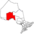 | |
|---|---|---|
| Towns | ||
| Townships | ||
| First Nations |
| |
| Indian reserves |
| |
| Indian settlements | ||
| Unorganized areas | ||
| Local services boards | ||
| Ghost towns | ||
| ||