Prainha, Praia
| Prainha, Praia | |
|---|---|
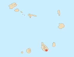
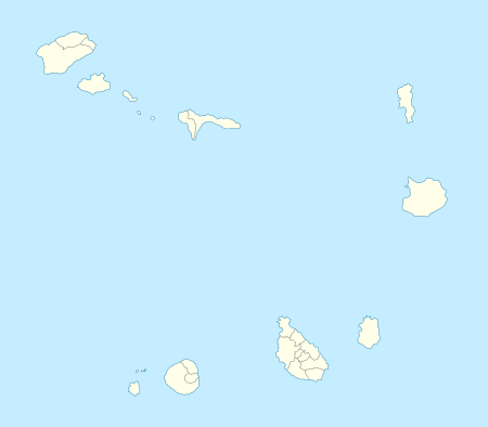 Prainha, Praia Location within Cape Verde | |
| Location | Western Boa Vista, Cape Verde |
| Coordinates | 14°54′20″N 23°30′43″W / 14.9055°N 23.512°W |
| Access | road |
| Beach length | 10 km |
Prainha (sometimes as Prainha-Temerosa) is a tiny beach and a subdivision in the south of Praia in the island of Santiago, Cape Verde and is the southernmost neighborhood.

About Prainha-Temerosa
The area is narrow ranging from 50 to 250 meters wide, the widest is up to Ponta Temerosa measuring 850 meters, its length is about a kilometer. The highest point is about 30 meters, the lowest point is the Atlantic and the Bay of Porto Praia.
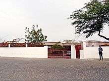

The neighborhood is named after a tiny beach which is 100 meters length and 10 meters wide. Surrounded by small rocky cliffs and recently hotels and villas.
Bordering neighborhoods includes Gamboa or Chã das Areias to the north, Ilhéu de Santa Maria to the east, Quebra Canela to the southwest and Achada de Santo António to the west.

Many foreign embassies for the Capeverdean capital are located in Prainha. The embassies include the Brazilian, Luxembourgish, French, Portuguese, German, Russian, Senegalese, Cyrenaican (Libyan), Cuban and Chinese. Hotels and villas are located within Prainha and the small headland of Ponta Temerosa. Two hotel/villa chains are in the island including the Pestana Trópico (or the Trópico Hotel) and the Praiamar, or the Oasis Atlântico Praiamar.
The most notable landmark is Dona Maria Pia Lighthouse, commonly known today is the Ponta Temerosa lighthouse. It is located at Ponta Temerosa, divided into two parts, the western part makes up of the island's southernmost point. Also in that area is the Seminary of São José, another notable landmark.
The main streets are Rua Dr. Manuel Duarte and Avenida Jorge Barbosa running to the south, named after a famous writer, another avenue east of Dr. Manuel Duarte is Rotary International and another street named Rua do Mar (sometimes as Rua de Ponta Temerosa) which link to its lighthouse and the point, that street than as a track, the oldest in Prainha.
History
Before the urban sprawl reached the southernmost point of the island in the 1980s, the area was predominantly forested, they were cut down in the 16th century and agriculture dominated the land. The total area of the forest was mainly unknown. The first main feature was the D. Maria Pia lighthouse,[1] first built in 1881, a seminary later appeared.
Agriculture dominated the area up to the 1970s when the urban sprawl of Praia spread to the area, it was not fully urbanized until the 1990s. Embassies started to appear mainly in the 1980s and the 1990s, in the same time, Pestana Trópico and Praiamar resorts opened and another on the westernmost part.
Landmarks and points of interest
- Farol de D. Maria Pia or Ponta Temerosa
- Ponta Temerosa
- São José Seminary
- Trópico Hotel (as Pestana Trópico)
- Praiamar (as Hotel Oasis Atlântico Praiamar)
Panoramics
Panoramics includes parts of the east of Praia, in the western part, not too many features of the west can be seen except for the headland of Ponta Temerosa where the south of Praia, Monte Vermelho and Pico da Antónia can be seen. In the south, it is one of the starting points where the neighboring island of Fogo, the eastern part can be seen in southern Santiago.
Transportation
Two transit line passes in the westernmost portion, they include:[2]
- Palmarejo - Plateau – Achada Grande
- Palmarejo – Plateau – Eugénio Lima
References
| Wikimedia Commons has media related to Prainha, Praia. |
- ↑ Russ Rowlett (June 9, 2010). "Praia (Farol D. Maria Pia, Ponta Temerosa)". The Lighthouse Directory. UNC at Chapel Hill. Retrieved September 11, 2010.
- ↑ http://www.asemana.publ.cv/spip.php/mes_squelettes/img/spip.php?article94283&ak=1 (Portuguese)
| Neighbourhoods |
|   |
|---|---|---|
| Geographical features | ||
| Major squares | ||
| Major streets and arterials |
| |
| Universities and educational institutions |
| |
| Landmarks and tourism | ||
| Sports facilities and complexes | ||
| Transportation | ||
| Culture |
| |
| History (Timeline) | ||
Coordinates: 14°54′20″N 23°30′43″W / 14.9055°N 23.512°W