Ponta Temerosa
| Ponta Temerosa | |
|---|---|
|
Ponta Temerosa and its lighthouse | |
 | |
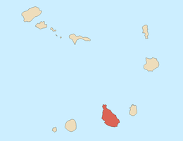
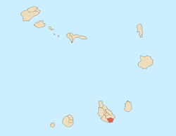
| Location | Praia, Santiago, Cape Verde |
| Coordinates | 14°53′58″N 23°30′38″W / 14.8995°N 23.5106°WCoordinates: 14°53′58″N 23°30′38″W / 14.8995°N 23.5106°W |
| Offshore water bodies |
Praia Harbor Atlantic Ocean |
| Elevation | 3 metres (10 ft) |
| Surface elevation | 12 metres (39 ft) |
| Length | 560 m |
| Width | 168 m |
| Area | 200 ha |
| Depth | 5 m |

Ponta Temerosa are two promontories and a headland located in the south of Praia on the island of Santiago, Cape Verde located nearly 2 km from the city center and 2.8 km by road from Albuquerque Square (the city's center) to the lighthouse. The western point is the southermnost point of the island. Once after Ilhéu de Santa Maria (and is naturally), it is now after Ponta do Porto (once called Porto de Visconde) forming the Port of Praia expanded in 2014 and forms an artificial headland. Ponta Temerosa is inside the neighborhood of Prainha-Temerosa.
_p0166_CAPE_VERDE%2C_PORTO_PRAYA.jpg)
The headland is 560 meters long straightly down southeast (600 meters indirectly) and 168 meters wide, it is almost entirely surrounded by rocky cliffs. The deepest area surrounding the headland is 3 meters, 2 kilometers (1.25 nmi) south has a depth of 100 meters and over 5 kilometers (2.7 nmi) south has a depth of 1,000 meters.
Notable landmarks on the headland include the Farol de D. Maria Pia or Ponta Temerosa lighthouse,[1] the Seminary of São José (Saint Joseph). At the end of the headland is the tiny beach of Prainha, sometimes included. The Praiamar hotel (or the Hotel Oasis Atlântico) is in the western end. In that area, the highest point is 11 to 12 meters. Residential streets includes Avenida Rotary International and Rua de Mar (or Rua de Ponta Temerosa). Adjacent to the headland is Ipanema restaurant located on Avenida Jorge Barbosa, the restaurant is named after the beach in Brazil.
History
Before the urban sprawl reached the southernmost point of the island in the 1980s, the geography of the headland before the 16th century is unknown. The Battle of Porto Praya took place between Great Britain and France off the point on 16 April 1780, as Portugal was neutral, Great Britain clashed with France southeast of the harbour in the waters, the naval battle ended in French victory.
The first main feature was the D. Maria Pia lighthouse, first built in 1881, a seminary later appeared, its first road first constructed.
Agriculture dominated the area up to the 1980s when the urban sprawl of Praia spread to the area, it was not fully urbanized until the 1990s. In the 1990s, the Praiamar resort opened.
Panoramics
Panoramics includes most of the city of Praia, also Monte Vermelho and Pico da Antónia can be seen, it is the starting point where the neighboring island of Fogo, the eastern part can be seen in southern Santiago.
References
- ↑ Russ Rowlett (June 9, 2010). "Praia (Farol D. Maria Pia, Ponta Temerosa)". The Lighthouse Directory. UNC at Chapel Hill. Retrieved September 11, 2010.
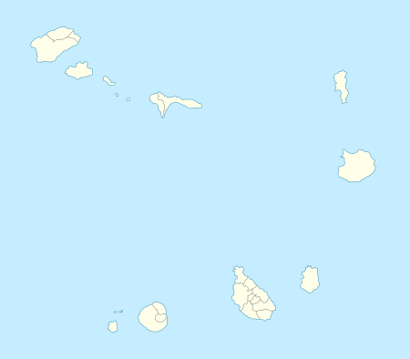
Geography, features and topics of Santiago and the surrounding islets | ||
|---|---|---|
| Topics |
|  |
| Mountains |
| |
| Streams |
| |
| Points and promontories |
| |
| Reservoirs |
| |
| Other geographic features | ||
| History | ||
| Neighbourhoods |
|   |
|---|---|---|
| Geographical features | ||
| Major squares |
| |
| Major streets and arterials |
| |
| Universities and educational institutions |
| |
| Landmarks and tourism | ||
| Sports facilities and complexes | ||
| Transportation | ||
| Culture |
| |
| History (Timeline) | ||