Pen Argyl, Pennsylvania
| Pen Argyl | |
| Kleiberg | |
| Borough | |
 Pen Argyl | |
| Official name: Borough of Pen Argyl | |
| Name origin: Pen, Cornish for "mountain;" Argyl, for "clay" (or slate) [1] | |
| Country | United States |
|---|---|
| State | Pennsylvania |
| County | Northampton |
| Elevation | 781 ft (238.0 m) |
| Coordinates | 40°52′08″N 75°15′20″W / 40.86889°N 75.25556°WCoordinates: 40°52′08″N 75°15′20″W / 40.86889°N 75.25556°W |
| Area | 1.4 sq mi (3.6 km2) |
| - land | 1.4 sq mi (4 km2) |
| - water | 0.0 sq mi (0 km2), 0% |
| Population | 3,595 (2010) |
| Density | 2,567.9/sq mi (991.5/km2) |
| Incorporated | 1882 [2] |
| Timezone | EST (UTC-5) |
| - summer (DST) | EDT (UTC-4) |
| ZIP code | 18072 |
| Area code | 610 and 484 |
| School District | Pen Argyl Area School District |
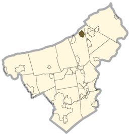 Location of Pen Argyl in Northampton County | |
 Location of Pen Argyl in Pennsylvania | |
 Location of Pennsylvania in the United States | |
| Website: http://www.penargylborough.com/ | |
Pen Argyl (Pennsylvania Dutch: Kleiberg) is a borough in Northampton County, Pennsylvania, 26 miles (42 km) north of Allentown, in the Lehigh Valley region of the state. It is part of Pennsylvania's Slate Belt.[3]
Population
In 1900, 2,784 people lived in Pen Argyl, and in 1910, 3,967 people lived here. The population was 3,595 at the 2010 census.
Geography
According to the United States Census Bureau, the borough has a total area of 1.4 square miles (3.6 km2), of which 0.71% is water.
Demographics
| Historical population | |||
|---|---|---|---|
| Census | Pop. | %± | |
| 1880 | 572 | — | |
| 1890 | 2,108 | 268.5% | |
| 1900 | 2,784 | 32.1% | |
| 1910 | 3,967 | 42.5% | |
| 1920 | 4,096 | 3.3% | |
| 1930 | 4,310 | 5.2% | |
| 1940 | 4,059 | −5.8% | |
| 1950 | 3,878 | −4.5% | |
| 1960 | 3,693 | −4.8% | |
| 1970 | 3,668 | −0.7% | |
| 1980 | 3,388 | −7.6% | |
| 1990 | 3,492 | 3.1% | |
| 2000 | 3,615 | 3.5% | |
| 2010 | 3,595 | −0.6% | |
| Est. 2015 | 3,541 | [4] | −1.5% |
| Sources:[5][6][7] | |||
As of the census[6] of 2000, there were 3,615 people, 1,427 households, and 1,003 families residing in the borough. The population density was 2,603.9 people per square mile (1,004.1/km2). There were 1,506 housing units at an average density of 1,084.8 per square mile (418.3/km2). The racial makeup of the borough was 99.81% White, 0.07% African American, 0.01% Native American, 0.05% Asian, 0.05% from other races, and 0.80% from two or more races. Hispanic or Latino of any race were 1.22% of the population.
There were 1,427 households, out of which 36.7% had children under the age of 18 living with them, 53.7% were married couples living together, 12.2% had a female householder with no husband present, and 29.7% were non-families. 24.5% of all households were made up of individuals, and 12.6% had someone living alone who was 65 years of age or older. The average household size was 2.52 and the average family size was 3.01.
In the borough the population was spread out, with 26.7% under the age of 18, 6.9% from 18 to 24, 31.0% from 25 to 44, 20.2% from 45 to 64, and 15.2% who were 65 years of age or older. The median age was 36 years. For every 100 females there were 91.1 males. For every 100 females age 18 and over, there were 86.9 males.
The median income for a household in the borough was $40,066, and the median income for a family was $47,935. Males had a median income of $32,596 versus $23,239 for females. The per capita income for the borough was $18,145. About 4.3% of families and 5.7% of the population were below the poverty line, including 5.7% of those under age 18 and 8.9% of those age 65 or over.
Public education
The borough is served by the Pen Argyl Area School District.
Notable locations and events
Pen Argyl is the burial place of actress Jayne Mansfield, whose family requested to have her body buried in Fairview Cemetery, located on the borough's outskirts. Her heart-shaped gravestone is visible from the road.
Pen Argyl is also home to the Weona Park Dentzel carousel, which is listed in the National Register of Historic Places.[8]
Pen Argyl's Fire Company, Lookout Fire Company #1, also holds an annual Labor Day parade and carnival.[9]
Pen Argyl is also home to Real English Foods, Inc, the company behind Mr. Pastie.
Notable people
- Kristen Maloney, gymnast and former Olympian.
- Jayne Mansfield, actress
- Tripp Eisen, Musician
- Bob Parsons, professional football player, Chicago Bears
- Aldo Ray, actor
- Tighe Scott, NASCAR and modified driver
- Ryo Tokita, artist
References
- ↑ Northampton County, Pennsylvania: Geology and Geography. Pennsylvania Department of Internal Affairs, Topographic and Geologic Survey. 1939. p. 69. line feed character in
|title=at position 34 (help) - ↑ "Northampton County - 4th Class" (PDF). Retrieved 2007-11-12.
- ↑ "About Slate Belt Chamber of Commerce". Archived from the original on 2007-09-29. Retrieved 2007-11-12.
- ↑ "Annual Estimates of the Resident Population for Incorporated Places: April 1, 2010 to July 1, 2015". Retrieved July 2, 2016.
- ↑ "Census of Population and Housing". U.S. Census Bureau. Retrieved 11 December 2013.
- 1 2 "American FactFinder". United States Census Bureau. Retrieved 2008-01-31.
- ↑ "Incorporated Places and Minor Civil Divisions Datasets: Subcounty Resident Population Estimates: April 1, 2010 to July 1, 2012". Population Estimates. U.S. Census Bureau. Retrieved 11 December 2013.
- ↑ National Park Service (2010-07-09). "National Register Information System". National Register of Historic Places. National Park Service.
- ↑ Lookout Fire Company parade marches through a sea of flags: In Pen Argyl, the Labor Day event is as big as any holiday celebration. - Morning Call (Allentown, PA) Encyclopedia.com
External links
| Wikimedia Commons has media related to Pen Argyl, Pennsylvania. |
Municipalities and communities of Northampton County, Pennsylvania, United States | ||
|---|---|---|
| Cities | 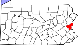 | |
| Boroughs | ||
| Townships | ||
| CDPs | ||
| Unincorporated communities | ||
| Footnotes | ‡This populated place also has portions in an adjacent county or counties | |