Danielsville, Pennsylvania
| Danielsville | |
| Settlement | |
| Country | United States |
|---|---|
| State | Pennsylvania |
| County | Northampton County |
| Elevation | 682 ft (207.9 m) |
| Coordinates | 40°47′40″N 75°31′38″W / 40.79444°N 75.52722°WCoordinates: 40°47′40″N 75°31′38″W / 40.79444°N 75.52722°W |
| Area | 15.1 sq mi (39.1 km2) |
| - land | 15.1 sq mi (39 km2) |
| - water | 0.00 sq mi (0 km2), 0% |
| Population | 3,085 (2000) |
| Density | 211/sq mi (81.5/km2) |
| Timezone | EST (UTC-5) |
| - summer (DST) | EDT (UTC-4) |
| ZIP code | 18038 |
| Area code | 610 and 484 |
 Location of Danielsville in Pennsylvania
| |
 Location of Pennsylvania in the United States
| |
Danielsville is a village northeast of Northampton in Northampton County, Pennsylvania along PA 946. The U.S. postal code (zip code) for Danielsville is 18038.
The village lies at the intersection of Route 946 and Blue Mountain Road. Danielsville is named for Charles B. Daniels, a postmaster who operated the Little Gap Slate Quarry.
The population of Danielsville was 3,085 at the 2000 census.
Public education
The village is served by the Northampton Area School District.
 |
Lower Towamensing Township, Carbon County | Blue Mountain Ski Area | Lower Towamensing Township, Carbon County | |
| Lehigh Gap | |
Rockville, Chapman | ||
| ||||
| | ||||
| Walnutport | Cherryville | Youngsville, Bath |
Municipalities and communities of Northampton County, Pennsylvania, United States | ||
|---|---|---|
| Cities | 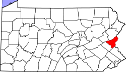 | |
| Boroughs | ||
| Townships | ||
| CDPs | ||
| Unincorporated communities | ||
| Footnotes | ‡This populated place also has portions in an adjacent county or counties | |
This article is issued from Wikipedia - version of the 9/4/2016. The text is available under the Creative Commons Attribution/Share Alike but additional terms may apply for the media files.