Freemansburg, Pennsylvania
| Borough of Freemansburg | |
| Settlement | |
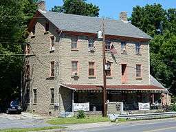 Jacob Freeman House. July 2015. | |
| Country | United States |
|---|---|
| State | Pennsylvania |
| County | Northampton |
| Elevation | 325 ft (99.1 m) |
| Coordinates | 40°37′38″N 75°20′23″W / 40.62722°N 75.33972°WCoordinates: 40°37′38″N 75°20′23″W / 40.62722°N 75.33972°W |
| Area | 0.8 sq mi (2.1 km2) |
| - land | 0.7 sq mi (2 km2) |
| - water | 0.04 sq mi (0 km2), 5% |
| Population | 1,897 (2000) |
| Density | 2,600.5/sq mi (1,004.1/km2) |
| Mayor | Gerald Yob |
| Timezone | EST (UTC-5) |
| - summer (DST) | EDT (UTC-4) |
| ZIP Code | 18017 |
| Area code | 610 and 484 |
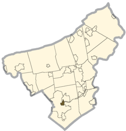 Location of Freemansburg in Northampton County | |
 Location of Freemansburg in Pennsylvania | |
 Location of Pennsylvania in the United States | |
| Website: http://www.boroughoffreemansburg.org | |
Freemansburg is a borough in Northampton County, Pennsylvania, United States. Freemansburg is located in the Lehigh Valley region of the state.
The population of Freemansburg was 1,897 at the 2000 census.
History
Freemansburg was named for Jacob Freeman.[1]
Geography
Freemansburg is located at 40°37′38″N 75°20′23″W / 40.62722°N 75.33972°W (40.627348, -75.339815).[2]
According to the United States Census Bureau, the borough has a total area of 0.8 square miles (2.1 km2), of which, 0.7 square miles (1.8 km2) of it is land and 0.04 square miles (0.10 km2) of it (5.26%) is water.
Demographics
| Historical population | |||
|---|---|---|---|
| Census | Pop. | %± | |
| 1860 | 649 | — | |
| 1870 | 643 | −0.9% | |
| 1880 | 634 | −1.4% | |
| 1890 | 615 | −3.0% | |
| 1900 | 596 | −3.1% | |
| 1910 | 867 | 45.5% | |
| 1920 | 1,203 | 38.8% | |
| 1930 | 1,777 | 47.7% | |
| 1940 | 1,728 | −2.8% | |
| 1950 | 1,739 | 0.6% | |
| 1960 | 1,652 | −5.0% | |
| 1970 | 1,681 | 1.8% | |
| 1980 | 1,879 | 11.8% | |
| 1990 | 1,946 | 3.6% | |
| 2000 | 1,897 | −2.5% | |
| 2010 | 2,636 | 39.0% | |
| Est. 2015 | 2,616 | [3] | −0.8% |
| Sources:[4][5][6] | |||
As of the census[5] of 2000, there were 1,897 people, 687 households, and 493 families residing in the borough. The population density was 2,600.5 people per square mile (1,003.3/km2). There were 721 housing units at an average density of 988.4 per square mile (381.3/km2). The racial makeup of the borough was 87.72% White, 2.79% African American, 0.32% Native American, 0.47% Asian, 5.75% from other races, and 2.95% from two or more races. Hispanic or Latino of any race were 14.87% of the population.
As of 2010, the population has increased 39.0% from 2000 to 2010, which there were 2,636 people in the borough. The 2010 racial makeup of the borough has dramatically changed as well. In 2010, the borough was 59.7% (Whites), 12.7% (African Americans), 0.3% (Native Americans), 0.8% (Asians), 0.04% (Pacific Islander), and 2.0% from two or more races. Hispanic or Latino of any race were 24% of the population.
There were 687 households, out of which 34.4% had children under the age of 18 living with them, 54.4% were married couples living together, 11.5% had a female householder with no husband present, and 28.2% were non-families. 23.3% of all households were made up of individuals, and 8.4% had someone living alone who was 65 years of age or older. The average household size was 2.64 and the average family size was 3.06.
In the borough the population was spread out, with 24.8% under the age of 18, 9.5% from 18 to 24, 34.2% from 25 to 44, 19.0% from 45 to 64, and 12.5% who were 65 years of age or older. The median age was 36 years. For every 100 females there were 101.8 males. For every 100 females age 18 and over, there were 98.7 males.
The median income for a household in the borough was $44,297, and the median income for a family was $48,333. Males had a median income of $31,994 versus $24,853 for females. The per capita income for the borough was $17,983. About 6.7% of families and 9.4% of the population were below the poverty line, including 11.0% of those under age 18 and 6.9% of those age 65 or over.
Public education
The Borough is served by the Bethlehem Area School District.
Gallery
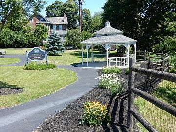 Park at Main Street Borough entrance.
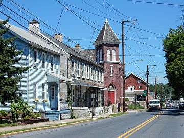 Main Street.
 Christ Lutheran Church.
 Pentecostal Church.
 Freemansburg Elementary School.
 Lehigh Canal and trail.
References
- ↑ Gannett, Henry (1905). The Origin of Certain Place Names in the United States. Govt. Print. Off. p. 132.
- ↑ "US Gazetteer files: 2010, 2000, and 1990". United States Census Bureau. 2011-02-12. Retrieved 2011-04-23.
- ↑ "Annual Estimates of the Resident Population for Incorporated Places: April 1, 2010 to July 1, 2015". Retrieved July 2, 2016.
- ↑ "Census of Population and Housing". U.S. Census Bureau. Retrieved 11 December 2013.
- 1 2 "American FactFinder". United States Census Bureau. Retrieved 2008-01-31.
- ↑ "Incorporated Places and Minor Civil Divisions Datasets: Subcounty Resident Population Estimates: April 1, 2010 to July 1, 2012". Population Estimates. U.S. Census Bureau. Retrieved 11 December 2013.
External links
| Wikimedia Commons has media related to Freemansburg, Pennsylvania. |
Municipalities and communities of Northampton County, Pennsylvania, United States | ||
|---|---|---|
| Cities | 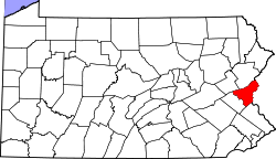 | |
| Boroughs | ||
| Townships | ||
| CDPs | ||
| Unincorporated communities | ||
| Footnotes | ‡This populated place also has portions in an adjacent county or counties | |