Ormoy-la-Rivière
| Ormoy-la-Rivière | ||
|---|---|---|
|
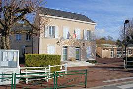
The town hall in Ormoy-la-Rivière | ||
| ||
 Ormoy-la-Rivière | ||
|
Location within Île-de-France region  Ormoy-la-Rivière | ||
| Coordinates: 48°24′16″N 2°09′00″E / 48.4044°N 2.1499°ECoordinates: 48°24′16″N 2°09′00″E / 48.4044°N 2.1499°E | ||
| Country | France | |
| Region | Île-de-France | |
| Department | Essonne | |
| Arrondissement | Étampes | |
| Canton | Étampes | |
| Intercommunality | Étampois | |
| Government | ||
| • Mayor (2008–2014) | Jean-Claude Reveau | |
| Area1 | 10.29 km2 (3.97 sq mi) | |
| Population (2006)2 | 1,014 | |
| • Density | 99/km2 (260/sq mi) | |
| Time zone | CET (UTC+1) | |
| • Summer (DST) | CEST (UTC+2) | |
| INSEE/Postal code | 91469 / 91150 | |
| Elevation | 67–147 m (220–482 ft) | |
|
1 French Land Register data, which excludes lakes, ponds, glaciers > 1 km² (0.386 sq mi or 247 acres) and river estuaries. 2 Population without double counting: residents of multiple communes (e.g., students and military personnel) only counted once. | ||
.svg.png)
Ormoy-la-Rivière is a commune in the Essonne department in Île-de-France in northern France.
Inhabitants of Ormoy-la-Rivière are known as Ormoisiens.
Geography
The village lies on the right bank of the Juine, which flows northward through the commune.
See also
References
- INSEE
- Mayors of Essonne Association (French)
External links
| Wikimedia Commons has media related to Ormoy-la-Rivière. |
- Mérimée database - Cultural heritage (French)
- Land use (IAURIF) (English)
This article is issued from Wikipedia - version of the 7/16/2016. The text is available under the Creative Commons Attribution/Share Alike but additional terms may apply for the media files.