Ballancourt-sur-Essonne
| Ballancourt-sur-Essonne | ||
|---|---|---|
|
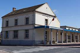
The town hall of Ballancourt-sur-Essonne | ||
| ||
 Ballancourt-sur-Essonne | ||
|
Location within Île-de-France region 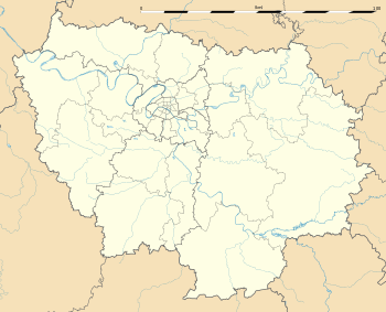 Ballancourt-sur-Essonne | ||
| Coordinates: 48°31′29″N 2°23′03″E / 48.5247°N 2.3843°ECoordinates: 48°31′29″N 2°23′03″E / 48.5247°N 2.3843°E | ||
| Country | France | |
| Region | Île-de-France | |
| Department | Essonne | |
| Arrondissement | Évry | |
| Canton | Mennecy | |
| Intercommunality | Val d'Essonne | |
| Government | ||
| • Mayor (2014–2020) | Jacques Mione | |
| Area1 | 11.30 km2 (4.36 sq mi) | |
| Population (2006)2 | 7,275 | |
| • Density | 640/km2 (1,700/sq mi) | |
| Time zone | CET (UTC+1) | |
| • Summer (DST) | CEST (UTC+2) | |
| INSEE/Postal code | 91045 / 91610 | |
| Elevation | 47–142 m (154–466 ft) | |
|
1 French Land Register data, which excludes lakes, ponds, glaciers > 1 km² (0.386 sq mi or 247 acres) and river estuaries. 2 Population without double counting: residents of multiple communes (e.g., students and military personnel) only counted once. | ||
.svg.png)
Ballancourt-sur-Essonne is a commune in the Essonne department in Île-de-France in northern France. Inhabitants of Ballancourt-sur-Essonne are known as Ballancourtois.
Geography
The Essonne forms the commune western border. Ballancourt-sur-Essonne is 37 kilometers south east of Paris-Notre-Dame, point zero from road of France, 13 kilometers south west of Évry, 5 kilometers north east of La Ferté-Alais, 12 kilometers south west of Corbeil-Essonnes, 12 kilometers south east of Arpajon, 15 kilometers south east of Montlhéry, 15 kilometers north west of Milly-la-Forêt, 20 kilometers north east of Étampes, 23 kilometers south east of Palaiseau, 27 kilometers east of Dourdan.
History
The commune is the site of the Château du Saussay.
Architectural heritage
- The castle of Saussay in the 17th century and its park were awarded historical monument in January 19, 1951.
- Father of the music rocks(Roches du père la Musique)
- Chapel Saint-Blaise
- Saint-Martin's church
- Maison et parc sauvage de Madame Chaumerdiac situés au 12, rue Pasteur
See also
References
- Mayors of Essonne Association (French)
External links
| Wikimedia Commons has media related to Ballancourt-sur-Essonne. |
- Official website (French)
- Mérimée database - Cultural heritage (French)
- Land use (IAURIF) (English)