Bures-sur-Yvette
| Bures-sur-Yvette | ||
|---|---|---|
|
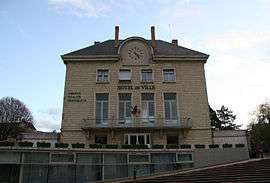
The town hall of Bures-sur-Yvette | ||
| ||
 Bures-sur-Yvette | ||
|
Location within Île-de-France region 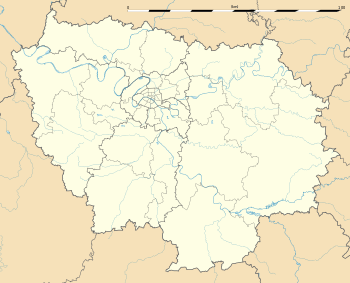 Bures-sur-Yvette | ||
| Coordinates: 48°41′49″N 2°09′50″E / 48.6969°N 2.1639°ECoordinates: 48°41′49″N 2°09′50″E / 48.6969°N 2.1639°E | ||
| Country | France | |
| Region | Île-de-France | |
| Department | Essonne | |
| Arrondissement | Palaiseau | |
| Canton | Orsay | |
| Intercommunality | Communauté d'agglomération du Plateau de Saclay | |
| Government | ||
| • Mayor (2008–2014) | Jean-François Vigier | |
| Area1 | 4.17 km2 (1.61 sq mi) | |
| Population (2006)2 | 9,994 | |
| • Density | 2,400/km2 (6,200/sq mi) | |
| Time zone | CET (UTC+1) | |
| • Summer (DST) | CEST (UTC+2) | |
| INSEE/Postal code | 91122 / 91440 | |
| Elevation | 56–163 m (184–535 ft) | |
|
1 French Land Register data, which excludes lakes, ponds, glaciers > 1 km² (0.386 sq mi or 247 acres) and river estuaries. 2 Population without double counting: residents of multiple communes (e.g., students and military personnel) only counted once. | ||
Bures-sur-Yvette is a commune in the Essonne department in Île-de-France in northern France.
Inhabitants of Bures-sur-Yvette are known as Buressois.
Geography
Bures-sur-Yvette is located in the Vallée de Chevreuse on the river Yvette, along which the RER line B is laid. The stations on the line serving the commune are Bures-sur-Yvette and La Hacquinière. Adjacent communes are Orsay, Gif-sur-Yvette, Gometz-le-Châtel, and Les Ulis. The small town is also twinned with Crewkerne UK.
Research
Bures-sur-Yvette hosts the greater part of the Orsay campus of the Paris University XI, as well as the IHÉS (Institut des Hautes Études Scientifiques).
See also
References
- INSEE
- Mayors of Essonne Association (French)
External links
- Bures-sur-Yvette city council website (in French)
- Mérimée database - Cultural heritage (French)
- Land use (IAURIF) (English)
| Wikimedia Commons has media related to Bures-sur-Yvette. |
This article is issued from Wikipedia - version of the 11/10/2016. The text is available under the Creative Commons Attribution/Share Alike but additional terms may apply for the media files.