Old Laund Booth
| Old Laund Booth | |
 Fence Gate Inn, Fence |
|
 Old Laund Booth |
|
| Population | 1,459 (2011) |
|---|---|
| OS grid reference | SD8240 |
| Civil parish | Old Laund Booth |
| District | Pendle |
| Shire county | Lancashire |
| Region | North West |
| Country | England |
| Sovereign state | United Kingdom |
| Post town | BURNLEY |
| Postcode district | BB12 |
| Dialling code | 01282 |
| Police | Lancashire |
| Fire | Lancashire |
| Ambulance | North West |
| EU Parliament | North West England |
| UK Parliament | Pendle |
|
|
Coordinates: 53°49′59″N 2°15′36″W / 53.833°N 2.260°W
Old Laund Booth is a civil parish in the Pendle district of Lancashire, England. It has a population of 1,459,[1] and contains the villages of Fence and Wheatley Lane.
Old Laund Booth was once a township in the ancient parish of Whalley. This became a civil parish in 1866, forming part of the Burnley Rural District from 1894 (until 1974). Until 1898 when the parish was enlarged, part of Goldshaw Booth and a detached area Higham with West Close Booth, divided the township into two parts with Fence in the eastern and Wheatley Lane and Old Laund hall in the western.[2][3] In 1935 the civil parish of Wheatley Carr Booth was abolished and the area also joined this parish.[4]
The parish adjoins the Pendle parishes of Roughlee Booth, Barrowford, Nelson, Brierfield, Reedley Hallows, Higham-with-West Close Booth and Goldshaw Booth. Higher areas of the parish, north-east of the villages are part of the Forest of Bowland Area of Outstanding Natural Beauty (AONB).[5]
According to the United Kingdom Census 2011, the parish has a population of 1,459,[1] a decrease from 1,586 in the 2001 census.[6]
Media gallery
 Ye Old Sparrow Hawk, Wheatley Lane
 St Anne's Church, Fence
 Inghamite Church, Wheatley Lane
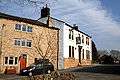 The White Swan, Wheatley Lane
See also
References
Citations
- 1 2 "Key Figures for 2011 Census: Key Statistics". Office for National Statistics. Retrieved 1 July 2015.
- ↑ Lancashire and Furness (Map) (1st ed.). 1 : 10,560. County Series. Ordnance Survey. 1848.
- ↑ "Old Laund Booth Tn/CP through time". visionofbritain.org.uk. GB Historical GIS / University of Portsmouth. Retrieved 7 September 2015.
- ↑ "Wheatley Carr Booth Tn/CP through time". visionofbritain.org.uk. GB Historical GIS / University of Portsmouth. Retrieved 7 September 2015.
- ↑ Forest of Bowland map (Map). forestofbowland.com. Lancashire County Council.
- ↑ Office for National Statistics : Census 2001 : Parish Headcounts : Pendle Retrieved 2009-09-18
External links
![]() Media related to Old Laund Booth at Wikimedia Commons
Media related to Old Laund Booth at Wikimedia Commons
- Map of modern parish boundary at Lancashire County Council website
- Old Laund Booth township - British History Online
- Wheatley Carr Booth township - British History Online