History of Lancashire
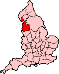
Lancashire is a county of England, in the northwest of the country. The county did not exist in 1086, for the Domesday Book, and was apparently first created in 1182[1] making it one of the youngest of the traditional counties. In 1974 Lancashire was administratively divided into Greater Manchester, Merseyside and the new ceremonial county of Lancashire; since then, Preston has served as the seat of the county council. Throughout these changes, historic Lancashire still continues to be recognized as a geographical and cultural area by the British Government.[2] The historic county palatine boundaries are also still recognized and unmoved with Lancaster still being recognised as the county town.[3] Traditional borders are still followed by organisations such as the Lancashire FA.[4]
The historic county consisted of two separate parts. The main part runs along the northwestern coast of England. When it included Manchester and Liverpool it had a greatest length of 76 miles, and breadth of 45 miles, and an area of 1,208,154 acres. The northern detached part of the old county palatine, consisting of Furness and Cartmell was 25 miles in length, 23 miles in breadth and was separated from the main portion of Lancashire by Morecambe Bay and the Kendal district of Westmorland.[5] Administratively it has now joined Westmorland as part of modern Cumbria. This district reaches a peak height of 2633 ft at Old Man of Coniston, the highest in England.
As a county palatine, the Duke of Lancaster had sovereignty rights in the areas of justice and administration within the county.[6] However, in 1461 Edward IV decreed that the county palatine should become part of the Duchy of Lancaster and from 1471 the offices of Chancellor of the Duchy and Chancellor of the Palatinate were held by the same person. The administrative centre moved to London, while Lancaster remained the legal centre. Under the Supreme Court of Judicature Act 1873 the common law and criminal jurisdictions transferred to the new High Court of Justice. After November 1875 the palatinate consisted only of the Court of Chancery and the Chancellor's right to appoint justices of the peace and other local officers. Under the Courts Act 1971, the Court of Chancery also merged with the High Court.[7] And in March 2005, under the Courts Act 2003, the power to appoint magistrates in Lancashire, Greater Manchester and Merseyside transferred to the Ministry of Justice.[8] The High Sheriffs of Lancashire, Greater Manchester and Merseyside are still appointed by the Queen in right of the duchy.[9] The duchy also benefits from the legal concept of bona vacantia within county palatine, whereby it has the right to property for which the legal owner cannot be found. The proceeds are divided between two registered charities, the Duchy of Lancaster Benevolent Fund and the Duchy of Lancaster Jubilee Trust.[10]
The emblem of the historic county of Lancashire is the Red Rose of the English royal House of Lancaster, and in 2008 the Flag of Lancashire became recognised by the Flag Institute. On 27 November, Lancashire Day celebrates the culture of the historic county ranging from its history to its own dialect.
Toponomy


Lancashire takes its name from the city of Lancaster, whose name means 'Roman fort on the River Lune',[11] combining the name of the river with the Old English cæster, which derived from the Roman word for a fort or camp.[12] Official documents called it the "County of Lancaster" rather than Lancashire, "Lancastershire" occurs in late 14th century and Leland, was still using it in 1540. "Lancashire" occurs in the Paston Letters in 1464.[13] Lancashire became the preferred designation, as a syncope of Lancastershire.
Background
At the time when the Romans arrived in England, much of northern England was inhabited by the Brigantes, though the Cumbrian highland area was inhabited by the Carvetii, who were possibly a tribe within the larger Brigantes group. Another tribe named the Setantii has also been hypothesized based on the name of a Roman era port near the mouth of the River Wyre, called Portus Setantiorum, and they were possibly also Brigantes, if they existed.[14]
The remains of Roman forts exist at Manchester,[15] Lancaster,[16] Over Burrow,[17] Ribchester,[18] Kirkham[19] and Castleshaw.[20] A number of Roman roads are known to have existed including one between Manchester and Carlisle, via Ribchester and Burrow.[21] It is thought that a cluster of Romano-British farmsteads existed to the east of Burnley[22][23][24]
The land that would become the ancient county of Lancashire had been part of the Kingdom of Northumbria, the River Mersey being considered the border with Mercia. The Anglo-Saxon Chronicle records that in 923, Edward the Elder brought an army to Mercia and ordered the repair of the defenses at Manchester in Northumbria.[25] It seems that from this time the area south of the Ribble became associated with Mercia.[26]
After the Norman conquest, William the Conqueror gave to Roger de Poitou, lands spanning eight ancient counties, which included the area between the River Ribble and the Mersey and Amounderness.[27] However, by the time of the Domesday survey, most of his lands are recorded to be under the king's control.[28] In the Domesday Book, some of its lands had been treated as part of Yorkshire. The area in between the Rivers Mersey and Ribble (referred to in the Domesday Book as "Inter Ripam et Mersam") formed part of the returns for Cheshire.[29][30][28] Although some have taken this to mean that, at this time, south Lancashire was part of Cheshire,[30] it is not clear that this was the case, and more recent research indicates that the boundary between Cheshire and what was to become Lancashire remained the river Mersey.[31][32][33] South of the Ribble was surveyed as six hundreds: Blackburn, Derby, Leyland, Newton, Salford and Warrington. The entries are brief, and unusually intermix the Anglo-Saxon hide with the Danelaw carucate as units of measurement. The entries for the north, consist of little more than lists of manors. Amounderness appears as a district, apparently stretching inland to the River Hodder, the hundred is thought to have been created shortly afterwards.[34] Lonsdale was also not recorded as a hundred, the name only appears apparently as a manor attached to Cockerham.[35]
Note that Lancaster itself was at this time apparently administratively united (to the extent it could be administered) with Kendal, Furness and Cartmell, but not with the area south of the Ribble river. This contiguous area of relatively undeveloped highland was administered by men such as Ivo de Taillebois, and a local aristocracy which still included . This is proposed by authors such as William Farrer to be the reason why the first Barons of Kendal used the surname "de Lancaster" despite Kendal not becoming a permanent part of the later developed county of Lancaster.[36]
Early history
After Domesday, Roger's lands where returned to him and in the early 1090s Lonsdale, Cartmel and Furness were added to Roger's estates to facilitate the defence of the area south of Morecambe Bay from Scottish raiding parties, which travelled round the Cumberland coast and across the bay at low water, rather than through the mountainous regions of the Lake District. However, in 1102 he supported Robert Curthose in a failed rebellion against Henry I and his English holdings where forfeit. The Lonsdale Hundred was created sometime during the late 11th or early 12th centuries, certainly by 1168. Place-name evidence suggests that previous district included areas within the River Lune's watershed, not included in the new hundred.[35]
From 1164 until 1189 the honour of Lancaster was held by the crown and its accounts are recorded in the Pipe rolls.[37] It was usually included under Yorkshire or Northumberland, as when the first reference to a County of Lancaster occurs in 1168 in the accounts of the sheriff.[38] In 1182 Lancaster recorded as a separate shire,[39] with a note stating "because there was no place for it in Northumberland".[40]
After 1194 the honour was again in the possession of the crown, but in 1267 Edmund Crouchback (father of the House of Lancaster) the son of King Henry III was created the 1st Earl of Lancaster. Henry de Lacy the Earl of Lincoln at this time held the baronies of Clitheroe, Penwortham and Halton and the lordships of Rochdale and Bury in this area. With his death in 1311, ownership passed to Crouchback's son Thomas, 2nd Earl of Lancaster who had been married to Henry's daughter, Alice.[41] Thomas was executed as a rebel and replaced by his younger brother Henry, 3rd Earl of Lancaster. In 1351 Henry's son, Henry of Grosmont, became the first Duke of Lancaster with palatine jurisdiction within the county.[42]
Once its initial boundaries were established, it bordered Cumberland, Westmorland, Yorkshire, and Cheshire. The county was divided into the six hundreds of Amounderness,[43] Blackburn,[44][45] Leyland,[46] Lonsdale,[35] Salford,[47][48] and West Derby.[49][50] Lonsdale was further partitioned into Lonsdale North, which was the detached part north of Morecambe Bay (also known as Furness), and Lonsdale South. Each hundred was sub-divided into parishes. As the parishes covered relatively large areas, they were further divided into townships that were more similar in size to parishes in counties in the south of England. Outside of the administration of the hundreds were the boroughs.
Industrial Revolution
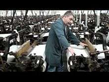
Lancashire was one of the homes of modern industrialization. This started with small scale experiments, for example in the automation of weaving. Lancashire, had a long history of supplying wool to skilled weavers in Europe and southern England, as well as having many cottager weavers itself by the 18th century. But the advent of increased imports of cotton needing processing was a trigger to innovation. John Kay, Richard Arkwright, Samuel Crompton, and James Hargreaves were from Lancashire.
Around 1700, a blast furnace thought to be the first built in Lancashire, was constructed in the Cliviger gorge.[51]
Prior to the Municipal Corporations Act there were relatively few boroughs in the county. But following the act, 22 towns were incorporated up to 1862 as the county became more populous due to the continuing industrial revolution. County Hall in Preston was built as a home for the county administration, the Quarter Sessions and Lancashire Constabulary) and opened on 14 September 1882.[52][53] In 1889, the administrative county of Lancashire was created, covering the historical county except for the county boroughs such as Blackburn, Burnley, Barrow-in-Furness, Preston, Wigan, Liverpool and Manchester.[54]
During the 20th century, the county became increasingly urbanised, particularly the southern part. To the existing county boroughs of Barrow-in-Furness, Blackburn, Bolton, Bootle, Burnley, Bury, Liverpool, Manchester, Oldham, Preston, Rochdale, Salford, St Helens and Wigan were added Blackpool (1904), Southport (1905), and Warrington (1900). The county boroughs also had many boundary extensions. The borders around the Manchester area were particularly complicated, with narrow protrusions of the administrative county between the county boroughs – Lees urban district formed a detached part of the administrative county, between Oldham county borough and the West Riding of Yorkshire.[55]
Modern history
| Districts and county boroughs of Lancashire in 1961 | |
|---|---|
 |
|
By the census of 1971, the population of Lancashire and its county boroughs had reached 5,129,416, making it the most populous geographic county in the UK.[56] The administrative county was also the most populous of its type outside London, with a population of 2,280,359 in 1961. On 1 April 1974, under the Local Government Act 1972, the administrative county was abolished, as were the county boroughs. The urbanised southern part largely became part of two metropolitan counties, Merseyside and Greater Manchester.[57]
The boroughs of Liverpool, Knowsley, St Helens and Sefton were included in Merseyside. In Greater Manchester the successor boroughs were Bury, Bolton, Manchester, Oldham (part), Rochdale, Salford, Tameside (part), Trafford (part) and Wigan. Warrington and Widnes, south of the new Merseyside/Greater Manchester border were added to the new non-metropolitan county of Cheshire. The urban districts of Barnoldswick and Earby, Bowland Rural District and the parishes of Bracewell and Brogden and Salterforth from Skipton Rural District in the West Riding of Yorkshire became part of the new Lancashire. One parish, Simonswood, was transferred from the borough of Knowsley in Merseyside to the district of West Lancashire in 1994.[58] In 1998 Blackpool and Blackburn with Darwen became independent of the county as unitary authorities, but remained in Lancashire for ceremonial purposes, including the provision of fire, rescue and policing.
Although the county town of Lancashire is considered to be Lancaster, the county council is seated in the city of Preston.
- Maps of early Lancashire
-

Map of mid-Lancashire, c. 400.
-

North Lancashire in 1610.
-

Southwest Lancashire in 1610.
See also
- History of England
- History of Manchester
- History of Liverpool
- History of Cumbria
- House of Lancaster
- Duchy of Lancaster
- Grade I listed buildings in Lancashire
- Grade II* listed buildings in Lancashire
Notes and references
- ↑ http://www.highsheriffs.com/Lancashire/LancashireHistory.htm
- ↑ http://county-wise.org.uk/counties/never-abolished/
- ↑ "County Palatine". Duchy of Lancaster.
- ↑ http://www.lancashirefa.com/the-assocation
- ↑ http://www.visionofbritain.org.uk/place/17463
- ↑ http://www.duchyoflancaster.co.uk/about-the-duchy/history/county-palatine/
- ↑ "Records of the Palatinate of Lancaster". The National Archives. Retrieved 5 December 2015.
- ↑ "Palatinate Magistracy". Duchy of Lancaster. Retrieved 5 December 2015.
- ↑ "Palatinate High Sheriffs". Duchy of Lancaster. Retrieved 5 December 2015.
- ↑ "Bona Vacantia". Duchy of Lancaster. Retrieved 6 December 2015.
- ↑ Copley, Gordon K. (1963). Names and places: With a Short Dictionary of Common or Well-known Place-names. Phoenix House. p. 19.
- ↑ Matthews, C.M. (1977). Place Names of the English-Speaking World. Encore Editions. p. 41. ISBN 978-0-684-15424-4.
- ↑ Tait 1904, p. 181
- ↑ https://web.archive.org/web/20150504035913/http://www.roman-britain.org/places/portus_setantiorum.htm
- ↑ Historic England. "Mamucium Roman fort (76731)". PastScape. Retrieved 19 March 2015.
- ↑ Historic England. "Lancaster Roman fort (41221)". PastScape. Retrieved 19 March 2015.
- ↑ Historic England. "Galacum Roman fort (43953)". PastScape. Retrieved 19 March 2015.
- ↑ Historic England. "Bremetennacum Veteranorum (43639)". PastScape. Retrieved 19 March 2015.
- ↑ Historic England. "Kirkham Roman fort (45891)". PastScape. Retrieved 19 March 2015.
- ↑ Historic England. "Castleshaw Roman forts (45891)". PastScape. Retrieved 19 March 2015.
- ↑ Historic England. "Monument No. 44005 (44005)". PastScape. Retrieved 19 March 2015.
- ↑ Historic England. "Two Romano-British farmsteads known as Ring Stones (1009488)". National Heritage List for England.
- ↑ Historic England. "Twist Castle Romano-British farmstead (1009497)". National Heritage List for England.
- ↑ Historic England. "Beadle Hill Romano-British farmstead (1009487)". National Heritage List for England.
- ↑ "The Anglo-Saxon Chronicle". Project Gutenburg. Retrieved 16 March 2015.
- ↑ Farrer & Brownbill 1906, pp. 270
- ↑ Farrer & Brownbill 1906, pp. 291
- 1 2 Farrer & Brownbill 1906, pp. 269
- ↑ Morgan (1978). pp.269c–301c,d.
- 1 2 Sylvester (1980). p. 14.
- ↑ Harris and Thacker (1987). write on page 252:
Certainly there were links between Cheshire and south Lancashire before 1000, when Wulfric Spot held lands in both territories. Wulfric's estates remained grouped together after his death, when they were left to his brother Aelfhelm, and indeed there still seems to have been some kind of connexion in 1086, when south Lancashire was surveyed together with Cheshire by the Domesday commissioners. Nevertheless, the two territories do seem to have been distinguished from one another in some way and it is not certain that the shire-moot and the reeves referred to in the south Lancashire section of Domesday were the Cheshire ones.
- ↑ Phillips and Phillips (2002). pp. 26–31.
- ↑ Crosby, A. (1996) writes on page 31:
The Domesday Survey (1086) included south Lancashire with Cheshire for convenience, but the Mersey, the name of which means 'boundary river' is known to have divided the kingdoms of Northumbria and Mercia and there is no doubt that this was the real boundary.
- ↑ Farrer & Brownbill 1906, pp. 269-283
- 1 2 3 Farrer & Brownbill 1914, p. 1
- ↑ Farrer, "The Domesday Survey of North Lancashire and the Adjacent Parts of Cumberland, Westmorland, and Yorkshire", Transactions of the Lancashire and Cheshire Antiquarian Society: 88
- ↑ Tait 1904, pp. 176-77
- ↑ Tait 1904, p. 159; Farrer 1902, pp. 13-4.
- ↑ Kenyon 1991, p. 159; Farrer 1902, p. xvii.
- ↑ Tait 1904, p. 176; Farrer 1902, p. 47.
- ↑ Farrer & Brownbill 1906, pp. 310-11
- ↑ Farrer & Brownbill 1906, pp. 296
- ↑ Farrer & Brownbill 1912, p. 68
- ↑ Farrer & Brownbill 1911c, p. 230
- ↑ Farrer & Brownbill 1912, p. 1
- ↑ Farrer & Brownbill 1911c, p. 1
- ↑ Farrer & Brownbill 1911a, p. 171
- ↑ Farrer & Brownbill 1911b, p. 1
- ↑ Farrer & Brownbill 1907, p. 1
- ↑ Farrer & Brownbill 1911a, p. 1
- ↑ Historic England. "Cliviger Furnace (45210)". PastScape. Retrieved 27 March 2015.
- ↑ Farrer & Brownbill 1914, p. 96
- ↑ "Opening of the new Town-Hall at Preston". The Times. 15 September 1882.
- ↑ "Lancashire AdmC through time". visionofbritain.org.uk. GB Historical GIS / University of Portsmouth. Retrieved 6 December 2015.
- ↑ Lord Redcliffe-Maud and Bruce Wood. English Local Government Reformed. (1974)
- ↑ "High Sheriff - Lancashire County History". highsheriffs.com.
- ↑ Jones, B. et al., Politics UK, (2004)
- ↑ OPSI – The Cheshire, Lancashire and Merseyside (County and Metropolitan Borough Boundaries) Order 1993
Bibliography
- Farrer, William; Brownbill, John, eds. (1906), The Victoria History of the County of Lancaster Vol 1, Victoria County History, Constable & Co, OCLC 832215399
- Farrer, William; Brownbill, John, eds. (1907), The Victoria History of the County of Lancaster Vol 3, Victoria County History, Constable & Co, OCLC 832215436
- Farrer, William; Brownbill, John, eds. (1911a), The Victoria History of the County of Lancaster Vol 4, Victoria County History, Constable & Co, OCLC 832215452
- Farrer, William; Brownbill, John, eds. (1911b), The Victoria History of the County of Lancaster Vol 5, Victoria County History, Constable & Co, OCLC 832215464
- Farrer, William; Brownbill, John, eds. (1911c), The Victoria History of the County of Lancaster Vol 6, Victoria County History, - Constable & Co, OCLC 832215477
- Farrer, William; Brownbill, John, eds. (1912), The Victoria History of the County of Lancaster Vol 7, Victoria County History, - Constable & Co, OCLC 832215488
- Farrer, William; Brownbill, John, eds. (1914), The Victoria History of the County of Lancaster Vol 8, Victoria County History, Constable & Co, OCLC 270761426
- Farrer, William (1902), The Lancashire Pipe rolls..., H. Young and Sons, OCLC 2001421
- Kenyon, Denise (1991), The Origins of Lancashire (Origins of the Shire), Manchester University Press, ISBN 0-7190-3546-5
- Tait, James (1904), Mediaeval Manchester and the Beginnings of Lancashire, Manchester: Manchester University Press, OCLC 6057079
- Crosby, A. (1996). A History of Cheshire. (The Darwen County History Series.) Chichester, West Sussex, UK: Phillimore & Co. Ltd. ISBN 0-85033-932-4.
- Harris, B. E., and Thacker, A. T. (1987). The Victoria History of the County of Chester. (Volume 1: Physique, Prehistory, Roman, Anglo-Saxon, and Domesday). Oxford: Oxford University Press. ISBN 0-19-722761-9.
- Morgan, P. (1978). Domesday Book Cheshire: Including Lancashire, Cumbria, and North Wales. Chichester, Sussex: Phillimore & Co. Ltd. ISBN 0-85033-140-4.
- Phillips A. D. M., and Phillips, C. B. (2002), A New Historical Atlas of Cheshire. Chester, UK: Cheshire County Council and Cheshire Community Council Publications Trust. ISBN 0-904532-46-1.
- Samuel Tymms (1837). "Lancashire". Northern Circuit. The Family Topographer: Being a Compendious Account of the ... Counties of England. 6. London: J.B. Nichols and Son. OCLC 2127940.
External links
- Lancashire Lantern, The Lancashire Life and Times E-Resource network
- The Chetham Society
- The Historic Society of Lancashire and Cheshire
- The Record Society of Lancashire and Cheshire
- Lancashire and Cheshire Antiquarian Society
- Map of the Lancashire County Hundreds
- The Victoria County History of Lancashire, (seven volumes, as part of British History Online)
- Friends of Real Lancashire, promoting the historic boundaries of Lancashire
- Silent footage of royal visit to Lancaster for the 600th anniversary of the County Palatine of Lancaster 1951 Produced by Sam Hanna, Burnley (Vimeo - North West Film Archive)
- "Lancashire", Historical Directories, UK: University of Leicester
- Fishwick, Henry. A history of Lancashire at Project Gutenberg
- british-towns.net
.svg.png)