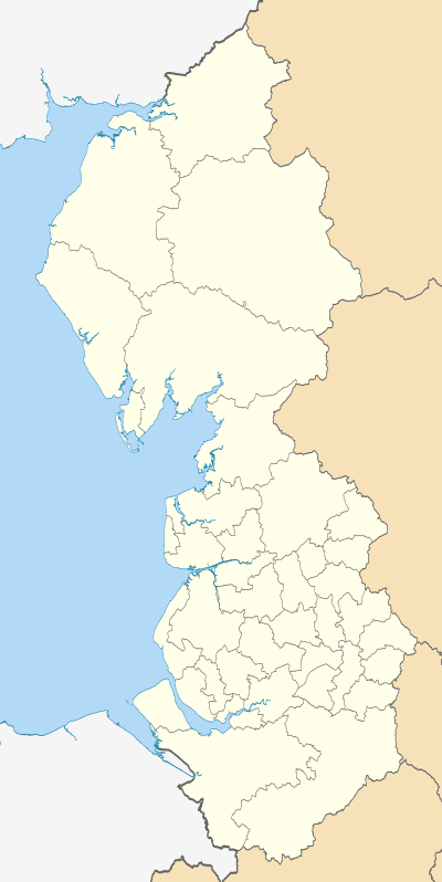
Hyndburn
Coordinates: 53°46′05″N 2°22′55″W / 53.768°N 2.382°W
| Borough of Hyndburn | |
|---|---|
| Borough | |
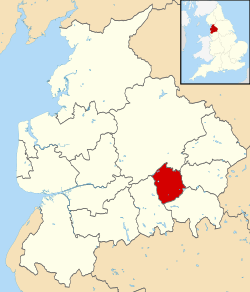 Shown within Lancashire and England | |
| Sovereign state | United Kingdom |
| Constituent country | England |
| Region | North West England |
| Ceremonial county | Lancashire |
| Founded | 1974 |
| Admin. HQ | Accrington |
| Government | |
| • Type | Hyndburn Borough Council |
| • Leadership: | Leader & Cabinet |
| • MPs: | Graham Jones |
| Area | |
| • Total | 28.19 sq mi (73.00 km2) |
| Area rank | 252nd |
| Population (mid-2014 est.) | |
| • Total | 80,208 |
| • Rank | Ranked 289th |
| • Density | 2,800/sq mi (1,100/km2) |
| Time zone | Greenwich Mean Time (UTC+0) |
| • Summer (DST) | British Summer Time (UTC+1) |
| Postcode | BB1, BB5, BB6 |
| Area code(s) | 01254 |
| ONS code |
30UG (ONS) E07000120 (GSS) |
| Ethnicity |
90.2% White 8.3% S.Asian[1] |
| Website | hyndburnbc.gov.uk |
Hyndburn /ˈhaɪndbərn/ is a local government district with borough status in Lancashire, England whose council is based in Accrington and the district is named after the River Hyndburn. The population of the Hyndburn Non-Metropolitan District taken at the 2011 census was 80,734.[2]
It was formed in 1974 by the amalgamation of the Borough of Accrington, the Urban Districts of Church, Clayton-le-Moors, Great Harwood, Oswaldtwistle /ˈɒzəl.twɪzəl/ and Rishton, and part of the Burnley Rural District.
Rename
In June 2007, the council proposed changing the name of Hyndburn, and replace it with Accrington & Districts, to aid recognition of the borough by those not familiar with the area.[3] In December 2007, after a public consultation, the plans were stalled.[4] In May 2008, however, this plan was shelved.
In March 2010, Hyndburn was voted the 10th best council in The Times "Best Public Sector Places to Work".[5] The borough also made it to The Times Best Companies Guide.
Education In Hyndburn
There are approximately nine state secondary schools in Hyndburn. These include Norden High School, St Christopher's Church of England High School, Accrington Academy, Rhyddings Business and Enterprise School, Mount Carmel Roman Catholic High School, The Hollins Technology College, along with Broadfield Specialist School, White Ash School, and North Cliffe School.[6]
The Percentage of pupils achieving 5 or more GCSEs at grades A*-C has increased from 43.7% in 2001 up to 69.9% in 2009. Absences has dropped from 12,052 in 2006 to 11,545 in 2009, mainly due to schools competing.[7]
Places in Hyndburn
- Accrington
- Altham
- Baxenden
- Church
- Clayton-le-Moors
- Great Harwood
- Huncoat
- Knuzden
- Oswaldtwistle
- Rising Bridge
- Rishton
Civil parishes
Altham is the only civil parish in Hyndburn.

Neighbouring districts
 |
Ribble Valley | Ribble Valley | Pendle | |
| Blackburn with Darwen | |
Burnley | ||
| ||||
| | ||||
| Blackburn with Darwen | Rossendale | Rossendale |
References
- ↑ "Resident Population Estimates by Ethnic Group (Percentages)". Office for National Statistics. 30 October 2007. Retrieved 2008-08-26.
- ↑ "Non=metropolitan district population 2011". Retrieved 18 January 2016.
- ↑ "Should it be Hyndburn or Accrington?". lancashiretelegraph.co.uk. June 1, 2007. Retrieved June 2, 2015.
- ↑ "Name change bid on ice". lancashiretelegraph.co.uk. December 4, 2007. Retrieved June 2, 2015.
- ↑ "Hyndburn Council in top 75 places to work". lancashiretelegraph.co.uk. March 18, 2010. Retrieved June 2, 2015.
- ↑ http://www.hyndburnbc.gov.uk/site/scripts/services_info.php?serviceID=243
- ↑ http://www.lancashire.gov.uk/office_of_the_chief_executive/lancashireprofile/areas/education.asp
External links
- Accrington Web Hyndburn's local community forum
- Civic Arts Centre Listings for what's on at the Civic Arts Centre