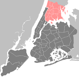
Norwood, Bronx
| Norwood | |
|---|---|
| Neighborhood of The Bronx | |
|
Storefronts along East 204th Street | |
 Norwood  Norwood  Norwood Location in New York City | |
| Coordinates: 40°52′46″N 73°52′47″W / 40.87953°N 73.87959°WCoordinates: 40°52′46″N 73°52′47″W / 40.87953°N 73.87959°W | |
| Country |
|
| State |
|
| City |
|
| Borough |
|
| Area[1] | |
| • Total | 1.36 km2 (0.525 sq mi) |
| Population (2010)[2] | |
| • Total | 40,494 |
| • Density | 30,000/km2 (77,000/sq mi) |
| Economics | |
| • Median income | $33,634 |
| ZIP codes | 10467 |
| Area code | 718, 347, 646 |
.png)
Norwood, also known as Bainbridge, is a working-class residential neighborhood in the northwest Bronx, New York City. As of the census[3] of 2000, the seven census tracts that make up the neighborhood have a population of 40,748. The area is dominated topographically by what was once known as Valentine's Hill, the highest point being near the intersection of 210th Street and Bainbridge Avenue, where Gun Hill Road intersects, and around the Montefiore Medical Center, the largest landowner and employer of the neighborhood. It borders Van Cortlandt Park and Woodlawn Cemetery to the north, the Bronx River to the east, and Mosholu Parkway to the south and west. Norwood's main commercial arteries are Gun Hill Road, Jerome Avenue, Webster Avenue, and Bainbridge Avenue.
Due to its use in city publications, subway maps, and local media, "Norwood" is the neighborhood's more common name, but the area is also known as "Bainbridge," most consistently within the neighborhood's Irish American community that is centered on the commercial zone of Bainbridge Avenue and East 204th Street. However, as this Irish community largely left the country during the 1990s, the name "Bainbridge" has accordingly lost a great deal of currency. Even the name "Norwood" does not carry a great deal of currency as do nearby neighborhoods such as Riverdale and Woodlawn.[4]
It is part of Bronx Community Board 7 and is patrolled by the NYPD's 52nd Precinct, located at 3016 Webster Avenue.
History
At the time of the Civil War, the area was Westchester County farmland on the border of West Farms and Yonkers. Chief property owners included the Valentine, Varian, and Bussing families. Woodlawn Cemetery was founded in 1863 to the north. Annexed to New York City in 1873 along with the rest of the West Bronx, the area's character shifted from rural to suburban by the turn of the 20th century. The neighborhood's streets in their present form were laid out in 1889 by Josiah Briggs between Middlebrook Parkway (renamed Mosholu Parkway) and Woodlawn Cemetery. Contemporary maps show that it was then considered part of Williamsbridge, with which it continues to share a post office. Williamsbridge Reservoir was opened in 1890, transforming the natural lake into an artery that served the New York City water supply system until no longer needed in 1934.[5][6]
The area went through a series of names around the turn of the 20th century, including North Bedford Park, after the neighborhood to the south, and Brendan Hill, after St. Brendan the Navigator and the parish church, established in 1908, that bears his name. The name Brendan Hill was made official by the Board of Aldermen in 1910.[7] Norwood, the name with greatest common currency, is first attributed in the form Norwood Heights—either in honor of Carlisle Norwood, a friend of Leonard Jerome, or simply a contraction of "North Woods", common to a number of places in the English-speaking world.
In the first half of the 20th century Norwood shared with the rest of the Bronx a population made up largely of European-origin Catholic, Protestant, and Jewish families affluent enough to leave Manhattan. These populations were joined by Puerto Ricans during the Great Depression and post World War II eras, and, post-1965, by other Latinos (especially Dominicans), Bangladeshis, Albanians, West Indians (especially Guyanese), West Africans (especially Ghanaians), and a new group of Irish immigrants.
Irish population
In the 1970s through the 1990s the neighborhood was well known for its Irish population, having attracted a number of immigrants from Catholic areas of Northern Ireland who fled the Troubles. During this time that the neighborhood became known by two more names: Bainbridge, after the Bainbridge Avenue - East 204th Street commercial strip - included Irish restaurants, groceries, and pubs, and Little Belfast, after the city from which many immigrants came.
The area contributed much in Irish and Irish-American culture and politics during this time. The musical group Black 47, made up of Irish expatriates, first made their name touring the bar scene here. Their lyrics would go on to reflect the experiences of the Irish in the area, in such songs as "Funky Ceílí," "Her Dear Donegal," and "Rockin' the Bronx." More controversially, Irish pubs in the area attracted press attention as centers of strong support for Irish republicanism, which proposes the severance of Northern Ireland's political ties to the United Kingdom and incorporation into the Republic of Ireland. A few pubs hosted benefits for Noraid, the Northern Irish Aid Committee, accused by Unionists of gun running for the Irish Republican Army (IRA). At least one area bar, The Phoenix, was raided by law enforcement in 1994, with Irish authorities simultaneously raiding its owner's holiday home in Donegal. Thomas Maguire, the owner, and five others, were charged with smuggling thousands of bomb detonators to Ireland from Tucson via New York. A jury found the defendants not guilty on all counts.[8]
A number of factors have contributed to the decline of the Irish population in Bainbridge. The most critical was the downturn in the US economy which forced many Irish immigrants to return to Ireland or to seek work in Germany (whose reunification process coincided with the American recession). A substantial portion of the Irish population were illegally in the country, and thus subject to INS investigation and deportation. The end of the Troubles period, with the signing of the Good Friday Agreement, encouraged some residents to return voluntarily to Northern Ireland on their own, particularly with the improvement of the Northern Irish economy. The growth of the economy of the Republic of Ireland - the so-called "Celtic Tiger" - persuaded some residents to move there. Others have continued to live in New York, moving to the Bronx neighborhoods of Riverdale and Woodlawn, or to nearby Yonkers. The same factors which encouraged return to Ireland have also discouraged further immigration to Bainbridge.
Demographics
2010 Census
Based on data from the 2010 United States Census, the population of Norwood was 40,494, a decrease of 323 (0.8%) from the 40,817 counted in 2000. Covering an area of 360.93 acres (146.06 ha), the neighborhood had a population density of 112.2 inhabitants per acre (71,800/sq mi; 27,700/km2).[2]
The racial makeup of the neighborhood was 9.9% (3,998) White, 17.9% (7,262) African American, 0.3% (114) Native American, 11.0% (4,451) Asian, 0.0% (9) Pacific Islander, 0.7% (264) from other races, and 1.5% (611) from two or more races. Hispanic or Latino of any race were 58.7% (23,785) of the population.[9]
2000 Census
As of the 2000 United States Census, the seven census tracts that make up the neighborhood have a population of 40,748. The racial makeup of the neighborhood is 32.66% White, 22.27% African American, 0.90% Native American, 9.01% Asian, 0.09% Pacific Islander, 28.23% from other races, and 1.59% from two or more races. 52.78% of the population are Hispanic or Latino of any race. 21.17% are Puerto Rican and 8.84% Dominican.
The median income for a household in the neighborhood is $28,724, and the median income for a family is $29,679. Males have a median income of $24,876 versus $20,814 for females. The per capita income for the neighborhood is $13,550.
35.15% of the population, (14,324 individuals), are foreign born. Another 8.55% were born in Puerto Rico, and are thus considered by some to be native born. Of the foreign born, 32.46% were born in the Caribbean, 13.95% in South America, 11.64% in South Central Asia, 11.44% in Central America, 11.35 in Eastern Europe, 5.35% in Southeast Asia, 3.60% in East Asia, 3.00% in West Africa, 0.84% in Southern Europe, 0.72% in Western Asia, and 0.71% in Western Europe. The countries which are represented by at least 2.5% (358 individuals) of the neighborhood's foreign born population are the Dominican Republic (21.17%), Mexico (7.81%), Jamaica (6.49%), Ecuador (5.65%), Bangladesh (5.42%), Guyana (4.64%), the Philippines (4.52%), Albania (4.07%), Ireland (3.00%), and Pakistan (2.81%).
Based on sample data from the same census, the U.S. Census Bureau estimates that 37.44% of the population 5 and older speak only English at home. 46.15% speak Spanish at home, either exclusively or along with English. Other languages spoken at home by more than 0.5% of the population of Norwood include Tagalog (1.89%), Urdu (0.93%), Korean (0.79%), French (0.68%), Serbo-Croatian (0.69%), Chinese (0.60%) and Gujarati (0.58%). In addition, 2.69% speak "Other Indic languages" (mainly Bengali), 2.47% speak "Other Indo-European languages" (mainly Albanian), 0.85% speak "African languages", and 0.56% speak "Other Slavic languages" (mainly Bulgarian).
Politics
Norwood is a long-term part of New York City Council District 11, represented by Andrew Cohen.
In 2012, after redistricting resulting from the 2010 Census, there were major changes in the other levels of government representation: The neighborhood, previously represented by Gustavo Rivera, was absorbed into New York State Senate District 36, represented by Ruth Hassell-Thompson. The neighborhood was split for the New York State Assembly between two districts:
- the 80th Assembly District, formerly represented by Naomi Rivera, who was beaten in the 2012 elections by Mark Gjonaj. He takes office as of January 1, 2013.
- the 81st Assembly District, represented by Jeffrey Dinowitz.
Additionally, after representation in the United States House of Representatives since 1989 by Congressman Eliot Engel, it became a part of New York's 13th congressional district, previously confined to Manhattan, represented by Charles B. Rangel. All its representatives are members of the Democratic Party.
Landmarks
- Montefiore Medical Center[10]
- Williamsbridge Oval,[10] commonly referred as "the Oval" or "Oval Park", is a park that features children's playgrounds, dog runs, basketball and tennis courts, and a football field (doubling as a soccer pitch). From the late 19th century into the early part of the 20th century, the Oval was an active reservoir, distributing water to the North Bronx.
- The Keeper's House at Williamsbridge Reservoir,[10] built in 1889, which was recently bought and restored by the Mosholu Preservation Corporation for use as a community space. Both houses have been named landmarks by the New York City Landmarks Commission.
- The Valentine–Varian House,[10] a fieldstone farmhouse built in 1758, which now houses the Museum of Bronx History.
- St. Brendan's Church and School,[10] founded in 1908, including the St. Brendan's School of Music.
- The Shrine Church of St. Ann,[10] founded in 1927, including the School of St. Ann (merged in 2012 in a regional system).
- The Aisling Irish Community Center.[10] Located in a former movie theater which closed in the 1980s, the site became the home first of an Irish dance school, and is now a social and cultural center serving the needs of Irish immigrants in their transition to life in the United States, as well as the support of elderly Irish-born residents in the North Bronx and Yonkers.[11] The theater served as a backdrop for a Hollywood movie during its time as a dance school.
- Mosholu Library, a branch of the New York Public Library[10]
Transportation
- Norwood – 205th Street (D train)
- Woodlawn (4 train)
- Mosholu Parkway (4 train)
- Bx10: to Riverdale (via Riverdale Avenue)
- Bx16: to Eastchester (via Nereid Avenue-Mundy Lane)
- Bx28: to Co-op City or Fordham (via Gun Hill Road, Section 5 in Coop City)
- Bx30: to Co-op City (via Gun Hill and Boston Roads)
- Bx34: to Woodlawn or Fordham (via Bainbridge Avenue)
- Bx38: to Bay Plaza Shopping Center (via Gun Hill Road, Sections 1-2-3 in Coop City)
- Bx41 (including Select Bus Service): to Gun Hill Road or Third Avenue – 149th Street stations (via Webster Av)
- W4: to Getty Square, Yonkers
- W20: to White Plains via Cross County Shopping Center
Adjoining areas
Nearby neighborhoods include Bedford Park, Williamsbridge, Olinville, Woodlawn, and Allerton. Norwood is sometimes referred to as a section of Williamsbridge, but given how different Norwood's adjoining area to the east is, it is difficult to understand how this notion ever came into being. Possible sources of such a misconception could be the shared zip code between Norwood and Williamsbridge (10467) or due to the "Williamsbridge Oval" in Norwood.
See also
References
- ↑ "Norwood neighborhood in New York". Retrieved 14 February 2016.
- 1 2 Table PL-P5 NTA: Total Population and Persons Per Acre - New York City Neighborhood Tabulation Areas*, 2010, Population Division - New York City Department of City Planning, February 2012. Accessed June 16, 2016.
- ↑ "American FactFinder". United States Census Bureau. Retrieved 2008-01-31.
- ↑ Jackson, Kenneth T., ed. (1995), The Encyclopedia of New York City, New Haven: Yale University Press, ISBN 0300055366, p. 855;
- ↑ New York City Department of Parks & Recreation. "Before They Were Parks". Official Website of the New York City Department of Parks & Recreation. The City of New York. Retrieved 3 September 2015.
- ↑ geoffbike. "Williamsbridge Reservoir". Geocaching. Retrieved 3 September 2015.
- ↑ John McNamara, A History in Asphalt (Bronx, NY: The Bronx County Historical Society, 1984). ISBN 0-941980-16-2.
- ↑ Andrew J. Wilson, Irish America and the Ulster conflict (1995: Catholic University of America Press, 1995). ix. ISBN 0-8132-0828-9.
- ↑ Table PL-P3A NTA: Total Population by Mutually Exclusive Race and Hispanic Origin - New York City Neighborhood Tabulation Areas*, 2010, Population Division - New York City Department of City Planning, March 29, 2011. Accessed June 14, 2016.
- 1 2 3 4 5 6 7 8 "MTA Neighborhood Maps: Van Cortlandt Park / NY Botanical Garden" (PDF). Metropolitan Transportation Authority. 2015. Retrieved 24 September 2015.
- ↑ Aisling Irish Community Center
External links
- Norwood News
- Norwood Bronx Park Views
- Norwood Forgotten NY
- Museum of Bronx History
- Montefiore Medical Center