University Heights, Bronx
| University Heights | |
|---|---|
| Neighborhood of The Bronx | |
|
Looking east on 183d to 183rd Street (IRT Jerome Avenue Line) from Croton Aqueduct three blocks away | |
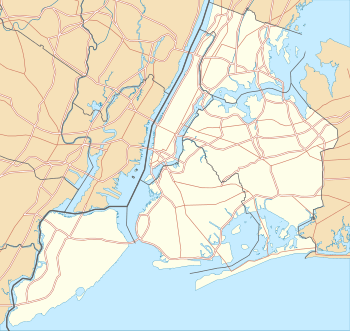 University Heights  University Heights  University Heights Location in New York City | |
| Coordinates: 40°51′36″N 73°54′33″W / 40.860100°N 73.9093030°WCoordinates: 40°51′36″N 73°54′33″W / 40.860100°N 73.9093030°W | |
| Country |
|
| State |
|
| City |
|
| Borough |
|
| Area[1] | |
| • Total | 1.03 km2 (0.397 sq mi) |
| Population (2011)[1] | |
| • Total | 25,702 |
| • Density | 25,000/km2 (65,000/sq mi) |
| Economics | |
| • Median income | $27,985 |
| ZIP codes | 10453, 10468 |
| Area code | 718, 347, 646 |

University Heights is a neighborhood of the West Bronx in New York City. The neighborhood is part of Bronx Community Board 5 and Bronx Community Board 7. Its boundaries, starting from the north and moving clockwise, are: West 190th Street to the north, Jerome Avenue to the east, West Burnside Avenue to the south and the Harlem River to the west. University Avenue is the primary thoroughfare in University Heights. The local subway is the IRT Jerome Avenue Line, operating along Jerome Avenue. ZIP codes include 10453 and 10468.
Demographics
University Heights has a population of around 25,702.[1] There is a mix of renter-occupied as well as owner-occupied households.[2] The demographics are 23.0% African American, 2.0% White, 3.4% Asian or Pacific Islander and 72.6% Hispanic or Latino, the majority of which are of Dominican and Puerto Rican descent.
Land use and terrain
University Heights consists of 5- and 6-story buildings, older multi-unit homes, newly constructed multi-unit townhouses and apartment buildings, and co-ops. The total land area is roughly one square mile. The terrain is elevated and hilly.
Public housing projects
- There are ten NYCHA developments located in University Heights.[3]
- Harrison Avenue Rehab (Group A); a 5-story building.
- Harrison Avenue Rehab (Group B); four buildings, 5 and 6 stories tall.
- Macombs Road; two buildings, 5 and 6 stories tall.
- Morris Heights Rehab; three buildings, 5 and 6 stories tall.
- Sedgwick Houses; seven buildings, 14 and 15 stories tall.
- University Avenue Rehab; four 6-story buildings.
- West Tremont Avenue-Sedgwick Avenue Area; a 12-story building.
- West Tremont Rehab (Group 1); two buildings, 5 and 6 stories tall.
- West Tremont Rehab (Group 2); two 6-story buildings.
- West Tremont Rehab (Group 3); a 5-story building.
History
The neighborhood takes its name from the hill on which New York University's Bronx campus was built in 1894. The campus includes the Hall of Fame for Great Americans. In 1973 NYU sold the campus to the City University of New York, which renamed the campus Bronx Community College, but the neighborhood name has remained.[4] With the opening of the IRT Jerome Avenue line in 1917, the neighborhood began a rapid transition from a one-time farm community that had become a place where wealthy people had their mansions and suburban villas, to an urban neighborhood built almost entirely of low-rise apartment buildings housing the prosperous middle classes.[5][6]
Urban renewal
There are many shops along Fordham Road and in neighboring Marble Hill, which is home to River Plaza, a mall that houses Target, Starbucks, and Marshall's stores.
Education
Public

- PS/MS 15/PS 291 (Hall of Fame Terrace and Andrews Avenue North)
- PS 33: Timothy Dwight (East 184th Street and Jerome Avenue)
- MS 447: Creston Academy (East 181st Street and Creston Avenue)
- PS 91: Anthony Baez (Clinton Place and Aqueduct Avenue East)
- PS 226: Nadia J. Pagan (West Burnside Avenue and Sedgwick Avenue)
- PS/MS 279: Capt. Manuel Rivera (Walton Avenue and East 181st Street)
- PS 315: Lab School (2246 Jerome Avenue)
- MS 206: Ann Cross Mersereau (West 183rd Street and Aqueduct Avenue East)
- MS 331: The Bronx School of Science Inquiry and Investigation (West Tremont and Davidson Avenue)
- MS 390: (West Burnside Avenue and Andrews Avenue South)
- MS 399: Elizabeth Barrett Browning (East 184th Street and Morris Avenue)
Parochial
- St. Nicholas of Tolentine Elementary School (2336 Andrews Avenue)
- Holy Spirit School (Dr. Martin L. King Jr. Boulevard and University Avenue) (Closed)[7]
Transportation
- Bx3: 238th Street station (1 train) to George Washington Bridge Bus Terminal (via University Avenue)
- Bx12: Bay Plaza Shopping Center to Inwood – 207th Street station (A train) (via Fordham Road–Pelham Parkway)
- Bx32: VA Hospital to Third Avenue – 138th Street station (6 <6> trains) (via Morris Avenue)
- Bx40: SUNY Maritime College to River Park Towers (via Tremont-Burnside Avenues)
- Bx42: Throggs Neck to River Park Towers (via Tremont–Burnside Avenues)
- Burnside Avenue station (4 train)
- 183rd Street station (4 train)
- Metro-North University Heights station (Hudson Line)
See also
References
- 1 2 3 "University Heights neighborhood in New York". Retrieved August 21, 2015.
- ↑ Bronx Community District 7
- ↑ NYCHA
- ↑ Chronopoulos, Themis. ""Urban Decline and the Withdrawal of New York University from University Heights, The Bronx." The Bronx County Historical Society Journal XLVI (Spring/Fall 2009): 4-24.". Retrieved 22 August 2015.
- ↑ Hughes, C.J. "University Heights, the Bronx: Anchored by a College Campus". The New York Times. Retrieved 27 November 2015.
- ↑ Waddell, Robert. "University Heights: 'Bronx in Microcosm'". Norwood News. Retrieved 27 November 2015.
- ↑ Powell, Michael. "Teachers Ask About Mission They Lived By". The New York Times. Retrieved 27 November 2015.
External links
| Wikimedia Commons has media related to University Heights, Bronx. |