Newport (city), Vermont
| Newport, Vermont | ||
|---|---|---|
| City | ||
|
Downtown Newport, looking west on Main Street | ||
| ||
 | ||
 Newport, Vermont Location in the United States | ||
| Coordinates: 44°56′39″N 72°12′16″W / 44.94417°N 72.20444°WCoordinates: 44°56′39″N 72°12′16″W / 44.94417°N 72.20444°W | ||
| Country | United States | |
| State | Vermont | |
| County | Orleans | |
| Organized | 1918 | |
| Government | ||
| • Mayor | Paul Monette | |
| Area | ||
| • Total | 7.6 sq mi (19.7 km2) | |
| • Land | 6.0 sq mi (15.6 km2) | |
| • Water | 1.6 sq mi (4.1 km2) 20.87% | |
| Elevation | 722 ft (208 m) | |
| Population (2010) | ||
| • Total | 4,589 | |
| • Density | 745.5/sq mi (286.7/km2) | |
| Time zone | Eastern (EST) (UTC-5) | |
| • Summer (DST) | EDT (UTC-4) | |
| ZIP code | 05855 | |
| Area code(s) | 802 | |
| FIPS code | 50-48850[1] | |
| GNIS feature ID | 1461773[2] | |
| Website | www.newportvermont.org | |


The city of Newport is the county seat[3][4] of Orleans County, Vermont, in the United States. As of the 2010 Census, the city population was 4,589. The city contains the largest population of any municipality in the county, yet encompasses the smallest area. It is the second smallest city by population in Vermont.
History
In 1753, the Abenakis brought the ransomed John Stark down Lake Memphremagog and came ashore where Newport is now situated. They then traveled southeast to his home in New Hampshire.
Rogers' Rangers were forced to retreat through the county following their attack on Saint-Francis, Quebec in 1759. To confound their avenging pursuers, they split up on the east shore of Lake Memphremagog. One group followed the Clyde River east. Another followed the Barton River south.[5]
Newport as a settlement began in 1793.[6] The village was first called Pickeral Point, but later renamed Lake Bridge for its location at the head of Lake Memphremagog.[7]
In the early 19th century, the women of pioneer Calvin Arnold's household, refused to live in the Arnold house near what is now Clyde Pond, because of depredations by the Indians.[8]
In 1816, part of the former town of Salem, was annexed to Newport town, and is now part of the city.[9]
The railroad reached the village in 1863.[10]
The city had a scare when they received news of the St. Albans Raid during the American Civil War. They thought these raids might repeat throughout the state but particularly at the south end of the lake. The militia was turned out. The ferry from Magog was met with determined looking armed men, much to the captain's surprise, who had heard nothing about the raid. Armed Norwich University students were shipped in by train. Nothing happened and everyone was sent home in a few days.[10]
In 1868, the Lake Bridge settlement was incorporated as the Village of Newport.
It became a busy lumber town. The firm of Prouty & Miller, a lumbering firm, was started in 1865. With the end of the lumbering concentration in Vermont, it went out of business in the 1980s.[11]

The Lady of the Lake steam excursion/ferry boat started operating in 1867. It stopped operations in 1917. This is used as Newport's logo.
In 1868, a livery stable that would ultimately grow to 100 horses, started operating behind a hotel, several blocks from the railway station.[12]
In 1873, the Bellevue Hotel was built to accommodate 75, and later, 100 guests. It was renamed the Newport House by 1891. It was demolished in 1973.[13]
The Newport Wharf Light was a tower built on Lake Memphremagog in 1879. It has since been demolished.[14]
The current county courthouse was built in 1886.[15] That was the year that the legislature moved the shire town here.[16]
In 1879, the Field Opera House and Clock Tower was constructed. In 1896, it was destroyed by fire. The municipal building is now at this site.[17]

By the late 19th century, the Boston & Maine and Central Vermont railroads were routed through Lake Bridge and the small village experienced a population boom.
The now-historic Goodrich Memorial Library was built in 1899.[18]
The Memphremagog Hotel burned in 1907.[19]

In 1917, the city of Newport was formed from portions of the towns of Newport (former village of Newport) and Derby (former village of West Derby). It was organized on March 5, 1918. There were four elementary schools named after the section of the city they were in: East, West, and South schools. Newport High was across from the West School. There were 60 businesses downtown; east, west and south had an additional 40 businesses.[20]
The current federal courthouse was built in 1904. Then, it included the post office.[15]
In 1917, the city paved Main Street. By 1930, 4,000 motor vehicles a day, during the summer, traveled the street.[15]
In 1932, the city had a poor farm for the indigent.[21]
In August 1942, a single-engined Royal Canadian Air Force training plane crashed into the lake near the west shore near the city, killing the only occupant, the pilot.[22]
Between 1936 and 1953, the International Club in Newport had the largest dance floor in New England, 220 by 60 feet (67 by 18 m).[23] It was capable of holding 2,000 dancers. Various performers stopped to entertain while en route between Boston and Montreal on the railroad. These included: Louis Armstrong, Charlie Barnet, Les Brown, Cab Calloway, Rosemary Clooney, the Dorsey Brothers, Jimmy and Tommy; Stan Kenton, Kay Kyser, Gene Krupa, Glenn Miller, Tony Pastor, and Louis Prima.[24][25]
From its founding, Newport's population plateaued around 5,000 people until 1950 when it started dropping. It reached bottom in 1990 at 4,434. In 2010 the population dropped from the 2000 census, and it still had not reached its 1950 high which was 5,217. In 2003, the Newport-headquartered Citizens Utility was sold and divided up among Great Bay Hydro and Vermont Electric Cooperative.[8]
The last passenger train left Newport in 1965.[19]
The city sold its airport to the state of Vermont in the 1970s.[26]
The Vermont Teddy Bear Company once had a plant within the city.[27] A Columbia Forest Products plant once employed about 100 workers.[28]
A local subsidiary of an international ski clothing manufacturer once employed 30 workers.[29] It closed in 2011.
Geography
According to the United States Census Bureau, the city has a total area of 7.6 square miles (19.7 km2), of which 6.0 square miles (15.6 km2) is land and 1.6 square miles (4.1 km2) (20.87%) is water. The city surrounds the southern shore of Lake Memphremagog. Three of the four major rivers in the county empty into the lake here: the Clyde, Barton, and the Black.
Newport borders the towns of Coventry to the south, Newport to the west, and Derby to the north and east.
Climate
| Climate data for Newport, Vermont | |||||||||||||
|---|---|---|---|---|---|---|---|---|---|---|---|---|---|
| Month | Jan | Feb | Mar | Apr | May | Jun | Jul | Aug | Sep | Oct | Nov | Dec | Year |
| Record high °F (°C) | 64 (18) |
62 (17) |
83 (28) |
87 (31) |
92 (33) |
95 (35) |
98 (37) |
95 (35) |
96 (36) |
84 (29) |
74 (23) |
66 (19) |
98 (37) |
| Average high °F (°C) | 26.3 (−3.2) |
31.0 (−0.6) |
41.0 (5) |
54.2 (12.3) |
69.0 (20.6) |
76.8 (24.9) |
80.9 (27.2) |
78.8 (26) |
69.5 (20.8) |
57.0 (13.9) |
43.1 (6.2) |
31.0 (−0.6) |
54.88 (12.71) |
| Average low °F (°C) | 5.5 (−14.7) |
7.8 (−13.4) |
18.7 (−7.4) |
31.3 (−0.4) |
43.2 (6.2) |
52.4 (11.3) |
56.8 (13.8) |
54.8 (12.7) |
46.8 (8.2) |
37.0 (2.8) |
27.3 (−2.6) |
13.0 (−10.6) |
32.88 (0.49) |
| Record low °F (°C) | −38 (−39) |
−38 (−39) |
−32 (−36) |
−2 (−19) |
20 (−7) |
28 (−2) |
36 (2) |
32 (0) |
20 (−7) |
0 (−18) |
−7 (−22) |
−40 (−40) |
−40 (−40) |
| Average precipitation inches (mm) | 2.96 (75.2) |
2.16 (54.9) |
2.96 (75.2) |
2.93 (74.4) |
3.67 (93.2) |
3.93 (99.8) |
4.19 (106.4) |
4.18 (106.2) |
3.76 (95.5) |
3.45 (87.6) |
3.47 (88.1) |
3.12 (79.2) |
40.78 (1,035.7) |
| Average snowfall inches (cm) | 24.7 (62.7) |
17.2 (43.7) |
18.8 (47.8) |
6.9 (17.5) |
0.1 (0.3) |
0 (0) |
0 (0) |
0 (0) |
trace | 1.1 (2.8) |
11.0 (27.9) |
23.1 (58.7) |
102.9 (261.4) |
| Source: NOAA [30] | |||||||||||||
Demographics
| Historical population | |||
|---|---|---|---|
| Census | Pop. | %± | |
| 1880 | 920 | — | |
| 1890 | 1,730 | 88.0% | |
| 1900 | 2,787 | 61.1% | |
| 1910 | 3,657 | 31.2% | |
| 1920 | 4,976 | 36.1% | |
| 1930 | 5,094 | 2.4% | |
| 1940 | 4,902 | −3.8% | |
| 1950 | 5,217 | 6.4% | |
| 1960 | 5,019 | −3.8% | |
| 1970 | 4,664 | −7.1% | |
| 1980 | 4,756 | 2.0% | |
| 1990 | 4,434 | −6.8% | |
| 2000 | 5,005 | 12.9% | |
| 2010 | 4,589 | −8.3% | |
| Est. 2015 | 4,442 | [31] | −3.2% |
| U.S. Decennial Census | |||
As of the census[1] of 2010, there were 4,589 people, 2,086 households, and 1,191 families residing in the city. The population density was 830.0 people per square mile (320.5/km2). There were 2,342 housing units at an average density of 388.4 per square mile (150.0/km2). The racial makeup of the city was 96.14% White, 0.76% Black or African American, 0.62% Native American, 0.62% Asian, 0.22% from other races, and 1.64% from two or more races. Hispanic or Latino of any race were 1.28% of the population. 33% were of French Canadian and French ancestry, 16% English, and 14% Irish.
There were 2,086 households out of which 26.6% had children under the age of 18 living with them, 41.0% were married couples living together, 12.6% had a female householder with no husband present, and 42.9% were non-families. 35.5% of all households were made up of individuals and 16.0% had someone living alone who was 65 years of age or older. The average household size was 2.20 and the average family size was 2.84.
In the city the population was distributed by age with 22.2% under 18, 8.3% from 18 to 24, 27.1% from 25 to 44, 23.1% from 45 to 64, and 19.3% who were 65 years of age or older. The median age was 40 years. For every 100 females there were 97.4 males. For every 100 females age 18 and over, there were 93.7 males.
In 2013, about 31% of adults in the area were obese. This was the highest in the state.[32]
Economy
Personal income
The median income for a household in the city was $25,544, and the median income for a family was $34,922. Males had a median income of $33,810 versus $19,787 for females. The per capita income for the city was $20,054. About 13.0% of families and 18.2% of the population were below the poverty line, including 25.4% of those under age 18 and 5.4% of those age 65 or over.
The per capita income is the highest in Orleans County. The income ranks it 108 out of 282 census areas in Vermont.
Industry
Poulin Grain ships its farm feed products to customers in New England and upstate New York.[33] It employs about 50 workers. The plant is producing feed 24 hours a day, seven days a week.[34]
A Columbia Forest Products plant employs about 100 workers.[28]
There is a call center employing 120 people.[35][36]
MSA manufactures military combat helmets.[37]
Health industry
North Country Hospital is located in the city. The hospital is the city's largest employer, employing 605 people.[38]
Orleans-Essex Visiting Nurses Association and Hospice employs 100 people locally.
The Northeast Kingdom Human Services aids mental health needs.
Social services are provided in part by the Northeast Kingdom Community Action located here and in other Northeast Kingdom sites.
Tourism
A commercial ice fishing derby has been held in February since 2004. In 2010, there were 920 participants.[39]
The only Soap Box Derby in Vermont is held in the city annually. The winner represents the state in the nationals.[40]
The local Rotary has held an annual music festival involving county high schools since 1947.[41]
Non-local government

Located in the city is the Northern State Correctional Facility, the Newport Court, Reparative Services, and the Vermont Correctional Industries.
City government
Municipal offices are located in the former National Guard Armory, 222 Main Street, Newport.
Elected government consists of 4 aldermen with staggered two years terms and a mayor.[42]
The city has a paid staff for tax assessment/zoning administrator, public works department, police, fire, recreation and parks, city attorney, and harbor master.
There are decision-making boards which are filled by unpaid appointees: planning commission (5 people, three year terms), harbor commission (5 people, two year terms),development review board (nine people, three year terms), and a recreation committee.
There are normal officers for Vermont cities and sometimes towns, except they are appointed for cities: Delinquent tax collector, town service officer, animal control, health officer, tree warden, weigher of coal, inspector of wood and shingles, representative to NVDA (Northeastern Vermont Development Association) board, representative to EDC board (Vermont Economic Development Authority), and Fence Viewers.
Budget (proposed 2014-2015) - $2.99 million. About $1 million is for the police force.[43]
Officials
The city is governed under the mayor-council system. Its mayor is Paul Monette, and the council is composed of John Wilson, Neil Morrissette, Jacques Roberge and Steve Vincent.[44] The city clerk/treasurer is James D. Johnson,[45] and the city manager is John O. Ward.[46]
Former mayors
| Mayors of Newport, Vermont | |
|---|---|
|
Elections
Fifty-four percent of those registered voted in the 2008 general election. This was the lowest turnout in the county. [47]
Education
Newport has two public schools: an elementary school, Newport City Elementary, and a high school, North Country Union High School. There is one private school, the United Christian Academy. It was formerly home to Sacred Heart School in the Burlington Roman Catholic Diocese School District,[48] but closed in fall of 2007. In 1996 United Christian Academy was formed uniting Roman Catholic and Protestant churches in offering quality high school education. Elementary was later added following the closing of Sacred Heart School.
School districts
The city has a school board that governs the operation of Newport Elementary.
School Board directors include Leo Willey (chair), Corinna Lancaster (vice chair), Marcy Miller, Patrick Haugwitz, and Phil Laramie.
The budget for the Newport City Elementary School was $4,435,765 in 2007.
In addition, the city belongs to North Country Supervisory Union with members from nearby towns. They operate the North Country Union High School and the North Country Union Junior High School. The supervisor hired by this union board supervises the town school, as well as the union schools.
- Member, North Country Union High School Board - Tim DelaBruere (2010), Richard Cartee (2008) and James Privee (2009)[49]
Higher education
Newport is home to a branch of the Community College of Vermont which enrolls nearly 300 students.[50] It awards an Associate's Degree for these undergraduate studies.
Infrastructure
Transportation
Major routes

-
 U.S. Route 5 - connecting Coventry to the south, Derby to the north and east
 -
 VT Route 14 - connecting the Town of Coventry
 -
 VT Route 100 - connecting the Town of Newport
 -
 VT Route 105 - connecting the Town of Newport (concurrent with route 100), and the town of Derby (concurrent with route 5)
 -
 VT Route 191 - "Access Road", connects I-91, Exit 27, to the city of Newport
The city has six stoplights, which is most of the stoplights in the county. Five are on Route 5.
Major bridges
There are three major bridges over the South Bay of Lake Memphremagog, two of which connect two parts of the city, the former village of Newport with the former village of West Derby. Those two are the bridge on Route 5, and the "Long Bridge" connecting Route 5 to Mt. Vernon Street. Plans are underway to replace this latter bridge starting in 2012. It will cost about $5.26 million. The state will pay 90%, the city, the remainder.[51]
The final bridge is the trestle for the railway.
Local community public and private transportation
The RCT (Rural Community Transportation), a non-profit organization, runs out of Saint Johnsbury and services Caledonia and two other counties, including Orleans.[49] For general use, there are four buses north and south during the week from west Newport city to Derby, and two buses each way on Saturday. The fare is US 25 cents.[52]
Railroads
Washington County Railroad (known by the reporting mark WACR) - In 2007 WACR was awarded a 30-year contract by the State of Vermont to operate the rail line between White River Junction and Newport. Today the only regular service on this line is freight traffic.
Central Maine and Quebec Railway (known by the reporting mark CMQ) - The CMQ operates the line running northwest through North Troy and eventually on to Farnham, Quebec. It interchanges freight traffic with the WACR at Newport yard, just south of town.
The Massawippi Valley Railway line, which was part of the Quebec Central Railway, once ran east of Lake Memphremagog up to Lennoxville, Quebec, but it has been abandoned and the right-of-way has been converted into a mixed-use bicycle and walking path.
Airport
The city is served by the Newport State Airport.[53] It contains two runways of 4,000 feet (1,200 m) each 05-23, and 18-36.
Sewage
The city discharged an average of 908,917 US gallons (3,440,630 l; 756,832 imp gal) of treated wastewater daily into the Clyde River in 2003-04.[54]
Media
- The Newport Daily Express - published daily except Saturdays and Sundays in Newport. Owned by Horizon Publications out of Marion, IL. Printed in Canada
- Newport Dispatch - online-only news updated daily.
Notable people
- Charles Francis Adams, first owner of the Boston Bruins
- David M. Camp, Lieutenant Governor of Vermont, 1836-1841
- Lane Dwinell, 69th Governor of New Hampshire
- Duane Graveline, astronaut
- Aaron H. Grout, son of Josiah Grout and Vermont Secretary of State
- Josiah Grout, 46th Governor of Vermont
- George H. Prouty, 52nd Governor of Vermont
- Winston L. Prouty, United States Senator
References
- 1 2 "American FactFinder". United States Census Bureau. Archived from the original on 2013-09-11. Retrieved 2008-01-31.
- ↑ "US Board on Geographic Names". United States Geological Survey. 2007-10-25. Retrieved 2008-01-31.
- ↑ Title 24, Part I, Chapter 1, §11, Vermont Statutes. Accessed 2007-11-01.
- ↑ "Find a County". National Association of Counties. Archived from the original on 2011-05-31. Retrieved 2011-06-07.
- ↑ Darrell Hoyt (1985). Sketches of Orleans, Vermont. Mempremagog Press. ISBN 0-9610860-2-5., page 1
- ↑ Columbia-Lippincott Gazeteer. (New York: Columbia University Press, 1952) p. 1314
- ↑ Austin J. Coolidge & John B. Mansfield, A History and Description of New England; Boston, Massachusetts 1859
- 1 2 Wheeler, Scott (February 2008). The Man Who Helped Electrify the Jay Peak Ski Lift. Northland Journal.
- ↑ "Derby, Vermont, New England, USA". Virtualvermont.com. 2013-05-25. Retrieved 2014-01-19.
- 1 2 Robinson, C. D. (June 2010). "The Memphremagog House and ST. Albans Raid". Newport Express and Standard, 1929. Newport, Vermont: Northland Journal. p. 10.
- ↑ Vermont Almanac accessed March 2, 2008
- ↑ Gibson, Peggy Day (August 6, 2008). The voice of harness racing. the Chronicle.
- ↑ Nelson, Emily M. (December 2009). "The History of the Newport House". Vermont's Northland Journal. 8 (9): 8, 9.
- ↑ Lighthouses at Lighthouse Depot ... Lighthouse Explorer Database ... Newport Wharf Light
- 1 2 3 Historic marker #9, Newport, Vermont
- ↑ Young, Darlene (1998). A history of Barton Vermont. Crystal Lake Falls Historical Association.
- ↑ Malloy, Barbara (November 11, 2013). "unk". The Newport Daily Express. Newport, Vermont.
- ↑ Goodrich Memorial Library website
- 1 2 Wheeler, Scott (January 2009). "Boxing, Singing, and Riding the Rails into the Page of Newport's History". Vermont's Northland Journal. 7 (10): 10.
- ↑ McNeal, Brian D. (December 16, 2015). "Remembering a Newport that was". The Chronicle. Barton, Vermont. pp. 4A.
- ↑ Wheeler, Scott (May 2012). "Life Down on the Community Poor Farm - Part 2". Derby, Vermont: Northland Journal. p. 27.
- ↑ "Salvage Operations on Crashed Plane Now Underway". Derby, Vermont: the November 13, 1943 Newport Daily Express as quoted in the Northland Journal. September 2008. pp. 29–30.
- ↑ http://www.oldstonehousemuseum.org/PDF/oshspring06.pdf
- ↑ Old Stone House Museum (June 29, 2007). Big band dance to honor Korean War veterans. the Chronicle.
- ↑ Goyette, Ray (August 2006). Reader Reflects on the International Club. Vermont's Northland Journal.
- ↑ Wright, Duane (September 2009). "Up, Up and Away with Cecil Wright and His Flying Machines". vermont's Northland Journal. 8 (6): 8.
- ↑ Career Opportunities
- 1 2 The Associated Press (December 4, 2008). 54 workers laid off in Newport. Burlington Free Press.
- ↑ "Bogner Of America Williston VT, –". Manta.com. Retrieved 2014-01-19.
- ↑ "Climatography of the United States No. 20" (PDF). NOAA. Retrieved March 19, 2011.
- ↑ "Annual Estimates of the Resident Population for Incorporated Places: April 1, 2010 to July 1, 2015". Retrieved July 2, 2016.
- ↑ Starr, Tena (September 18, 2013). "Three-fourths of region's adults are overweight". The Chronicle. Barton, Vermont. pp. 1A.
- ↑ Poulin Grain - Dealer Locator
- ↑ Vermont Business Magazine
- ↑ http://www.manta.com/coms2/dnbcompany_dg203
- ↑ the Chronicle, September 3, 2008, page 11, "We're on a real growth path right now"
- ↑
- ↑ North Country Hospital information
- ↑ Creaser, Richard (February 2, 2011). "Northeast Kingdom's lakes ripe for ice fishing". The Chronicle. Barton, Vermont. p. 12.
- ↑ The Chronicle, July 1, 2009, page 21, "Mosholder takes top spot in derby," Dr. Turcotte
- ↑ "Rotary holds sixty-ninth annual music festival". the Chronicle. Barton, Vermont. April 10, 2013. p. 3.
- ↑ Newport, Vermont
- ↑ Gresser, Joseph (January 15, 2014). "Aldermen reluctantly approve budget". The Chronicle. Barton, Vermont. pp. 1A,25A.
- ↑ Newport City Council, Newport, 2015. Accessed 2015-04-25.
- ↑ City Clerk/Treasurer, Newport, 2008. Accessed 2015-4-25.
- ↑ City Manager, Newport, 2015. Accessed 2015-04-25.
- ↑ Voter turnout. the Chronicle. November 5, 2008.
- ↑
- 1 2 Annual City & School Report, City of Newport, Vermont. Memphremagog Press, Inc., Newport, Vermont. 2007.
- ↑ Facts & Figures - Community College of Vermont
- ↑ Gresser, Joseph (21 July 2010). "Long Bridge to close for long time". Barton, Vermont: the Chronicle. p. 8.
- ↑ Rural Community Transportation Large Format Bus Schedule - The Highlander (Newport/Derby/Derby Line. 2008.
- ↑ Newport State Airport
- ↑ "Basin 17:Lake Memphremagog Watershed Assessment Report". Vermont Agency of Natural Resources,Department of Environmental Conservation, Water Quality Division. March 2006. p. 34. Archived from the original (PDF) on 2007-08-29.
Further reading
- "Northern Vermont" (PDF). The New York Times. July 26, 1872. Retrieved 2015-01-20.
External links
| Wikimedia Commons has media related to Newport, Vermont. |
- City of Newport, Vermont - Official website
Municipalities and communities of Orleans County, Vermont, United States | ||
|---|---|---|
| City | 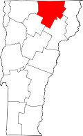 | |
| Towns | ||
| Villages | ||
| CDPs | ||
| Unincorporated community | ||
Montpelier (capital) | |
| Regions | |
| Counties | |
| Cities | |
| Towns (pop. >5000) | |
| Festivals | |
| Topics |
|
| Society |
|