List of cities in Vermont
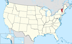
Vermont is a state located in Northeastern United States. The state of Vermont has 255 municipalities. Of these, the nine listed below are incorporated as cities, and considered municipalities independent of the surrounding town(s) and county(s).
Six of Vermont's 14 counties have at least one city within its borders. Of those counties, five of the cities serve as county seats for their respective counties—these are indicated with an asterisk (*).
Aggregates and averages
Population
Based on the 2010 census, 115,085 people resided in Vermont's cities, or 18.39% of the state's population.
| City | County | 2010 Population | Rank (Population) | Area in sq mi (km²) | Rank (Area) | Incorporated | Median Household Income (1999) | Rank (Income) |
|---|---|---|---|---|---|---|---|---|
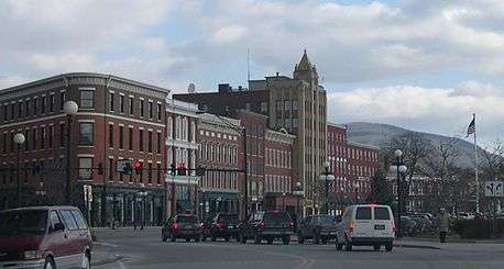
| Burlington[1]* | Chittenden | 42,417 | 1 | 15.1 square miles (40.1 km²) | 2 | 1864 | $33,070 | 6 |
| South Burlington[2] | Chittenden | 17,904 | 2 | 29.6 square miles (76.7 km²) | 1 | 1971 | $51,566 | 1 |
| Rutland[3]* | Rutland | 16,495 | 3 | 7.6 square miles (19.8 km²) | 4 | 1892 | $30,478 | 8 |
| Barre[4] | Washington | 9,052 | 4 | 4.0 square miles (10.4 km²) | 6 | 1895 | $30,393 | 9 |
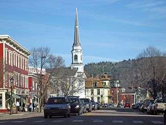
| Montpelier[5]* | Washington | 7,855 | 5 | 10.3 square miles (26.6 km²) | 3 | 1895 | $37,513 | 3 |
| Winooski[6] | Chittenden | 7,267 | 6 | 1.5 square miles (3.9 km²) | 9 | 1921 | $30,592 | 7 |
| St. Albans[7]* | Franklin | 6,918 | 7 | 2.0 square miles (5.3 km²) | 8 | 1902 | $37,221 | 4 |
| Newport[8]* | Orleans | 4,589 | 8 | 7.6 square miles (19.7 km²) | 5 | 1917 | $34,922 | 5 |
| Vergennes[9] | Addison | 2,588 | 9 | 2.5 square miles (6.5 km²) | 7 | 1788 | $37,763 | 2 |
Personal income
The average median household income of the cities was $35,946 (rounded to nearest dollar) - 25.90% less than the state average ($48,508). Only one city (South Burlington) exceeds the national average household income.
Area
The aggregate area of Vermont's cities totaled 80.2 sq mi (208 km2). This is approximately 0.8% of the total area of 9,620 sq mi (24,900 km2).
See also
- List of counties in Vermont
- List of gores in Vermont
- List of towns in Vermont
- List of incorporated villages
- List of census-designated places in Vermont
References
- ↑ "Burlington city, Vermont – Fact Sheet". American FactFinder. U.S. Census Bureau. Retrieved 2009-01-07.
- ↑ "South Burlington city, Vermont – Fact Sheet". American FactFinder. U.S. Census Bureau. Retrieved 2009-01-07.
- ↑ "Rutland city, Vermont – Fact Sheet". American FactFinder. U.S. Census Bureau. Retrieved 2009-01-07.
- ↑ "Barre city, Vermont – Fact Sheet". American FactFinder. U.S. Census Bureau. Retrieved 2009-01-07.
- ↑ "Montpelier city, Vermont – Fact Sheet". American FactFinder. U.S. Census Bureau. Retrieved 2009-01-07.
- ↑ "Winooski city, Vermont – Fact Sheet". American FactFinder. U.S. Census Bureau. Retrieved 2009-01-07.
- ↑ "Saint Albans city, Vermont – Fact Sheet". American FactFinder. U.S. Census Bureau. Retrieved 2009-01-07.
- ↑ "Newport city, Vermont – Fact Sheet". American FactFinder. U.S. Census Bureau. Retrieved 2009-01-07.
- ↑ "Vergennes city, Vermont – Fact Sheet". American FactFinder. U.S. Census Bureau. Retrieved 2009-01-07.
Montpelier (capital) | |
| Regions | |
| Counties | |
| Cities | |
| Towns (pop. >5000) | |
| Festivals | |
| Topics |
|
| Society |
|