Essex, Vermont
| Essex, Vermont | |
|---|---|
| Town | |
| Motto: "Crossroads of Chittenden County"[1] | |
 Location in Chittenden County and the state of Vermont. | |
 Essex, Vermont Location in the United States | |
| Coordinates: 44°30′7″N 73°5′38″W / 44.50194°N 73.09389°WCoordinates: 44°30′7″N 73°5′38″W / 44.50194°N 73.09389°W | |
| Country | United States |
| State | Vermont |
| County | Chittenden |
| Incorporated | June 7, 1763[1] |
| Area | |
| • Total | 39.3 sq mi (101.8 km2) |
| • Land | 38.8 sq mi (100.6 km2) |
| • Water | 0.5 sq mi (1.3 km2) |
| Elevation | 486 ft (148 m) |
| Population (2010) | |
| • Total | 19,587 |
| • Estimate (2015) | 20,946 |
| • Density | 534/sq mi (206.1/km2) |
| Time zone | Eastern (EST) (UTC−5) |
| • Summer (DST) | EDT (UTC−4) |
| ZIP codes | 05451-05452 |
| Area code | 802 |
| FIPS code | 50-24175[2] |
| GNIS feature ID | 1462091[3] |
| Website |
www |
Essex is a town in Chittenden County, Vermont, United States. With an estimated population of 20,946 in 2015,[4] Essex is the most populous town in Vermont and second most populous municipality after Burlington. It is home to the village of Essex Junction, which includes the state of Vermont's busiest Amtrak station and largest private employer, GlobalFoundries. Vermont Route 289 crosses the town from east to west.
History
| Town vote to merge | Revote | |||
|---|---|---|---|---|
| District | 2006-11-07 | 2007-01-23 | ||
| Yes | No | Yes | No | |
| 6-1 (outside village) | 1,283 | 2,319 | 690 | 2,528 |
| 6-3 (outside village) | 365 | 822 | ||
| 6-2 (within village) | 2,728 | 1,026 | 2,009 | 362 |
| Townwide totals | 4,376 | 4,167 | 2,699 | 2,890 |
| Village vote to accept | No revote required, result was uncontested. | |||
| 2,922 | 1,085 | |||
The town was incorporated on June 7, 1763,[1] named after the Earl of Essex.[5]
The village of Essex Junction was formed—within the town of Essex—on November 15, 1892. The village was formed to provide services (such as sidewalks, water, and sewers) to the villagers that the rest of the, mostly rural, town citizens did not want, and did not want to pay for.
As the town outside the village developed, they gradually added similar services for themselves, and by 1958, the first hints of merger showed up in a voter petition. Since then a series of votes (often contentious) had defeated or passed merger in each community, but never at the same time in both (which was required by the state legislature for them to sign off on the merger).
This temporarily changed on November 7, 2006, when merger passed in the town as a whole, and in the village. The town as a whole (including the village) got to vote once on the merger, and the village, separately, got to vote in a second ballot to accept the merger if it passed the townwide vote. This was confusing enough that the regional paper misreported the results as a defeat of the merger, based solely on the vote results outside the village.[6] The next day the correct results were reported in both the town's paper,[7] and as a correction in the regional paper.[8]
On December 6, 2006, a petition to reconsider the merger was submitted to the town. The petition contained signatures totaling more than 5 percent of registered voters, which is the threshold required to force a re-vote.[9] The revote was held on January 23, 2007, with a result that overturned the merger by 191 votes, rejecting the current merger proposal.[10]
If the results had stood, a multi-year merger process would have resulted in a new "Town of Essex Junction" replacing the current governments of the town of Essex and the village of Essex Junction.
Geography
Essex is located in central Chittenden County, bordered on the south by the Winooski River. Neighboring municipalities are Colchester to the west, Milton at Essex' northwest corner, Westford to the north, Underhill at Essex' northeast corner, Jericho to the east, Williston to the south, and the city of South Burlington to the southwest. According to the United States Census Bureau, the town of Essex has a total area of 39.3 square miles (101.8 km2), of which 38.8 square miles (100.6 km2) is land and 0.50 square miles (1.3 km2), or 1.26%, is water.[11]
The village of Essex Junction is located in the southwestern part of the town.[12]
Demographics
| Historical population | |||
|---|---|---|---|
| Census | Pop. | %± | |
| 1790 | 354 | — | |
| 1800 | 729 | 105.9% | |
| 1810 | 957 | 31.3% | |
| 1820 | 1,089 | 13.8% | |
| 1830 | 1,664 | 52.8% | |
| 1840 | 1,824 | 9.6% | |
| 1850 | 2,052 | 12.5% | |
| 1860 | 1,906 | −7.1% | |
| 1870 | 2,022 | 6.1% | |
| 1880 | 2,104 | 4.1% | |
| 1890 | 2,013 | −4.3% | |
| 1900 | 2,203 | 9.4% | |
| 1910 | 2,714 | 23.2% | |
| 1920 | 2,449 | −9.8% | |
| 1930 | 2,876 | 17.4% | |
| 1940 | 3,059 | 6.4% | |
| 1950 | 3,931 | 28.5% | |
| 1960 | 7,090 | 80.4% | |
| 1970 | 10,951 | 54.5% | |
| 1980 | 14,392 | 31.4% | |
| 1990 | 16,498 | 14.6% | |
| 2000 | 18,626 | 12.9% | |
| 2010 | 19,587 | 5.2% | |
| Est. 2015 | 20,946 | [13] | 6.9% |
| U.S. Decennial Census[14] | |||
2010 census
As of the census[2] of 2010, there were 19,587 people and 7,322 households in the town. The racial makeup of the town was 91.6% non-Hispanic White, 1.5% Black or African American, 3.2% Asian, 0.3% Native American, 0.1% other races, and 1.8% from two or more races. Hispanic or Latino of any race made up 1.7% of the population. The population density was 534 people per square mile (184.4/km2). There were 7,170 housing units at an average density of 183.8 per square mile (71.0/km2). There were 7,013 households out of which 38.5% had children under the age of 18 living with them, 59.7% were married couples living together, 8.8% had a female householder with no husband present, and 28.5% were non-families. 21.7% of all households were made up of individuals and 5.5% had someone living alone who was 65 years of age or older. The average household size was 2.62 and the average family size was 3.09.
In the town the age distribution of the population shows 27.9% under the age of 18, 6.8% from 18 to 24, 32.5% from 25 to 44, 24.6% from 45 to 64, and 8.2% who were 65 years of age or older. The median age was 36 years. For every 100 females there were 97.4 males. For every 100 females age 18 and over, there were 94.8 males.
The median income for a household in the town was $58,441, and the median income for a family was $65,794. Males had a median income of $45,428 versus $27,426 for females. The per capita income for the town was $25,854. About 1.8% of families and 2.6% of the population were below the poverty line, including 2.4% of those under age 18 and 6.6% of those age 65 or over.
Arts and culture
Museums and other points of interest
The Harriet Farnsworth Powell Museum is located in Essex. The museum is housed in a former two-room schoolhouse, and includes a collection of costumes, school items, and local memorabilia.[1][15]
Government
Essex comprises three Vermont Legislature districts (seats): District 8-2 includes Essex Junction[16] (a semi-independent village within the town), and Districts 8-1[17] & 8-3 cover the remainder of the town outside the village (although District 8-3 also includes the town of Westford[18]). The village and town each operate separate fire departments, libraries, parks departments, and municipal services, and contain separate school districts for grades K–8. The governments operate a unified police department and the unified Essex High School.
Education
There are two school districts in the town of Essex, educating 3,500 students in 2009:[19] the Essex Junction School District and the Town of Essex School District.
The Essex Junction School District (Chittenden County Supervisory Union) funds and supervises Essex High School, Summit Street School, Fleming School, Albert D. Lawton School, the Hiawatha School, The Center for Technology, Essex and Westford School.[19]
The Town of Essex School District funds and supervises Essex Elementary, Founders Memorial School and Essex Middle School.[19] The middle school contains a "school within a school". In 2009, 87 students from 4th grade to 8th grade began to study in an alternative environment called the "Edge Academy" that allows them a say in how and what they study.[20] Busing is run for all schools. Essex High School (EHS) provides busing for those who live in Essex town, South Hero, Grand Isle, North Hero and Georgia, but not for Essex Junction, Westford or Isle La Motte. There is also busing for Westford School.
Media
The Essex Reporter is a weekly newspaper published in town, covering news in Essex and the surrounding communities in Chittenden County.[21] It has a weekly circulation of 8,800 copies.[22]
Infrastructure
Transportation
Vermont's Circumferential Highway (Vermont Route 289 or "The Circ") courses through Essex, and the section within Essex's jurisdiction has been completed. However, further construction of the highway has been halted in surrounding communities by court action from environmental protesters.
Bus service is provided by Chittenden County Transportation Authority.
Rail
Amtrak, the national rail passenger system, provides daily service from its station in Essex Junction, operating the Vermonter train between St. Albans, Vermont and Washington, D.C. In 2008, a study indicated that the cheapest method for one person to get to New York City from "Burlington" (Essex Junction), was by train at $48 one way. It was also the longest, taking an estimated 9 hours and 25 minutes.[23][24]
Notable people
- Bert Abbey (1869–1962), pitcher with the Washington Senators, Chicago Colts, and Brooklyn Grooms/Bridegrooms[25]
- William B. Castle, mayor of Cleveland, Ohio[26]
- Steven A. Cray, Adjutant General of Vermont[27]
- Linda K. Myers, member of the Vermont House of Representatives[28]
See also
References
- 1 2 3 4 "Town of Essex Vermont". Town of Essex Vermont. Retrieved November 10, 2012.
- 1 2 "American FactFinder". United States Census Bureau. Archived from the original on 2013-09-11. Retrieved 2008-01-31.
- ↑ "US Board on Geographic Names". United States Geological Survey. 2007-10-25. Retrieved 2008-01-31.
- ↑ "Annual Estimates of the Resident Population: April 1, 2010 to July 1, 2014 (PEPANNRES): Minor Civil Divisions by County, Vermont". U.S. Census Bureau, American Factfinder. Retrieved August 19, 2015.
- ↑ "Profile for Essex, Vermont, VT". ePodunk. Retrieved November 10, 2012.
- ↑ Welch, Victoria (2006-11-08), "Essex Defeats Merger 2-1", Burlington Free Press.
- ↑ Tyler, George (2006-11-09), "Merger Wins: Confusion over vote count", Essex Reporter.
- ↑ Welch, Victoria (2006-11-09), "Essex merger moves forward: An apology to our Essex readers", Burlington Free Press.
- ↑ Welch, Victoria (2006-12-07), "New rift emerges in Essex merger", Burlington Free Press
- ↑ Welch, Victoria (2007-01-24), "This time, Essex rejects merger" (– Scholar search), Burlington Free Press .
- ↑ "Geographic Identifiers: 2010 Census Summary File 1 (G001): Essex town, Chittenden County, Vermont". U.S. Census Bureau, American Factfinder. Retrieved August 19, 2015.
- ↑ Official map by the United States Census Bureau; Chittenden County listed on page 3. Accessed 2009-08-22.
- ↑ "Annual Estimates of the Resident Population for Incorporated Places: April 1, 2010 to July 1, 2014". Retrieved June 4, 2015.
- ↑ "U.S. Decennial Census". United States Census Bureau. Archived from the original on May 11, 2015. Retrieved May 16, 2015.
- ↑ "Champlain Valley Region Vermont Historical Societies". Vermont Living Magazine. Retrieved November 10, 2012.
- ↑
- ↑
- ↑
- 1 2 3
- ↑ Ryan, Matt (3 September 2009). "Academy school take role in learning". Burlington, Vermont: Burlington Free Press. pp. 2B.
- ↑ "The Essex Reporter". The Essex Reporter. Retrieved November 10, 2012.
- ↑ "The Essex Reporter". Mondo Times. Retrieved November 10, 2012.
- ↑ Assuming $4 per gallon ($1 per liter) gasoline and 20 mpg-US (12 L/100 km; 24 mpg-imp) when comparing to auto
- ↑ McKean, Dan (August 17, 2008), Which way?, Burlington Free Press
- ↑ "Bert Abbey Stats". Baseball Almanac. Retrieved November 10, 2012.
- ↑ "William B. Castle". Find a Grave. Retrieved November 10, 2012.
- ↑ Peter Hirschfeld, Vermont Press Bureau, Steven Cray to Serve as Next Adjutant General of Vermont National Guard, February 21, 2013
- ↑ "Linda K. Myers". Project Vote Smart. Retrieved November 10, 2012.
External links
| Wikimedia Commons has media related to Essex, Vermont. |
| Wikivoyage has a travel guide for Essex, Vermont. |
- Town of Essex official website
- Lake Champlain Regional Chamber of Commerce
- City-Data.com
- ePodunk: Profile for Essex, Vermont
- The Essex Reporter
Municipalities and communities of Chittenden County, Vermont, United States | ||
|---|---|---|
| Cities | 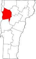 | |
| Towns | ||
| Villages | ||
| CDPs | ||
| Unincorporated communities | ||