Circleville, Ohio
- Not to be confused with Centerville, Ohio.
| Circleville, Ohio | ||
|---|---|---|
| City | ||
|
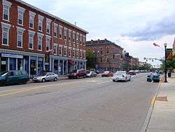
Circleville's Main Street | ||
| ||
| Motto: "Home Of "The Pumpkin Show" | ||
 Location of Circleville, Ohio | ||
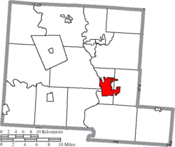 Location of Circleville in Pickaway County | ||
| Coordinates: 39°36′11″N 82°56′21″W / 39.60306°N 82.93917°WCoordinates: 39°36′11″N 82°56′21″W / 39.60306°N 82.93917°W | ||
| Country | United States | |
| State | Ohio | |
| County | Pickaway | |
| Government | ||
| • Mayor | Don McIlroy | |
| Area[1] | ||
| • Total | 6.76 sq mi (17.51 km2) | |
| • Land | 6.64 sq mi (17.20 km2) | |
| • Water | 0.12 sq mi (0.31 km2) | |
| Elevation[2] | 696 ft (212 m) | |
| Population (2010)[3] | ||
| • Total | 13,314 | |
| • Estimate (2012[4]) | 13,453 | |
| • Density | 2,005.1/sq mi (774.2/km2) | |
| Time zone | Eastern (EST) (UTC-5) | |
| • Summer (DST) | EDT (UTC-4) | |
| ZIP code | 43113 | |
| Area code(s) | 740 - 420 | |
| FIPS code | 39-15070[5] | |
| GNIS feature ID | 1056803[2] | |
| Website | http://ci.circleville.oh.us/ | |


Circleville is a city in and the county seat of Pickaway County, Ohio, United States,[6] along the Scioto River. The population was 13,314 at the 2010 census.
The city was originally laid out after 1810 within the 1100-foot diameter of a circle of a Hopewell tradition earthwork dating to the early centuries of the Common Era. The county courthouse was built in the center of the innermost circle. By the late 1830s residents had tired of this design and gained authorization from the state legislature to change the layout to a standard grid, which was accomplished by the mid-1850s. All traces of the Hopewell earthwork were destroyed here, although hundreds of other monuments may be found in the Ohio Valley.
History
By the mid-18th century, the Lenape (Delaware Indians) were pushed west from Pennsylvania by English-led settlers flowing into the colony. The Lenape were given permission by the Wyandot to settle in the Ohio country. One of their settlements was Maguck, built by 1750 on the banks of the Scioto River. Modern Circleville was built to the north of this site.[7]
Noted frontier explorer Christopher Gist was the first recorded European visitor to the Circleville area. Gist reached Maguck, the small Lenape village of about 10 families on the east bank of the Scioto River, on January 20, 1751. He wrote that he had stayed in the town for four days.[8]
Circleville was founded by European-American settlers in 1810, as migrants moved west after the American Revolutionary War. It derived its name from the circular portion of what is now known to have been a large Hopewell culture earthwork; the town was built on top of the remains of this. The original town plan integrated Circleville into the remains of the Hopewell earthworks with a street layout 1100-foot diameter circle. This was connected to a 900-foot square. These dated from the early Common Era; the Hopewell tradition flourished up to 500CE. An octagonal courthouse was placed directly in the center circle of the town.[9]
The Hopewell circles were documented by Caleb Atwater, a resident and historian who was considered an early archeologist; the earthworks were illustrated in Plate 5 of his Description of the Antiquities Discovered in the State of Ohio and Other Western States, a 160-page report he published in 1820 in the first volume of the Transactions of the American Antiquarian Society.[10]
Dissatisfaction among residents rose over Circleville's layout, however. In 1837 at the request of the town, the Ohio General Assembly authorized the "Circleville Squaring Company" to convert the town plan into a squared grid, as was typical of other platted towns. In 1856, this had been completed in several phases.[9] No traces of the original earthworks remain. A few of the older buildings have curved walls built to conform to the town's original circular layout.
Tornado
On October 13, 1999, an F-3 tornado hit the city, set off by a squall line moving through the region. The tornado touched down on the north side of town, doing substantial damage to a barber shop and a masonry building. A furniture store was also damaged with a hole in its roof, where it was reported that items from inside the store were sucked out.[11] Damage to nearby buildings occurred as the tornado moved east across the north-central part of town.
The tornado moved into a residential area in the Northwood Park neighborhood, destroying several homes along Fairlawn Drive. Trees and vehicles were also heavily damaged. The tornado lifted as it crossed Edgewood Drive, but snapped the tops of some nearby trees.
Geography
Circleville is located at 39°36′11″N 82°56′21″W / 39.60306°N 82.93917°W (39.602990, -82.939272).[12]
According to the United States Census Bureau, the city has a total area of 6.76 square miles (17.51 km2), of which, 6.64 square miles (17.20 km2) is land and 0.12 square miles (0.31 km2) is water.[1]
Calamus Swamp is a 19-acre public reserve located 1.5 miles (2.4 km) from the town.
Demographics
| Historical population | |||
|---|---|---|---|
| Census | Pop. | %± | |
| 1820 | 908 | — | |
| 1830 | 1,136 | 25.1% | |
| 1840 | 2,329 | 105.0% | |
| 1850 | 3,411 | 46.5% | |
| 1860 | 4,383 | 28.5% | |
| 1870 | 5,407 | 23.4% | |
| 1880 | 6,046 | 11.8% | |
| 1890 | 6,556 | 8.4% | |
| 1900 | 6,991 | 6.6% | |
| 1910 | 6,744 | −3.5% | |
| 1920 | 7,049 | 4.5% | |
| 1930 | 7,369 | 4.5% | |
| 1940 | 7,989 | 8.4% | |
| 1950 | 8,723 | 9.2% | |
| 1960 | 11,059 | 26.8% | |
| 1970 | 11,687 | 5.7% | |
| 1980 | 11,682 | 0.0% | |
| 1990 | 11,666 | −0.1% | |
| 2000 | 13,485 | 15.6% | |
| 2010 | 13,314 | −1.3% | |
| Est. 2015 | 13,857 | [13] | 4.1% |
| Sources:[5][14][15][16] | |||
Median home prices in the Circleville area as of 2009 were $120,147.[17]
2010 census
As of the census[3] of 2010, there were 13,314 people, 5,402 households, and 3,447 families residing in the city. The population density was 2,005.1 inhabitants per square mile (774.2/km2). There were 6,024 housing units at an average density of 907.2 per square mile (350.3/km2). The racial makeup of the city was 95.4% White, 1.9% African American, 0.2% Native American, 0.4% Asian, 0.4% from other races, and 1.7% from two or more races. Hispanic or Latino of any race were 1.1% of the population.
There were 5,402 households of which 30.3% had children under the age of 18 living with them, 44.2% were married couples living together, 14.5% had a female householder with no husband present, 5.1% had a male householder with no wife present, and 36.2% were non-families. 30.5% of all households were made up of individuals and 13.5% had someone living alone who was 65 years of age or older. The average household size was 2.36 and the average family size was 2.90.
The median age in the city was 39.3 years. 23.3% of residents were under the age of 18; 8.9% were between the ages of 18 and 24; 24.8% were from 25 to 44; 25.4% were from 45 to 64; and 17.7% were 65 years of age or older. The gender makeup of the city was 47.9% male and 52.1% female.
2000 census
As of the census[5] of 2000, there were 13,485 people, 5,378 households, and 3,581 families residing in the city. The population density was 2,037.2 people per square mile (786.5/km²). There were 5,706 housing units at an average density of 862.0 per square mile (332.8/km²). The racial makeup of the city was 95.36% White, 2.54% African American, 0.20% Native American, 0.49% Asian, 0.06% Pacific Islander, 0.27% from other races, and 1.08% from two or more races. Hispanic or Latino of any race were 0.82% of the population.
There were 5,378 households out of which 31.1% had children under the age of 18 living with them, 49.8% were married couples living together, 12.7% had a female householder with no husband present, and 33.4% were non-families. 29.0% of all households were made up of individuals and 13.4% had someone living alone who was 65 years of age or older. The average household size was 2.40 and the average family size was 2.93.
In the city the population was spread out with 26.7% under the age of 18, 8.6% from 18 to 24, 26.7% from 25 to 44, 22.0% from 45 to 64, and 16.1% who were 65 years of age or older. The median age was 36 years. For every 100 females there were 94.8 males. For every 100 females age 18 and over, there were 85.8 males.
The median income for a household in the city was $34,572, and the median income for a family was $41,943. Males had a median income of $32,342 versus $26,115 for females. The per capita income for the city was $17,220. About 11.1% of families and 13.3% of the population were below the poverty line, including 21.4% of those under age 18 and 6.5% of those age 65 or over.
Employers and Industry
Manufacturing makes up a significant proportion of area industry and employment; in the 2010 census, 3075 county residents (13.4%) were employed in manufacturing.[18] Circleville is home to the largest DuPont chemical plant in Ohio. Opened in the 1950s, it produces Mylar and Tedlar plastic films, the latter used extensively in the production of photovoltaic modules.[19][20] PACCAR, a Seattle-based truck manufacturing company has maintained a large factory for over 35 years. A GE Lighting plant, recently expanded to produce energy-efficient compact fluorescent lamps, opened in 1948 and currently employs more than 200 people.[21] Other manufacturing concerns in Circleville or surrounding Pickaway County include Aleris, a producer of rolled and extruded aluminum products,[21] and Florida Production Engineering, Inc. (FPE), producing plastic injection molded components for the automotive industry.[22] The former Jefferson-Smurfit paper mill, a 300-acre site, is being redeveloped.[23] Georgia-Pacific, a manufacturer of paperboard containers and other paper products, has a plant located south of town. The PPG Industries Circleville plant is the company's center for polymer resin production, primarily for automotive applications.[24] Fastenal Company distributes industrial, safety and construction supplies from its facility on US Highway 23 west of Circleville.
Other major employers include Berger Health System; Circleville City, Teays Valley Local and Logan Elm Local School districts; Circle Plastics/TriMold LLC; the State of Ohio; and Wal-Mart Stores.[18]
Events
Circleville hosts the Circleville Pumpkin Show every October.
Notable people
- Caleb Atwater - known as the "Father of Ohio's Public School System", the state's first historian, and an early scholar of the ancient Native American mounds and other earthworks in the Ohio Valley
- Tony Laubach - storm chaser and meteorologist featured on the Discovery Channel
- Ted Lewis - Vaudeville performer and bandleader during the "Roaring Twenties". A Ted Lewis Museum is located in the city, and a local park bears his name
- Conchata Ferrell - actress, best known for playing Berta the housekeeper in the CBS sitcom Two and a Half Men
- Kohl Sudduth - Actor known for the Jesse Stone series of TV Movies
- Pat Colangeli - ABC World News Person of the Week[25]
See also
- Ohio Christian University (formerly Circleville Bible College)
References
- 1 2 "US Gazetteer files 2010". United States Census Bureau. Archived from the original on 2012-01-24. Retrieved 2013-01-06.
- 1 2 "US Board on Geographic Names". United States Geological Survey. 2007-10-25. Retrieved 2008-01-31.
- 1 2 "American FactFinder". United States Census Bureau. Retrieved 2013-01-06.
- ↑ "Population Estimates". United States Census Bureau. Archived from the original on 2013-06-17. Retrieved 2013-06-17.
- 1 2 3 "American FactFinder". United States Census Bureau. Archived from the original on 2013-09-11. Retrieved 2008-01-31.
- ↑ "Find a County". National Association of Counties. Archived from the original on 2011-05-31. Retrieved 2011-06-07.
- ↑ R. Douglas Hurt, The Ohio Frontier: Crucible of the Old Northwest, 1720-1830 (Bloomington: Indiana University Press, 1998) p. 17
- ↑ Darlington, William, Christopher Gist's Journals
- 1 2 History of Circleville, City of Circleville. Retrieved 11 May 2015
- ↑ John D. Clifford, Constantine Samuel Rafinesque, John D. Clifford's Indian Antiquities, edited, annotated and Introduction by Charles E. Boewe, Univ. of Tennessee Press, 2000
- ↑ NWS Wilmington Damage Survey
- ↑ "US Gazetteer files: 2010, 2000, and 1990". United States Census Bureau. 2011-02-12. Retrieved 2011-04-23.
- ↑ "Annual Estimates of the Resident Population for Incorporated Places: April 1, 2010 to July 1, 2015". Retrieved July 2, 2016.
- ↑ "Number of Inhabitants: Ohio" (PDF). 18th Census of the United States. U.S. Census Bureau. Retrieved 22 November 2013.
- ↑ "Ohio: Population and Housing Unit Counts" (PDF). U.S. Census Bureau. Retrieved 22 November 2013.
- ↑ "Incorporated Places and Minor Civil Divisions Datasets: Subcounty Population Estimates: April 1, 2010 to July 1, 2012". U.S. Census Bureau. Archived from the original on 17 June 2013. Retrieved 25 November 2013.
- ↑ 2009 Circleville Home Sales Report
- 1 2 "Demographics and Income plus other local statistics for Pickaway County P3 Ohio". Pickawayprogress.com. Retrieved 2013-09-22.
- ↑ Tuesday, May 22, 2012 8:57 pm (2012-05-22). "DuPont celebrates Tedlar expansion - Circleville Herald: News". Circlevilletoday.com. Retrieved 2013-09-22.
- ↑ "News & Events for Pickaway Progress Business Development Project Central Ohio". Pickawayprogress.com. 2010-01-18. Archived from the original on 2013-09-27. Retrieved 2013-09-22.
- 1 2 Thursday, August 22, 2013 5:00 pm (2013-08-22). "GE plant to add 50 jobs - Circleville Herald: News". Circlevilletoday.com. Retrieved 2013-09-22.
- ↑ "Plastic Injection Molding from 100 tons to 3000 tons in Florida, Kentucky and Ohio". Fpe-inc.com. Retrieved 2013-09-22.
- ↑ "Projects - Green Investment Group, Inc". Greeninvgroup.com. Retrieved 2013-09-22.
- ↑ "Circleville, OH - Life At PPG - College Recruiting". Ppg.com. Retrieved 2013-09-22.
- ↑ "Teacher's Experiment Proves $10 Goes a Long Way". ABC World News. Retrieved 2008-04-11.
External links
| Wikimedia Commons has media related to Circleville, Ohio. |
- City website
- Downtown Circleville
- "History of Circleville", with drawing of original layout and buildings in circles
Municipalities and communities of Pickaway County, Ohio, United States | ||
|---|---|---|
| City |  | |
| Villages | ||
| Townships | ||
| CDPs | ||
| Unincorporated communities | ||
| Ghost town | ||
| Footnotes | ‡This populated place also has portions in an adjacent county or counties | |