National Register of Historic Places listings in Lincoln, Rhode Island
This is a list of Registered Historic Places in Lincoln, Rhode Island.
Bristol | Kent | Newport | Providence | Washington |
- This National Park Service list is complete through NPS recent listings posted December 2, 2016.[1]
| [2] | Name on the Register[3] | Image | Date listed[4] | Location | City or town | Description |
|---|---|---|---|---|---|---|
| 1 | Albion Historic District | 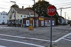 |
(#84001899) |
Roughly bounded by Berkshire Dr., Willow Lane, Ledge Way, Kennedy Boulevard, and School and Main Sts. 41°57′06″N 71°27′26″W / 41.951667°N 71.457222°W |
Lincoln | |
| 2 | Eleazer Arnold House | 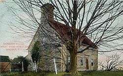 |
(#68000006) |
Great Rd. (RI 123) near its junction with RI 126 41°54′10″N 71°25′14″W / 41.902778°N 71.420556°W |
Lincoln | |
| 3 | Israel Arnold House | 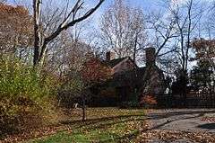 |
(#70000017) |
Great Rd. 41°54′17″N 71°25′35″W / 41.904722°N 71.426389°W |
Lincoln | |
| 4 | Ballou House | 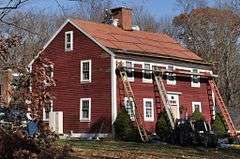 |
(#84001908) |
Albion Rd. 41°56′48″N 71°28′21″W / 41.946667°N 71.4725°W |
Lincoln | |
| 5 | Blackstone Canal | 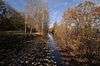 |
(#71000030) |
From Steeple and Promenade Sts. in Providence to the Massachusetts border in North Smithfield 41°55′16″N 71°25′21″W / 41.921111°N 71.4225°W |
Lincoln, Cumberland, Woonsocket, and North Smithfield | Initial listing extended from Providence, through Pawtucket, and as far north as Lincoln; a 1991 expansion (#91001536) extended it to the state line; the canal itself extended into Worcester County, Massachusetts, where it is the subject of separate listings. |
| 6 | Elliot-Harris-Miner House | 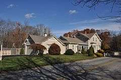 |
(#84001984) |
1406 Old Louisquisset Pike 41°52′43″N 71°26′11″W / 41.878611°N 71.436389°W |
Lincoln | |
| 7 | Great Road Historic District | 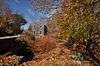 |
(#74000051) |
Great Rd. 41°54′21″N 71°25′41″W / 41.905833°N 71.428056°W |
Lincoln | |
| 8 | Hearthside | 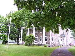 |
(#73000069) |
Great Rd. 41°54′23″N 71°25′50″W / 41.906389°N 71.430556°W |
Lincoln | |
| 9 | Jenckes House |  |
(#84002019) |
81 Jenckes Hill Rd. 41°54′16″N 71°27′32″W / 41.904444°N 71.458889°W |
Lincoln | |
| 10 | Jenckes House | 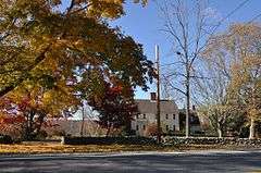 |
(#84000088) |
1730 Old Louisquisset Pike 41°53′44″N 71°26′55″W / 41.895556°N 71.448611°W |
Lincoln | |
| 11 | Lime Kilns | Upload image | (#84002015) |
Off Louisquisset Pike, Sherman and Dexter Rock Rds. |
Lincoln | Ruined remnants of three colonia-era lime kilns at different locations. |
| 12 | Limerock Village Historic District | 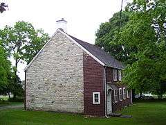 |
(#74000052) |
In an irregular pattern along Smith, Wilbur, and Great Rds., and Old Louisquisset Pike 41°55′40″N 71°27′22″W / 41.927778°N 71.456111°W |
Lincoln | |
| 13 | Lonsdale Historic District | 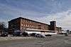 |
(#84002022) |
Lonsdale Ave., Blackstone Ct., and Front, Main, Cook, Broad, Mill, Cross and Blackstone Sts. 41°54′34″N 71°24′11″W / 41.909444°N 71.403056°W |
Cumberland and Lincoln | |
| 14 | Manville Company Worker Housing Historic District |  |
(#08001183) |
Bounded by Chestnut St., Angle St., Railroad St., Winter St., Fall St., Spring St., Park Way, Almeida Dr., and Main St. 41°58′13″N 71°28′18″W / 41.970278°N 71.471667°W |
Lincoln | |
| 15 | Old Ashton Historic District | 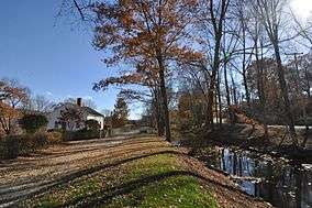 |
(#84002037) |
Lower River Rd. and Blackstone Canal Towpath 41°56′11″N 71°26′04″W / 41.936389°N 71.434444°W |
Lincoln | Now a site on the Blackstone River Bikeway State Park |
| 16 | Pullen Corner School | 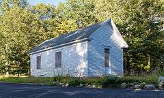 |
(#84002039) |
Angell and Whipple 41°53′44″N 71°28′06″W / 41.895556°N 71.468333°W |
Lincoln | |
| 17 | Sassafras Site, RI-55 |  |
(#84000360) |
Between Albion Rd. and the Blackstone River[5] 41°57′08″N 71°27′03″W / 41.952222°N 71.450833°W |
Lincoln | |
| 18 | Saylesville Historic District | Upload image | (#84002049) |
Roughly bounded by Memorial Ave., Scotts Road, Industrial Circle, Smithfield Ave., and Woodland Court 41°53′33″N 71°24′37″W / 41.8925°N 71.410278°W |
Lincoln | |
| 19 | Saylesville Meetinghouse | |
(#78000008) |
Smithfield Ave. 41°54′02″N 71°25′06″W / 41.900556°N 71.418333°W |
Lincoln | |
| 20 | Whipple-Cullen House and Barn |  |
(#91001647) |
Old River Rd. south of its junction with George Washington Highway 41°55′49″N 71°26′31″W / 41.930278°N 71.441944°W |
Lincoln |
See also
- National Register of Historic Places listings in Providence County, Rhode Island
- List of National Historic Landmarks in Rhode Island
References
- ↑ "National Register of Historic Places: Weekly List Actions". National Park Service, United States Department of the Interior. Retrieved on December 2, 2016.
- ↑ Numbers represent an ordering by significant words. Various colorings, defined here, differentiate National Historic Landmarks and historic districts from other NRHP buildings, structures, sites or objects.
- ↑ National Park Service (2009-03-13). "National Register Information System". National Register of Historic Places. National Park Service.
- ↑ The eight-digit number below each date is the number assigned to each location in the National Register Information System database, which can be viewed by clicking the number.
- ↑ Barber, Russell J. "Quartz Technology at the Sassafras Site". In Quartz Technology in Prehistoric New England, Russell J. Barber, ed. Cambridge: Peabody Museum, Harvard University, 1981, 53.
| Topics | _(extra_close)_(US48).svg.png) | ||||||||||||||||||
|---|---|---|---|---|---|---|---|---|---|---|---|---|---|---|---|---|---|---|---|
| Lists by county | |||||||||||||||||||
| Lists by city |
| ||||||||||||||||||
| |||||||||||||||||||
This article is issued from Wikipedia - version of the 4/22/2016. The text is available under the Creative Commons Attribution/Share Alike but additional terms may apply for the media files.