Mill City, Oregon
| Mill City, Oregon | |
|---|---|
| City | |
|
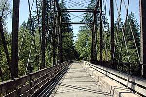
Pedestrian bridge over the North Santiam River at Mill City | |
 Location in Oregon | |
| Coordinates: 44°45′7″N 122°28′42″W / 44.75194°N 122.47833°WCoordinates: 44°45′7″N 122°28′42″W / 44.75194°N 122.47833°W | |
| Country | United States |
| State | Oregon |
| Counties | Linn, Marion |
| Incorporated | 1947 |
| Government | |
| • Mayor | Thorin Faust Thacker |
| Area[1] | |
| • Total | 0.83 sq mi (2.15 km2) |
| • Land | 0.83 sq mi (2.15 km2) |
| • Water | 0 sq mi (0 km2) |
| Elevation | 832 ft (253.6 m) |
| Population (2010)[2] | |
| • Total | 1,855 |
| • Estimate (2012[3]) | 1,867 |
| • Density | 2,234.9/sq mi (862.9/km2) |
| Time zone | Pacific (UTC-8) |
| • Summer (DST) | Pacific (UTC-7) |
| ZIP code | 97360 |
| Area code(s) | 503 and 971 |
| FIPS code | 41-48150[4] |
| GNIS feature ID | 1124148[5] |
| Website | www.mill-city.or.us |
Mill City is a city in Linn and Marion counties in the U.S. state of Oregon. The population was 1,855 at the 2010 census. It is on the North Santiam River, downstream from Detroit Lake.
The Linn County portion of Mill City is part of the Albany–Lebanon Micropolitan Statistical Area, while the Marion County portion is part of the Salem Metropolitan Statistical Area.
From 1998 until 2014, the Mill City Independent Press (formerly known as the Enterprise) covered local news. It was owned by Phil Foster and then by Bill Downer, a former logger and former mayor of Mill City, and his wife Judy Downer.[6]
The Mill City railroad bridge, now a pedestrian bridge is a Phoenix Column Bridge, built by Phoenix Iron Works, Phoenixville, PA It was manufactured in 1888, moved to San Jose, CA then Lake Oswego, Oregon then to Mill City Oregon, installed 1919. Abandoned by Southern Pacific railroad around 1967 and used as a pedestrian and bike bridge. Current restoration efforts are being undertaken by the 'Save our Bridge" Foundation. [7]
Mill City is served by a non commercial 100 watt community radio station that went on the air in 2014. KYAC LP 94.9. Is a all volunteer radio station that serves Mill City, Gates, Lyons, Mehama, Elkhorn and the Little North Fork. It is owned by Santiam Hearts to Arts.
Geography
According to the United States Census Bureau, the city has a total area of 0.83 square miles (2.15 km2), all land.[1]
Demographics
| Historical population | |||
|---|---|---|---|
| Census | Pop. | %± | |
| 1950 | 1,792 | — | |
| 1960 | 1,289 | −28.1% | |
| 1970 | 1,451 | 12.6% | |
| 1980 | 1,565 | 7.9% | |
| 1990 | 1,555 | −0.6% | |
| 2000 | 1,537 | −1.2% | |
| 2010 | 1,855 | 20.7% | |
| Est. 2015 | 1,875 | [8] | 1.1% |
2010 census
As of the census[2] of 2010, there were 1,855 people, 681 households, and 475 families residing in the city. The population density was 2,234.9 inhabitants per square mile (862.9/km2). There were 742 housing units at an average density of 894.0 per square mile (345.2/km2). The racial makeup of the city was 90.7% White, 0.4% African American, 1.9% Native American, 0.4% Asian, 0.6% Pacific Islander, 2.0% from other races, and 3.9% from two or more races. Hispanic or Latino of any race were 9.2% of the population.
There were 681 households of which 36.1% had children under the age of 18 living with them, 49.3% were married couples living together, 13.8% had a female householder with no husband present, 6.6% had a male householder with no wife present, and 30.2% were non-families. 22.8% of all households were made up of individuals and 8.1% had someone living alone who was 65 years of age or older. The average household size was 2.72 and the average family size was 3.14.
The median age in the city was 36.2 years. 27.9% of residents were under the age of 18; 8.2% were between the ages of 18 and 24; 24.2% were from 25 to 44; 26.3% were from 45 to 64; and 13.5% were 65 years of age or older. The gender makeup of the city was 51.8% male and 48.2% female.
2000 census
As of the census[4] of 2000, there were 1,537 people, 565 households, and 422 families residing in the city. The population density was 1,940.4 people per square mile (751.2/km²). There were 629 housing units at an average density of 794.1 per square mile (307.4/km²). The racial makeup of the city was 86.27% White, 0.26% African American, 2.34% Native American, 0.85% Asian, 0.20% Pacific Islander, 6.70% from other races, and 3.38% from two or more races. Hispanic or Latino of any race were 11.39% of the population.
There were 565 households out of which 35.6% had children under the age of 18 living with them, 60.0% were married couples living together, 11.0% had a female householder with no husband present, and 25.3% were non-families. 20.4% of all households were made up of individuals and 8.0% had someone living alone who was 65 years of age or older. The average household size was 2.72 and the average family size was 3.13.
In the city the population was spread out with 30.1% under the age of 18, 7.7% from 18 to 24, 26.7% from 25 to 44, 22.2% from 45 to 64, and 13.3% who were 65 years of age or older. The median age was 36 years. For every 100 females there were 102.2 males. For every 100 females age 18 and over, there were 96.9 males.
The median income for a household in the city was $32,321, and the median income for a family was $36,736. Males had a median income of $30,197 versus $20,625 for females. The per capita income for the city was $14,595. About 10.0% of families and 13.0% of the population were below the poverty line, including 19.9% of those under age 18 and 2.2% of those age 65 or over.
Education
Mill City is the home of Santiam Elementary School and Santiam Junior/Senior High School. Mill City is served by the Santiam Canyon School District.[10]
References
- 1 2 "US Gazetteer files 2010". United States Census Bureau. Retrieved 2012-12-21.
- 1 2 "American FactFinder". United States Census Bureau. Retrieved 2012-12-21.
- ↑ "Population Estimates". United States Census Bureau. Retrieved 2013-06-02.
- 1 2 "American FactFinder". United States Census Bureau. Retrieved 2008-01-31.
- ↑ "US Board on Geographic Names". United States Geological Survey. 2007-10-25. Retrieved 2008-01-31.
- ↑ Utz, Annette (9 May 2014). "Press closes in Mill City". Statesman Journal.
- ↑ "Saving the bridge: Preserving an historical Mill City icon".
- ↑ "Annual Estimates of the Resident Population for Incorporated Places: April 1, 2010 to July 1, 2015". Retrieved July 2, 2016.
- ↑ "Census of Population and Housing". Census.gov. Retrieved June 4, 2015.
- ↑ "Santiam Canyon School District".
External links
- Entry for Mill City in the Oregon Blue Book
- Reinhardt, Bob. "Mill City". The Oregon Encyclopedia.
Municipalities and communities of Linn County, Oregon, United States | ||
|---|---|---|
| Cities | 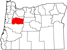 | |
| CDPs | ||
| Other unincorporated communities | ||
| Ghost towns | ||
| Footnotes | ‡This populated place also has portions in an adjacent county or counties | |
Municipalities and communities of Marion County, Oregon, United States | ||
|---|---|---|
| Cities | 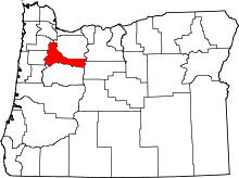 | |
| CDPs | ||
| Unincorporated communities | ||
| Ghost towns | ||
| Footnotes | ‡This populated place also has portions in an adjacent county or counties | |