Idanha, Oregon
| Idanha, Oregon | |
|---|---|
| City | |
|
Idanha City Hall | |
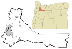 Location in Oregon | |
| Coordinates: 44°42′18″N 122°5′27″W / 44.70500°N 122.09083°WCoordinates: 44°42′18″N 122°5′27″W / 44.70500°N 122.09083°W | |
| Country | United States |
| State | Oregon |
| Counties | Marion, Linn |
| Incorporated | 1949 |
| Government | |
| • Mayor | Karen Clark |
| Area[1] | |
| • Total | 1.09 sq mi (2.82 km2) |
| • Land | 1.06 sq mi (2.75 km2) |
| • Water | 0.03 sq mi (0.08 km2) |
| Elevation | 1,718 ft (523.6 m) |
| Population (2010)[2] | |
| • Total | 134 |
| • Estimate (2012[3]) | 136 |
| • Density | 126.4/sq mi (48.8/km2) |
| Time zone | Pacific (UTC-8) |
| • Summer (DST) | Pacific (UTC-7) |
| ZIP code | 97350 |
| Area code(s) | 503 |
| FIPS code | 41-35800[2] |
| GNIS feature ID | 1143981[4] |
| Website | www.cityofidanha.com |

Idanha /ɪˈdænə/ is a city on the Marion County/Linn County line in Oregon, United States, on Oregon Route 22 and the Santiam River. The population was 134 at the 2010 census.
The Marion County portion of Idanha is part of the Salem Metropolitan Statistical Area, while the Linn County portion is part of the Albany–Lebanon Micropolitan Statistical Area.
Geography
According to the United States Census Bureau, the city has a total area of 1.09 square miles (2.82 km2), of which 1.06 square miles (2.75 km2) is land and 0.03 square miles (0.08 km2) is water.[1]
Idanha encompasses the area of New Idanha in Linn County, classed by the USGS as a separate populated place.[5][6]
Climate
This region experiences warm (but not hot) and dry summers, with no average monthly temperatures above 71.6 °F (22.0 °C). According to the Köppen Climate Classification system, Idanha has a warm-summer Mediterranean climate, abbreviated "Csb" on climate maps.[7]
Demographics
| Historical population | |||
|---|---|---|---|
| Census | Pop. | %± | |
| 1950 | 442 | — | |
| 1960 | 295 | −33.3% | |
| 1970 | 382 | 29.5% | |
| 1980 | 319 | −16.5% | |
| 1990 | 289 | −9.4% | |
| 2000 | 232 | −19.7% | |
| 2010 | 134 | −42.2% | |
| Est. 2015 | 137 | [8] | 2.2% |
2010 census
As of the census of 2010, there were 134 people, 65 households, and 34 families residing in the city. The population density was 126.4 inhabitants per square mile (48.8/km2). There were 86 housing units at an average density of 81.1 per square mile (31.3/km2). The racial makeup of the city was 96.3% White and 3.7% from two or more races. Hispanic or Latino of any race were 5.2% of the population.[2]
There were 65 households of which 12.3% had children under the age of 18 living with them, 46.2% were married couples living together, 1.5% had a female householder with no husband present, 4.6% had a male householder with no wife present, and 47.7% were non-families. 36.9% of all households were made up of individuals and 12.3% had someone living alone who was 65 years of age or older. The average household size was 2.06 and the average family size was 2.62.[2]
The median age in the city was 51.2 years. 11.2% of residents were under the age of 18; 5.8% were between the ages of 18 and 24; 12.6% were from 25 to 44; 52.2% were from 45 to 64; and 17.9% were 65 years of age or older. The gender makeup of the city was 56.7% male and 43.3% female.[2]
2000 census
As of the census of 2000, there were 232 people, 85 households, and 65 families residing in the city. The population density was 222.0 people per square mile (86.1/km²). There were 116 housing units at an average density of 111.0 per square mile (43.1/km²). The racial makeup of the city was 92.67% White, 0.43% African American, 5.60% from other races, and 1.29% from two or more races. Hispanic or Latino of any race were 6.03% of the population.[2]
There were 85 households out of which 36.5% had children under the age of 18 living with them, 63.5% were married couples living together, 9.4% had a female householder with no husband present, and 23.5% were non-families. 16.5% of all households were made up of individuals and 4.7% had someone living alone who was 65 years of age or older. The average household size was 2.73 and the average family size was 3.06.[2]
In the city the population was spread out with 30.2% under the age of 18, 6.5% from 18 to 24, 30.2% from 25 to 44, 24.6% from 45 to 64, and 8.6% who were 65 years of age or older. The median age was 37 years. For every 100 females there were 107.1 males. For every 100 females age 18 and over, there were 107.7 males.[2]
The median income for a household in the city was $30,982, and the median income for a family was $32,500. Males had a median income of $22,250 versus $21,000 for females. The per capita income for the city was $12,405. About 12.5% of families and 17.1% of the population were below the poverty line, including 17.3% of those under the age of 18 and none of those 65 or over.[2]
Education
Idanha is served by the Santiam Canyon School District.[10]
Transportation
Idanha served as the eastern terminus of a transcontinental railroad, proposed by Colonel T. Egenton Hogg, that terminated in Idanha because of a lack of funding. Idanha saw rail service until the 1950s, when the track was removed for development of Detroit Lake, situated over the historical road bed of the former Oregon Pacific Railroad.[11]
References
- 1 2 "US Gazetteer files 2010". United States Census Bureau. Retrieved 2012-12-21.
- 1 2 3 4 5 6 7 8 9 "American FactFinder". United States Census Bureau. Retrieved 2012-12-21.
- ↑ "Population Estimates". United States Census Bureau. Retrieved 2013-06-02.
- ↑ "US Board on Geographic Names". United States Geological Survey. 2007-10-25. Retrieved 2008-01-31.
- ↑ "New Idanha". Geographic Names Information System. United States Geological Survey. November 28, 1980. Retrieved March 28, 2012.
- ↑ Map of Idanha from the Oregon Department of Transportation
- ↑ "Idanha, Oregon". Weatherbase. CantyMedia. 2015. Retrieved 2015-04-07.
- ↑ "Annual Estimates of the Resident Population for Incorporated Places: April 1, 2010 to July 1, 2015". Retrieved July 2, 2016.
- ↑ "Census of Population and Housing". Census.gov. Retrieved June 4, 2015.
- ↑ Santiam Canyon School District
- ↑ Oregon Pacific Railroad
External links
- Entry for Idanha in the Oregon Blue Book
- Reinhardt, Bob. "City of Idanha". The Oregon Encyclopedia.
Municipalities and communities of Linn County, Oregon, United States | ||
|---|---|---|
| Cities |  | |
| CDPs | ||
| Other unincorporated communities | ||
| Ghost towns | ||
| Footnotes | ‡This populated place also has portions in an adjacent county or counties | |
Municipalities and communities of Marion County, Oregon, United States | ||
|---|---|---|
| Cities |  | |
| CDPs | ||
| Unincorporated communities | ||
| Ghost towns | ||
| Footnotes | ‡This populated place also has portions in an adjacent county or counties | |