Mehama, Oregon
| Mehama, Oregon | |
|---|---|
| CDP | |
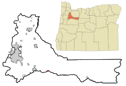 Location of Mehama, Oregon | |
| Coordinates: 44°47′24″N 122°37′9″W / 44.79000°N 122.61917°WCoordinates: 44°47′24″N 122°37′9″W / 44.79000°N 122.61917°W | |
| Country | United States |
| State | Oregon |
| County | Marion |
| Area | |
| • Total | 0.5 sq mi (1.3 km2) |
| • Land | 0.5 sq mi (1.2 km2) |
| • Water | 0.0 sq mi (0.1 km2) |
| Elevation | 633 ft (193 m) |
| Population (2000) | |
| • Total | 283 |
| • Density | 596.8/sq mi (230.4/km2) |
| Time zone | Pacific (PST) (UTC-8) |
| • Summer (DST) | PDT (UTC-7) |
| ZIP code | 97384 |
| Area code(s) | 503 |
| FIPS code | 41-47300[1] |
| GNIS feature ID | 1124044[2] |
Mehama is an unincorporated community in Marion County, Oregon, United States, located on Oregon Route 22 and the North Santiam River. For statistical purposes, the United States Census Bureau has defined Mehama as a census-designated place (CDP). The census definition of the area may not precisely correspond to local understanding of the area with the same name. The population was 283 at the 2000 census. It is part of the Salem Metropolitan Statistical Area.
Mehama is the eastern terminus of Oregon Route 226, and is just one mile north of Lyons, across the North Santiam.
History
Mehama was named for the wife of pioneer James X. Smith.[3] Smith laid out the townsite and operated a ferry on the North Santiam.[3] A post office, misnamed Mehamah, was established in 1877, but the name was changed to Mehama by 1881.[3]
Geography
According to the United States Census Bureau, the CDP has a total area of 0.5 square miles (1.3 km2), of which 0.5 square miles (1.3 km2) of it is land and 0.04 square miles (0.10 km2) (4%) is water.
Demographics
As of the census[1] of 2000, there were 283 people, 110 households, and 77 families residing in the CDP. The population density was 596.8 people per square mile (232.5/km²). There were 123 housing units at an average density of 259.4 per square mile (101.0/km²). The racial makeup of the CDP was 89.05% White, 0.35% African American, 2.47% Native American, 1.06% Asian, 0.35% from other races, and 6.71% from two or more races. Hispanic or Latino of any race were 1.06% of the population.
There were 110 households out of which 31.8% had children under the age of 18 living with them, 58.2% were married couples living together, 9.1% had a female householder with no husband present, and 29.1% were non-families. 23.6% of all households were made up of individuals and 9.1% had someone living alone who was 65 years of age or older. The average household size was 2.57 and the average family size was 3.01.
In the CDP the population was spread out with 22.6% under the age of 18, 7.8% from 18 to 24, 28.3% from 25 to 44, 26.1% from 45 to 64, and 15.2% who were 65 years of age or older. The median age was 40 years. For every 100 females there were 102.1 males. For every 100 females age 18 and over, there were 112.6 males.
The median income for a household in the CDP was $38,854, and the median income for a family was $54,286. Males had a median income of $35,192 versus $14,712 for females. The per capita income for the CDP was $17,617. None of the families and 11.2% of the population were living below the poverty line.
References
- 1 2 "American FactFinder". United States Census Bureau. Archived from the original on September 11, 2013. Retrieved 2008-01-31.
- ↑ "US Board on Geographic Names". United States Geological Survey. 2007-10-25. Retrieved 2008-01-31.
- 1 2 3 McArthur, Lewis A.; Lewis L. McArthur (2003) [1928]. Oregon Geographic Names (Seventh ed.). Portland, Oregon: Oregon Historical Society Press. p. 635. ISBN 0-87595-277-1.
External links
Municipalities and communities of Marion County, Oregon, United States | ||
|---|---|---|
| Cities | 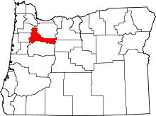 | |
| CDPs | ||
| Unincorporated communities | ||
| Ghost towns | ||
| Footnotes | ‡This populated place also has portions in an adjacent county or counties | |