West Scio, Oregon
| West Scio, Oregon | |
|---|---|
| Unincorporated community and census-designated place | |
 West Scio, Oregon  West Scio, Oregon Location within the state of Oregon | |
| Coordinates: 44°42′39″N 122°52′58″W / 44.71083°N 122.88278°WCoordinates: 44°42′39″N 122°52′58″W / 44.71083°N 122.88278°W | |
| Country | United States |
| State | Oregon |
| County | Linn |
| Elevation | 318 ft (97 m) |
| Population (2010)[1] | |
| • Total | 120 |
| Time zone | Pacific (UTC-8) |
| • Summer (DST) | Pacific (UTC-7) |
| ZIP code | 97374 |
| GNIS feature ID | 1136891 |
| Coordinates and elevation from United States Geological Survey[2] | |
West Scio is an unincorporated community in Linn County, in the U.S. state of Oregon.[2] It lies at the intersection of Jefferson–Scio Road and West Scio Road about 2 miles (3 km) west of Scio.[3] For statistical purposes, the United States Census Bureau has defined West Scio as a census-designated place (CDP). The census definition of the area may not precisely correspond to local understanding of the area with the same name. As of the 2010 Census, the population was 120.[1]
References
- 1 2 "Community Facts, West Scio CDP". U.S. Census Bureau. 2010. Retrieved December 4, 2014.
- 1 2 "West Scio". Geographic Names Information System. United States Geological Survey. November 28, 1980. Retrieved December 4, 2014.
- ↑ Oregon Atlas & Gazetteer (7th ed.). Yarmouth, Maine: DeLorme. 2008. p. 34. ISBN 978-0-89933-347-2.
Municipalities and communities of Linn County, Oregon, United States | ||
|---|---|---|
| Cities | 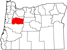 | |
| CDPs | ||
| Other unincorporated communities | ||
| Ghost towns | ||
| Footnotes | ‡This populated place also has portions in an adjacent county or counties | |
This article is issued from Wikipedia - version of the 7/30/2016. The text is available under the Creative Commons Attribution/Share Alike but additional terms may apply for the media files.