Markle, Indiana
| Markle, Indiana | |
|---|---|
| Village | |
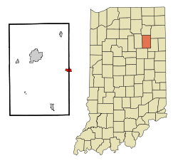 Location of Markle in the state of Indiana | |
| Coordinates: 40°49′35″N 85°20′17″W / 40.82639°N 85.33806°WCoordinates: 40°49′35″N 85°20′17″W / 40.82639°N 85.33806°W | |
| Country | United States |
| State | Indiana |
| Counties | Huntington, Wells |
| Township | Rockcreek, Rock Creek |
| Area[1] | |
| • Total | 1.27 sq mi (3.29 km2) |
| • Land | 1.22 sq mi (3.16 km2) |
| • Water | 0.05 sq mi (0.13 km2) |
| Elevation[2] | 810 ft (247 m) |
| Population (2010)[3] | |
| • Total | 1,095 |
| • Estimate (2012[4]) | 1,095 |
| • Density | 897.5/sq mi (346.5/km2) |
| Time zone | Eastern (EST) (UTC-5) |
| • Summer (DST) | EDT (UTC-4) |
| ZIP code | 46770 |
| Area code(s) | 260 |
| FIPS code | 18-47160[5] |
| GNIS feature ID | 438624 |
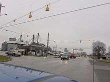
Markle is a village in Huntington and Wells counties, in the U.S. state of Indiana.[6] The population was 1,095 at the 2010 census. It lies along Interstate 69, U.S. Route 224, State Road 116 and State Road 3.
History
Markle was laid out in 1836, but did not prosper until the railroad was extended to that point some time later.[7]
The Markle post office has been in operation since 1852.[8]
Geography
Markle is located at 40°49′35″N 85°20′17″W / 40.82639°N 85.33806°W (40.826477, -85.338076).[9] The Wabash River flows through the south edge of the town.
According to the 2010 census, Markle has a total area of 1.27 square miles (3.29 km2), of which 1.22 square miles (3.16 km2) (or 96.06%) is land and 0.05 square miles (0.13 km2) (or 3.94%) is water.[1]
Demographics
| Historical population | |||
|---|---|---|---|
| Census | Pop. | %± | |
| 1880 | 220 | — | |
| 1890 | 670 | 204.5% | |
| 1900 | 729 | 8.8% | |
| 1910 | 820 | 12.5% | |
| 1920 | 717 | −12.6% | |
| 1930 | 621 | −13.4% | |
| 1940 | 671 | 8.1% | |
| 1950 | 733 | 9.2% | |
| 1960 | 789 | 7.6% | |
| 1970 | 963 | 22.1% | |
| 1980 | 975 | 1.2% | |
| 1990 | 1,208 | 23.9% | |
| 2000 | 1,102 | −8.8% | |
| 2010 | 1,095 | −0.6% | |
| Est. 2015 | 1,095 | [10] | 0.0% |
2010 census
As of the census[3] of 2010, there were 1,095 people, 433 households, and 282 families residing in the town. The population density was 897.5 inhabitants per square mile (346.5/km2). There were 470 housing units at an average density of 385.2 per square mile (148.7/km2). The racial makeup of the town was 98.3% White, 0.8% African American, 0.2% Asian, 0.1% from other races, and 0.6% from two or more races. Hispanic or Latino of any race were 1.2% of the population.
There were 433 households of which 29.8% had children under the age of 18 living with them, 52.7% were married couples living together, 9.0% had a female householder with no husband present, 3.5% had a male householder with no wife present, and 34.9% were non-families. 31.2% of all households were made up of individuals and 12.3% had someone living alone who was 65 years of age or older. The average household size was 2.35 and the average family size was 2.94.
The median age in the town was 43 years. 23.1% of residents were under the age of 18; 6.9% were between the ages of 18 and 24; 22.3% were from 25 to 44; 27.7% were from 45 to 64; and 20.3% were 65 years of age or older. The gender makeup of the town was 47.9% male and 52.1% female.
2000 census
As of the census[5] of 2000, there were 1,102 people, 434 households, and 289 families residing in the town. The population density was 1,116.3 people per square mile (429.8/km²). There were 471 housing units at an average density of 477.1 per square mile (183.7/km²). The racial makeup of the town was 99.27% White, 0.36% African American, and 0.36% from two or more races. Hispanic or Latino of any race were 0.64% of the population.
There were 434 households out of which 28.8% had children under the age of 18 living with them, 53.7% were married couples living together, 9.7% had a female householder with no husband present, and 33.4% were non-families. 28.6% of all households were made up of individuals and 12.0% had someone living alone who was 65 years of age or older. The average household size was 2.42 and the average family size was 2.98.
In the town the population was spread out with 24.3% under the age of 18, 9.4% from 18 to 24, 27.4% from 25 to 44, 20.5% from 45 to 64, and 18.3% who were 65 years of age or older. The median age was 38 years. For every 100 females there were 90.0 males. For every 100 females age 18 and over, there were 84.9 males.
The median income for a household in the town was $37,039, and the median income for a family was $48,654. Males had a median income of $35,163 versus $20,813 for females. The per capita income for the town was $18,504. About 3.6% of families and 6.7% of the population were below the poverty line, including 9.4% of those under age 18 and 3.1% of those age 65 or over.
References
- 1 2 "G001 - Geographic Identifiers - 2010 Census Summary File 1". United States Census Bureau. Retrieved 2015-07-17.
- ↑ "US Board on Geographic Names". United States Geological Survey. October 25, 2007. Retrieved 2016-07-06.
- 1 2 "American FactFinder". United States Census Bureau. Retrieved 2012-12-11.
- ↑ "Population Estimates". United States Census Bureau. Retrieved 2013-06-25.
- 1 2 "American FactFinder". United States Census Bureau. Retrieved 2008-01-31.
- ↑ "Markle, Indiana". Geographic Names Information System. United States Geological Survey. Retrieved 2016-07-06.
- ↑ Bash, Frank Sumner (1914). History of Huntington County, Indiana: A Narrative Account of Its Historical Progress, Its People, and Its Principal Interests. The Lewis Publishing Company. p. 160.
- ↑ "Huntington County". Jim Forte Postal History. Retrieved July 6, 2016.
- ↑ "US Gazetteer files: 2010, 2000, and 1990". United States Census Bureau. 2011-02-12. Retrieved 2011-04-23.
- ↑ "Annual Estimates of the Resident Population for Incorporated Places: April 1, 2010 to July 1, 2015". Retrieved July 2, 2016.
- ↑ "Census of Population and Housing". Census.gov. Retrieved June 4, 2015.
External links
Municipalities and communities of Huntington County, Indiana, United States | ||
|---|---|---|
| City | ||
| Towns | ||
| Townships | ||
| Unincorporated communities | ||
| Footnotes | ‡This populated place also has portions in an adjacent county or counties | |
Municipalities and communities of Wells County, Indiana, United States | ||
|---|---|---|
| City | ||
| Towns | ||
| Townships | ||
| Unincorporated communities | ||
| Footnotes | ‡This populated place also has portions in an adjacent county or counties | |
| Counties |  | |
|---|---|---|
| Municipalities with population over 10,000 in 2010 | ||
| Municipalities with population 1,000-10,000 in 2010 | ||
| Municipalities with population under 1,000 in 2010 | ||
| CDPs | ||