Huntington, Indiana
| City of Huntington | |
|---|---|
| City | |
|
Aerial view of Huntington looking northeast. | |
| Nickname(s): "The Lime City" | |
 Location in the state of Indiana, USA | |
| Coordinates: 40°52′55″N 85°29′44″W / 40.88194°N 85.49556°WCoordinates: 40°52′55″N 85°29′44″W / 40.88194°N 85.49556°W | |
| Country |
|
| State |
|
| County | Huntington |
| Government | |
| • Mayor | Brooks Fetters (R) |
| Area[1] | |
| • Total | 8.84 sq mi (22.90 km2) |
| • Land | 8.71 sq mi (22.56 km2) |
| • Water | 0.13 sq mi (0.34 km2) |
| Elevation | 748 ft (228 m) |
| Population (2010)[2] | |
| • Total | 17,391 |
| • Estimate (2012[3]) | 17,291 |
| • Density | 1,996.7/sq mi (770.9/km2) |
| Time zone | EST (UTC-5) |
| • Summer (DST) | EDT (UTC-4) |
| ZIP Code | 46750 |
| Area code(s) | 260 |
| FIPS code | 18-35302[4] |
| GNIS feature ID | 0436634[5] |
| Website | http://www.huntington.in.us/city/ |

Huntington, known as the "Lime City", is the largest city in and the county seat of Huntington County, Indiana, United States.[6] It is in Huntington and Union townships. The population was 17,391 at the 2010 census.
Geography
According to the 2010 census, Huntington has a total area of 8.844 square miles (22.91 km2), of which 8.71 square miles (22.56 km2) (or 98.48%) is land and 0.134 square miles (0.35 km2) (or 1.52%) is water.[1]
Demographics
| Historical population | |||
|---|---|---|---|
| Census | Pop. | %± | |
| 1850 | 594 | — | |
| 1860 | 1,664 | 180.1% | |
| 1870 | 2,925 | 75.8% | |
| 1880 | 3,863 | 32.1% | |
| 1890 | 7,328 | 89.7% | |
| 1900 | 9,491 | 29.5% | |
| 1910 | 10,272 | 8.2% | |
| 1920 | 14,000 | 36.3% | |
| 1930 | 13,420 | −4.1% | |
| 1940 | 13,903 | 3.6% | |
| 1950 | 15,079 | 8.5% | |
| 1960 | 16,185 | 7.3% | |
| 1970 | 16,217 | 0.2% | |
| 1980 | 16,202 | −0.1% | |
| 1990 | 16,389 | 1.2% | |
| 2000 | 17,450 | 6.5% | |
| 2010 | 17,391 | −0.3% | |
| Est. 2015 | 17,095 | [7] | −1.7% |
2010 census
As of the census[2] of 2010, there were 17,391 people, 6,566 households, and 4,197 families residing in the city. The population density was 1,996.7 inhabitants per square mile (770.9/km2). There were 7,487 housing units at an average density of 859.6 per square mile (331.9/km2). The racial makeup of the city was 96.4% White, 0.6% African American, 0.4% Native American, 0.5% Asian, 0.6% from other races, and 1.4% from two or more races. Hispanic or Latino of any race were 2.4% of the population.
There were 6,566 households of which 34.1% had children under the age of 18 living with them, 45.2% were married couples living together, 13.3% had a female householder with no husband present, 5.4% had a male householder with no wife present, and 36.1% were non-families. 30.4% of all households were made up of individuals and 12.5% had someone living alone who was 65 years of age or older. The average household size was 2.48 and the average family size was 3.06.
The median age in the city was 33.4 years. 24.8% of residents were under the age of 18; 13.5% were between the ages of 18 and 24; 25.5% were from 25 to 44; 22.5% were from 45 to 64; and 13.5% were 65 years of age or older. The gender makeup of the city was 47.7% male and 52.3% female.
2000 census
As of the census[4] of 2000, there were 17,450 people, 6,717 households, and 4,419 families residing in the city. The population density was 2,091.0 people per square mile (806.9/km²). There were 7,262 housing units at an average density of 870.2/sq mi (335.8/km²). The main religion is Roman Catholic, with around 42% of the city attending masses. The racial makeup of the city was 97.83% White, 0.21% African American, 0.45% Native American, 0.45% Asian, 0.02% Pacific Islander, 0.30% from other races, and 0.73% from two or more races. Hispanic or Latino of any race were 1.12% of the population.
There were 6,717 households out of which 33.5% had children under the age of 18 living with them, 48.9% were married couples living together, 12.4% had a female householder with no husband present, and 34.2% were non-families. 29.0% of all households were made up of individuals and 12.0% had someone living alone who was 65 years of age or older. The average household size was 2.46 and the average family size was 3.03.
In the city the population was spread out with 26.2% under the age of 18, 12.9% from 18 to 24, 28.2% from 25 to 44, 18.9% from 45 to 64, and 13.8% who were 65 years of age or older. The median age was 33 years. For every 100 females there were 91.5 males. For every 100 females age 18 and over, there were 87.3 males.
The median income for a household in the city was $45,600, and the median income for a family was $56,454. Males had a median income of $35,830 versus $26,921 for females. The per capita income for the city was $21,242. About 5.2% of families and 7.1% of the population were below the poverty line, including 8.2% of those under age 18 and 6.4% of those age 65 or over.
Schools
The Huntington County Community School Corporation serves the city of Huntington and all of Huntington County. The corporation's lone high school, Huntington North High School, is located in Huntington. The two corporation middle schools, Crestview Middle School, Riverview Middle School, and three of the five elementary schools lie just outside the city limits. Private schools include Huntington Catholic School operated by the Roman Catholic Church.
History
Name
Huntington was named by Capt. Elias Murray, a member of the legislature. The name Huntington is derived from Samuel Huntington, a judge, politician, and patriot in the American Revolution. Samuel Huntington is also known for being the 3rd Governor of Connecticut and the 7th President of the Continental Congress. Being a delegate to the Second Continental Congress, Huntington took part in voting for and signing the Declaration of Independence and the Articles of Confederation.
Early settlement
The county of Huntington was formally organized on December 2, 1834. The city of Huntington was first established by a group of pioneers, most notably Capt. Elias Murray. By 1849, Huntington contained 150 houses and a population of 700.[9]
Historical literature
A small number of books have been published about the history of Huntington County, the first being History of Huntington County, Indiana originally published by Brant & Fuller. Two other books about Huntington include History of Huntington County, IN by Frank Sumner Bash in 1914 (describing its historical progress, its people, and its principal interests) and Huntington County, IN: Histories and Families by Turner Publishing Company in 1993 as a result of the Huntington County Historical Society officers and board of directors meeting in the summer of 1992 to discuss the family history of Huntington, the glue that has held together the city and county of Huntington in the heartland of the Midwest for more than 175 years.
Wabash and Erie Canal

The Wabash and Erie Canal was constructed through Huntington County in 1834 and added major economic benefit to the area. In addition to the Wabash River cutting through Huntington (see Forks of the Wabash), this newly opened trade route accelerated the population and economic growth in Huntington.
Economy
Catholic publisher Our Sunday Visitor is based in Huntington.
Communications
Local radio stations
- WGL FM 102.9
- WBZQ AM 1300 La Jefa Radio (Spanish)
- WVSH FM 91.9 The Edge, high school station (Huntington North High School)
- WQHU FM 105.5 FUSE FM, Huntington University
Transportation
Huntington Municipal Airport, a small airport for general aviation, lies southeast of the city.
Several highways serve the city:
Notable people
Sports
- E.J. Tackett, professional bowler
- Dusty Fahrnow, Indy car driver
- Gary Dilley, Swimmer, Silver Medalist
Entertainment
- Denny Jiosa, Grammy-nominated jazz guitarist
- Mick Mars, guitarist of Mötley Crüe
Politics
- J. Danforth Quayle, former Vice-President of the United States, U.S. Senator, U.S. Representative
- J. Edward Roush, U.S. Representative, father of "911 Emergency System"
- James R. Slack, state senator and Civil War general
Religion
- Archbishop John F. Noll, founder of Our Sunday Visitor a Roman Catholic Newspaper, and publishing company. Former Father of St. Mary's Catholic Church.
Other
- Richard Leroy Walters, homeless philanthropist
Points of interest
- Church of the United Brethren in Christ National Headquarters
- Drover Town Historic District
- Forks of the Wabash
- Hawley Heights Historic District
- Hotel LaFontaine
- Huntington County Historical Museum
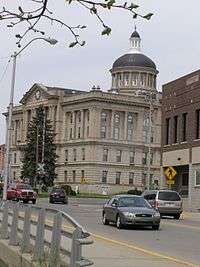
- Huntington Courthouse Square Historic District
- Huntington University Arboretum and Botanical Garden
- Huntington University
- J. Edward Roush Lake
- Merillat Centre for the Arts
- Moore/Carlew Building
- North Jefferson Street Historic District
- Old Plat Historic District
- Our Sunday Visitor
- David Alonzo and Elizabeth Purviance House
- Samuel Purviance House
- St. Peter's First Community Church
- Sheets Wildlife Museum and Learning Center
- Sunken Gardens
- Taylor-Zent House
- The Indiana Room Genealogy Center
- United States Vice Presidential Museum
- Victory Noll
- William Street School
- Nick's Kitchen
- AAA Ace Hardware
Further reading
- Williamson, David The 47th Indiana Volunteer Infantry: A Civil War History (Jefferson, NC: McFarland & Company, Publishers), 2012. ISBN 0786465956.
- Williamson, David, ed. Slack's War: Selected Civil War Letters of General James R. Slack, 47th Indiana Volunteer Infantry, to His Wife, Ann, 1862-1865 (CreateSpace Publishing Platform), 2012. ISBN 1478379588.
- Williamson, David, ed. The 47th Indiana Volunteer Infantry: Court-Martial Case Files (CreateSpace Publishing Platform), 2012. ISBN 1477687572.
References
- 1 2 "G001 - Geographic Identifiers - 2010 Census Summary File 1". United States Census Bureau. Retrieved 2015-07-28.
- 1 2 "American FactFinder". United States Census Bureau. Retrieved 2012-12-11.
- ↑ "Population Estimates". United States Census Bureau. Archived from the original on June 17, 2013. Retrieved 2013-06-25.
- 1 2 "American FactFinder". United States Census Bureau. Archived from the original on September 11, 2013. Retrieved 2008-01-31.
- ↑ "US Board on Geographic Names". United States Geological Survey. 2007-10-25. Retrieved 2008-01-31.
- ↑ "Find a County". National Association of Counties. Archived from the original on May 31, 2011. Retrieved 2011-06-07.
- ↑ "Annual Estimates of the Resident Population for Incorporated Places: April 1, 2010 to July 1, 2015". Retrieved July 2, 2016.
- ↑ "Census of Population and Housing". Census.gov. Archived from the original on May 11, 2015. Retrieved June 4, 2015.
- ↑ Branson, Ronald. "Huntington County". Crossroads of America: Early Indiana History HUNTINGTON COUNTY. Indiana County History Preservation Society. Retrieved 5 December 2011.
External links
| Wikisource has the text of the 1911 Encyclopædia Britannica article Huntington (Indiana). |
- City of Huntington, Indiana website
- HuntingtonDaily.com, Huntington news website
- Huntington County Tab newspaper
- Huntington Herald Press daily newspaper
- Huntington County United Economic Development
- Huntington Indiana Information
- The HUFF 50K Trail Run ultramarathon
- Info on BBQ grills made in Huntington
- Huntington County Community School Corporation
- Huntington City-Township Public Library
Municipalities and communities of Huntington County, Indiana, United States | ||
|---|---|---|
| City | ||
| Towns | ||
| Townships | ||
| Unincorporated communities | ||
| Footnotes | ‡This populated place also has portions in an adjacent county or counties | |
| Counties |  | |
|---|---|---|
| Municipalities with population over 10,000 in 2010 | ||
| Municipalities with population 1,000-10,000 in 2010 | ||
| Municipalities with population under 1,000 in 2010 | ||
| CDPs | ||