Keng Tawng
This article is about the town. For the present-day administrative division, see Keng Tawng Subtownship. For the former state, see Kengtawng State.
| Keng Tawng Kēng Tawng | |
|---|---|
| Town | |
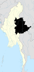
 Keng Tawng Location in Burma | |
| Coordinates: 20°43′41″N 98°01′12″E / 20.72806°N 98.02°ECoordinates: 20°43′41″N 98°01′12″E / 20.72806°N 98.02°E | |
| Country |
|
| State | Shan State |
| District | Loilem District |
| Township | Mong Nai Township |
| Time zone | MST (UTC+6.30) |
Keng Tawng is a river town in Mong Nai Township in the Shan State of Burma. The area of the town is watered by the Nam Teng River.
History
Prior to the end of World War II, Kengtawng state was one of the substates of Mongnai State, in the Southern Shan States.
Keng Tawng was the town of Khun Sam Law, the hero of an ancient legend of the Shan people. It was also the birthplace of notorious usurper and warmonger Twet Nga Lu.[1]
There is a hydroelectric project in the area of the town. Places like the iconic Kengtawng Falls are threatened by the project.[2]
References
Capital: Möng Nai | |
|

This article is issued from Wikipedia - version of the 5/29/2016. The text is available under the Creative Commons Attribution/Share Alike but additional terms may apply for the media files.