Mong Hsat
This article is about the town. For the district, see Mong Hsat District. For the township, see Mong Hsat Township. For the former state, see Monghsat State.
| Mong Hsat Mongsat | |
|---|---|
| Town | |
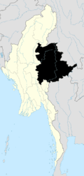
 Mong Hsat Location in Burma | |
| Coordinates: 20°32′N 99°15′E / 20.533°N 99.250°ECoordinates: 20°32′N 99°15′E / 20.533°N 99.250°E | |
| Country |
|
| Region | Shan State |
| District | Mong Hsat District |
| Township | Mong Hsat Township |
| Time zone | MST (UTC+6.30) |
Mong Hsat is a town in the Shan State of Myanmar, the capital of Mong Hsat Township. It is served by Monghsat Airport.
History
Monghsat State (Mönghsat, where Mong is equivalent to Thai Mueang) was one of the Shan States. It was a tributary state of Kengtung State. The capital was the town of Monghsat.[1][2]
Cultivation of the opium poppy is said to be on the rise in the area after the United Wa State Army decided to stop it in their territory of northern Shan state.[3]
References
- ↑ Imperial Gazetteer of India, v. 15, p. 200.
- ↑ Sanda Simms, The Kingdoms of Laos. p. 207
- ↑ Solomon, Mungpi. "Ethnic militia accuses junta of forcing opium cultivation". Mizzima News. Retrieved 2008-12-25.
External links
- Satellite map GeoNames
Capital: Mong Hsat | |
|

This article is issued from Wikipedia - version of the 5/27/2016. The text is available under the Creative Commons Attribution/Share Alike but additional terms may apply for the media files.