Kyaukme District
| Kyaukme | |
|---|---|
| District | |
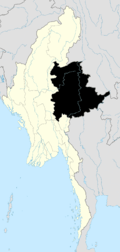
 Kyaukme Location in Burma | |
| Coordinates: 22°32′00″N 97°2′00″E / 22.53333°N 97.03333°ECoordinates: 22°32′00″N 97°2′00″E / 22.53333°N 97.03333°E | |
| Country |
|
| State | Shan State |
| Elevation[1] | 775 m (2,543 ft) |
| Time zone | MST (UTC+6.30) |
Kyaukme District is a district of northern Shan State in Burma (Myanmar). As of 2001, it consisted of 9 towns and 1946 villages.
Administrative divisions
As of 2015, Kyaukme District contained the following townships:
Prior to August 2010, Kyaukme District also included Mantong Township and Namhsan Township, which both were transferred that month to the newly created Pa Laung Self-Administered Zone.[2]
Kyaukme District also consisted of the following townships, which formed to become Mongmit District:
References

This article is issued from Wikipedia - version of the 8/18/2016. The text is available under the Creative Commons Attribution/Share Alike but additional terms may apply for the media files.