Hopong
This article is about the town. For the present-day administrative division, see Hopong Township. For the former Shan princely state, see Hopong State.
| Hopong | |
|---|---|
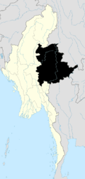
 Hopong Location in Burma | |
| Coordinates: 20°47′0″N 97°11′0″E / 20.78333°N 97.18333°ECoordinates: 20°47′0″N 97°11′0″E / 20.78333°N 97.18333°E | |
| Country |
|
| Division | Shan State |
| Districts | Taunggyi District |
| Township | Hopong Township |
| Elevation | 3,541 ft (1,079 m) |
| Population (2005) | |
| • Religions | Buddhism |
| Time zone | MST (UTC+6.30) |
Hopong (Burmese: ဟိုပုန်းမြို့) is a town in the Shan State of eastern Burma. It is located in Hopong Township in Taunggyi District.
External links

This article is issued from Wikipedia - version of the 11/14/2015. The text is available under the Creative Commons Attribution/Share Alike but additional terms may apply for the media files.