Hainesport Township, New Jersey
| Hainesport Township, New Jersey | |
|---|---|
| Township | |
| Township of Hainesport | |
|
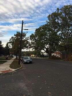
Broad Street of Hainesport, NJ | |
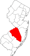
 Hainesport Township highlighted in Burlington County. Inset map: Burlington County highlighted in the State of New Jersey. | |
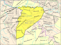 Census Bureau map of Hainesport Township, New Jersey | |
| Coordinates: 39°58′41″N 74°50′11″W / 39.977956°N 74.836334°WCoordinates: 39°58′41″N 74°50′11″W / 39.977956°N 74.836334°W[1][2] | |
| Country |
|
| State |
|
| County | Burlington |
| Incorporated | March 12, 1924 |
| Government[3] | |
| • Type | Township |
| • Body | Township Committee |
| • Mayor | Michael Dickinson (R, term ends December 31, 2016)[4][5] |
| • Administrator / Clerk | Leo F. Selb Jr[6] |
| Area[1] | |
| • Total | 6.723 sq mi (17.414 km2) |
| • Land | 6.459 sq mi (16.730 km2) |
| • Water | 0.264 sq mi (0.685 km2) 3.93% |
| Area rank |
183rd of 566 in state 18th of 40 in county[1] |
| Elevation[7] | 49 ft (15 m) |
| Population (2010 Census)[8][9][10] | |
| • Total | 6,110 |
| • Estimate (2015)[11] | 6,053 |
| • Rank |
341st of 566 in state 27th of 40 in county[12] |
| • Density | 945.9/sq mi (365.2/km2) |
| • Density rank |
392nd of 566 in state 25th of 40 in county[12] |
| Time zone | Eastern (EST) (UTC-5) |
| • Summer (DST) | Eastern (EDT) (UTC-4) |
| ZIP code | 08036[13][14] |
| Area code(s) | 609[15] |
| FIPS code | 3400529010[1][16][17] |
| GNIS feature ID | 0882092[1][18] |
| Website |
www |
Hainesport Township is a township in Burlington County, New Jersey, United States. As of the 2010 United States Census, the township's population was 6,110,[8][9][10] reflecting an increase of 1,984 (+48.1%) from the 4,126 counted in the 2000 Census, which had in turn increased by 877 (+27.0%) from the 3,249 counted in the 1990 Census.[19]
History
In 1778, the township was the site of a skirmish during the American Revolutionary War, when American rebels fired upon Hessian soldiers after they were halted by the dismantling of a bridge over the Rancocas.[20][21]
Hainesport Township was incorporated as a township by an act of the New Jersey Legislature on March 12, 1924, from portions of Lumberton Township.[22] The township was named for Barclay Haines, who bought property in the area and established a wharf near his home on the Rancocas Creek.[20][23]
Geography
According to the United States Census Bureau, the township had a total area of 6.723 square miles (17.414 km2), including 6.459 square miles (16.730 km2) of land and 0.264 square miles (0.685 km2) of water (3.93%).[1][2]
Unincorporated communities, localities and place names located partially or completely within the township include Clermont, Creekview, Franklin Estates, The Glen at Mason's Creek, Hainesport Chase, Lakeside at Creekview, Mason's Woods, Oakdale, Rancocas Heights, Sage Run and Union Mills.[24][25]
The township borders Mount Laurel Township, Lumberton Township, Mount Holly Township and Westampton Township (across the Rancocas Creek north branch).[26]
Demographics
| Historical population | |||
|---|---|---|---|
| Census | Pop. | %± | |
| 1930 | 984 | — | |
| 1940 | 858 | −12.8% | |
| 1950 | 1,793 | 109.0% | |
| 1960 | 3,271 | 82.4% | |
| 1970 | 2,990 | −8.6% | |
| 1980 | 3,236 | 8.2% | |
| 1990 | 3,249 | 0.4% | |
| 2000 | 4,126 | 27.0% | |
| 2010 | 6,110 | 48.1% | |
| Est. 2015 | 6,053 | [11][27] | −0.9% |
| Population sources: 1930-2000[28] 1930[29] 1930-1990[30] 2000[31][32] 2010[8][9][10] | |||
Census 2010
At the 2010 United States Census, there were 6,110 people, 2,239 households, and 1,726 families residing in the township. The population density was 945.9 per square mile (365.2/km2). There were 2,305 housing units at an average density of 356.8 per square mile (137.8/km2). The racial makeup of the township was 84.78% (5,180) White, 7.50% (458) Black or African American, 0.10% (6) Native American, 4.08% (249) Asian, 0.00% (0) Pacific Islander, 1.42% (87) from other races, and 2.13% (130) from two or more races. Hispanics or Latinos of any race were 5.07% (310) of the population.[8]
There were 2,239 households, of which 34.8% had children under the age of 18 living with them, 65.0% were married couples living together, 8.0% had a female householder with no husband present, and 22.9% were non-families. 18.9% of all households were made up of individuals, and 9.9% had someone living alone who was 65 years of age or older. The average household size was 2.72 and the average family size was 3.11.[8]
In the township, 25.4% of the population were under the age of 18, 6.1% from 18 to 24, 24.2% from 25 to 44, 30.1% from 45 to 64, and 14.3% who were 65 years of age or older. The median age was 41.9 years. For every 100 females there were 92.9 males. For every 100 females age 18 and over, there were 89.9 males.[8]
The Census Bureau's 2006-2010 American Community Survey showed that (in 2010 inflation-adjusted dollars) median household income was $87,047 (with a margin of error of +/- $8,609) and the median family income was $95,054 (+/- $7,689). Males had a median income of $64,477 (+/- $9,344) versus $40,658 (+/- $8,999) for females. The per capita income for the borough was $35,813 (+/- $2,708). About 0.0% of families and 1.9% of the population were below the poverty line, including 1.3% of those under age 18 and 1.1% of those age 65 or over.[33]
Census 2000
As of the 2000 United States Census[16] there were 4,126 people, 1,477 households, and 1,150 families residing in the township. The population density was 632.8 people per square mile (244.3/km²). There were 1,555 housing units at an average density of 238.5 per square mile (92.1/km²). The racial makeup of the township was 94.09% White, 2.67% African American, 0.10% Native American, 1.70% Asian, 0.51% from other races, and 0.95% from two or more races. Hispanic or Latino of any race were 2.13% of the population.[31][32]
There were 1,477 households out of which 35.7% had children under the age of 18 living with them, 67.5% were married couples living together, 7.2% had a female householder with no husband present, and 22.1% were non-families. 17.5% of all households were made up of individuals and 8.3% had someone living alone who was 65 years of age or older. The average household size was 2.78 and the average family size was 3.16.[31][32]
In the township the population was spread out with 26.3% under the age of 18, 5.7% from 18 to 24, 31.4% from 25 to 44, 24.9% from 45 to 64, and 11.8% who were 65 years of age or older. The median age was 38 years. For every 100 females there were 95.7 males. For every 100 females age 18 and over, there were 94.5 males.[31][32]
The median income for a household in the township was $66,417, and the median income for a family was $72,005. Males had a median income of $49,015 versus $33,932 for females. The per capita income for the township was $28,091. About 2.0% of families and 3.0% of the population were below the poverty line, including 3.1% of those under age 18 and 5.2% of those age 65 or over.[31][32]
Government
Local government
Hainesport Township is governed under the Township form of government. The five-member Township Committee is elected directly by the voters at-large in partisan elections to serve three-year terms of office on a staggered basis, with either one or two seats coming up for election each year as part of the November general election in a three-year cycle.[3][34] At an annual reorganization meeting, the Township Committee selects one of its members to serve as Mayor and another as Deputy Mayor.
As of 2016, members of the Hainesport Township Committee are Mayor Michael Dickinson (R, term as committee member ends December 31, 2017; term as mayor ends 2016), Deputy Mayor Anthony Porto, II (R, term on committee ends 2017; term as deputy mayor ends 2016), William Boettcher, III (R, 2016), Michael Fitzpatrick (R, 2018) and Bruce MacLachlan (R, 2016).[4][35][36][37][38][39]
Federal, state and county representation
Hainesport Township is located in the 3rd Congressional District[40] and is part of New Jersey's 8th state legislative district.[9][41][42]
New Jersey's 3rd Congressional District is represented by Tom MacArthur (R, Toms River).[43] New Jersey is represented in the United States Senate by Cory Booker (D, Newark, term ends 2021)[44] and Bob Menendez (D, Paramus, 2019).[45][46]
For the 2016–2017 session (Senate, General Assembly), the 8th Legislative District of the New Jersey Legislature is represented in the State Senate by Dawn Marie Addiego (R, Evesham Township) and in the General Assembly by Maria Rodriguez-Gregg (R, Evesham Township) and Joe Howarth (R, Evesham Township).[47] The Governor of New Jersey is Chris Christie (R, Mendham Township).[48] The Lieutenant Governor of New Jersey is Kim Guadagno (R, Monmouth Beach).[49]
Burlington County is governed by a Board of chosen freeholders, whose five members are elected at-large in partisan elections to three-year terms of office on a staggered basis, with either one or two seats coming up for election each year.[50] The board chooses a director and deputy director from among its members at an annual reorganization meeting held in January.[50] As of 2015, Burlington County's Freeholders are Director Mary Ann O'Brien (R, Medford Township, 2017; Director of Administration and Human Services),[51] Deputy Director Bruce Garganio (R, Florence Township, 2017; Director of Public Works and Health),[52] Aimee Belgard (D, Edgewater Park Township, 2015; Director of Hospital, Medical Services and Education)[53] Joseph Donnelly (R, Cinnaminson Township, 2016; Director of Public Safety, Natural Resources, and Education)[54] and Joanne Schwartz (D, Southampton Township, 2015; Director of Health and Corrections).[55][50] Constitutional officers are County Clerk Tim Tyler,[56] Sheriff Jean E. Stanfield[57] and Surrogate George T. Kotch.[58]
Politics
As of March 23, 2011, there were a total of 4,014 registered voters in Hainesport Township, of which 1,089 (27.1% vs. 33.3% countywide) were registered as Democrats, 1,244 (31.0% vs. 23.9%) were registered as Republicans and 1,679 (41.8% vs. 42.8%) were registered as Unaffiliated. There were 2 voters registered to other parties.[59] Among the township's 2010 Census population, 65.7% (vs. 61.7% in Burlington County) were registered to vote, including 88.0% of those ages 18 and over (vs. 80.3% countywide).[59][60]
In the 2012 presidential election, Republican Mitt Romney received 1,650 votes here (50.9% vs. 40.2% countywide), ahead of Democrat Barack Obama with 1,545 votes (47.7% vs. 58.1%) and other candidates with 19 votes (0.6% vs. 1.0%), among the 3,239 ballots cast by the township's 4,217 registered voters, for a turnout of 76.8% (vs. 74.5% in Burlington County).[61][62] In the 2008 presidential election, Democrat Barack Obama received 1,679 votes here (50.3% vs. 58.4% countywide), ahead of Republican John McCain with 1,594 votes (47.8% vs. 39.9%) and other candidates with 39 votes (1.2% vs. 1.0%), among the 3,338 ballots cast by the township's 4,022 registered voters, for a turnout of 83.0% (vs. 80.0% in Burlington County).[63] In the 2004 presidential election, Republican George W. Bush received 1,643 votes here (54.0% vs. 46.0% countywide), ahead of Democrat John Kerry with 1,367 votes (44.9% vs. 52.9%) and other candidates with 26 votes (0.9% vs. 0.8%), among the 3,045 ballots cast by the township's 3,650 registered voters, for a turnout of 83.4% (vs. 78.8% in the whole county).[64]
In the 2013 gubernatorial election, Republican Chris Christie received 1,444 votes here (69.7% vs. 61.4% countywide), ahead of Democrat Barbara Buono with 566 votes (27.3% vs. 35.8%) and other candidates with 28 votes (1.4% vs. 1.2%), among the 2,073 ballots cast by the township's 4,222 registered voters, yielding a 49.1% turnout (vs. 44.5% in the county).[65][66] In the 2009 gubernatorial election, Republican Chris Christie received 1,250 votes here (55.4% vs. 47.7% countywide), ahead of Democrat Jon Corzine with 856 votes (37.9% vs. 44.5%), Independent Chris Daggett with 105 votes (4.7% vs. 4.8%) and other candidates with 27 votes (1.2% vs. 1.2%), among the 2,258 ballots cast by the township's 4,044 registered voters, yielding a 55.8% turnout (vs. 44.9% in the county).[67]
Education
The Hainesport Township School District serves public school students in pre-Kindergarten through eighth grade at the Hainesport School. As of the 2011-12 school year, the district's one school had an enrollment of 693 students and 55.1 classroom teachers (on an FTE basis), for a student–teacher ratio of 12.58:1.[68]
For ninth through twelfth grades, public school students attend the Rancocas Valley Regional High School, a comprehensive regional public high school serving students from five communities encompassing approximately 40 square miles (100 km2) and comprises the communities of Eastampton Township, Hainesport Township, Lumberton Township, Mount Holly Township and Westampton Township.[69][70][71] As of the 2013-14 school year, the high school had an enrollment of 1,968 students and 115.0 classroom teachers (on an FTE basis), for a student–teacher ratio of 17.1:1.[72] The school is located in Mount Holly Township and is part of the Rancocas Valley Regional High School District.
Students from Hainesport Township, and from all of Burlington County, are eligible to attend the Burlington County Institute of Technology, a countywide public school district that serves the vocational and technical education needs of students at the high school and post-secondary level at its campuses in Medford and Westampton Township.[73]
Transportation
Roads and highways
As of May 2010, the township had a total of 43.05 miles (69.28 km) of roadways, of which 30.72 miles (49.44 km) were maintained by the municipality, 9.50 miles (15.29 km) by Burlington County and 2.83 miles (4.55 km) by the New Jersey Department of Transportation.[74]
Route 38 passes through in the center of the township. The two major county roads that pass through are CR 537 near the center and CR 541 in the eastern section.
Interstate 295 and the New Jersey Turnpike are accessible outside the municipality in neighboring Westampton and Mount Laurel Townships.
Public transportation
New Jersey Transit provides bus service in the township on the 317 route between Asbury Park and Philadelphia, and on the 413 route between Camden and Burlington.[75][76]
BurLink bus service is offered on the B1 route between Beverly and Pemberton.[77]
References
- 1 2 3 4 5 6 2010 Census Gazetteer Files: New Jersey County Subdivisions, United States Census Bureau. Accessed May 21, 2015.
- 1 2 US Gazetteer files: 2010, 2000, and 1990, United States Census Bureau. Accessed September 4, 2014.
- 1 2 2012 New Jersey Legislative District Data Book, Rutgers University Edward J. Bloustein School of Planning and Public Policy, March 2013, p. 103.
- 1 2 Township Committee Members, Township of Hainesport. Accessed June 21, 2016.
- ↑ 2016 New Jersey Mayors Directory, New Jersey Department of Community Affairs. Accessed June 14, 2016.
- ↑ Administrator / Clerk, Township of Hainesport. Accessed June 21, 2016.
- ↑ U.S. Geological Survey Geographic Names Information System: Township of Hainesport, Geographic Names Information System. Accessed March 5, 2013.
- 1 2 3 4 5 6 DP-1 - Profile of General Population and Housing Characteristics: 2010 for Hainesport township, Burlington County, New Jersey, United States Census Bureau. Accessed June 19, 2012.
- 1 2 3 4 Municipalities Grouped by 2011-2020 Legislative Districts, New Jersey Department of State, p. 4. Accessed January 6, 2013.
- 1 2 3 Profile of General Demographic Characteristics: 2010 for Hainesport township, New Jersey Department of Labor and Workforce Development. Accessed June 19, 2012.
- 1 2 PEPANNRES - Annual Estimates of the Resident Population: April 1, 2010 to July 1, 2015 - 2015 Population Estimates for New Jersey municipalities, United States Census Bureau. Accessed May 22, 2016.
- 1 2 GCT-PH1 Population, Housing Units, Area, and Density: 2010 - State -- County Subdivision from the 2010 Census Summary File 1 for New Jersey, United States Census Bureau. Accessed July 10, 2013.
- ↑ Look Up a ZIP Code for Hainesport, NJ, United States Postal Service. Accessed June 19, 2012.
- ↑ Zip Codes, State of New Jersey. Accessed September 10, 2013.
- ↑ Area Code Lookup - NPA NXX for Hainesport, NJ, Area-Codes.com. Accessed September 10, 2013.
- 1 2 American FactFinder, United States Census Bureau. Accessed September 4, 2014.
- ↑ A Cure for the Common Codes: New Jersey, Missouri Census Data Center. Accessed June 19, 2012.
- ↑ US Board on Geographic Names, United States Geological Survey. Accessed September 4, 2014.
- ↑ Table 7. Population for the Counties and Municipalities in New Jersey: 1990, 2000 and 2010, New Jersey Department of Labor and Workforce Development, February 2011. Accessed June 19, 2012.
- 1 2 History, Township of Hainesport. Accessed August 31, 2015. "In 1847, Barclay Haines, a sixth generation Haines, bought 311 acres from John Creek. Barclay Haines was a prominent landowner from Lumberton who established and maintained a wharf or port in 1848 just below his new home on the south branch of the Rancocas. From his port, sidewheeler steamboats carried freight and passengers to and from Philadelphia. In 1848, the name of the little town became Haines' Port, and in 1850 was condensed to Hainesport."
- ↑ Harbach, Lousie. "A New Plaque Recalls An Old Indian Village", The Philadelphia Inquirer, November 28, 1995. Accessed July 14, 2016. "There, local residents skirmished with 7,000 Hessians who had come marching up the old Philadelphia Road on their way to the Battle of Fort Monmouth on June 20, 1778. The local militia burned Long Bridge, which the Hessians promptly rebuilt, but not before killing three Hainesport citizens who opposed them."
- ↑ Snyder, John P. The Story of New Jersey's Civil Boundaries: 1606-1968, Bureau of Geology and Topography; Trenton, New Jersey; 1969. p. 97. Accessed June 19, 2012.
- ↑ Hutchinson, Viola L. The Origin of New Jersey Place Names, New Jersey Public Library Commission, May 1945. Accessed August 31, 2015.
- ↑ Locality Search, State of New Jersey. Accessed May 21, 2015.
- ↑ Community Overview, Township of Hainesport. Accessed October 19, 2015. "Hainesport Township has several communities, old and new, within the area of the township such as Clermont, Creekview, Franklin Estates, The Glen at Mason's Creek, Hainesport Chase, Lakeside at Creekview, Mason's Woods, Oakdale, Rancocas Heights, and Sage Run."
- ↑ Areas touching Hainesport Township, MapIt. Accessed December 28, 2014.
- ↑ Census Estimates for New Jersey April 1, 2010 to July 1, 2015, United States Census Bureau. Accessed May 22, 2016.
- ↑ Barnett, Bob. Population Data for Burlington County Municipalities, 1800 - 2000, WestJersey.org, January 6, 2011. Accessed November 26, 2013.
- ↑ Fifteenth Census of the United States: 1930 - Population Volume I, United States Census Bureau, p. 714. Accessed June 19, 2012.
- ↑ Table 6. New Jersey Resident Population by Municipality: 1930 - 1990, New Jersey Department of Labor and Workforce Development. Accessed June 28, 2015.
- 1 2 3 4 5 Census 2000 Profiles of Demographic / Social / Economic / Housing Characteristics for Hainesport township, Burlington County, New Jersey, United States Census Bureau. Accessed July 10, 2013.
- 1 2 3 4 5 DP-1: Profile of General Demographic Characteristics: 2000 - Census 2000 Summary File 1 (SF 1) 100-Percent Data for Hainesport township, Burlington County, New Jersey, United States Census Bureau. Accessed July 10, 2013.
- ↑ DP03: Selected Economic Characteristics from the 2006-2010 American Community Survey 5-Year Estimates for Hainesport township, Burlington County, New Jersey, United States Census Bureau. Accessed June 19, 2012.
- ↑ "Forms of Municipal Government in New Jersey", p. 7. Rutgers University Center for Government Studies. Accessed June 3, 2015.
- ↑ 2015 Municipal Data Sheet, Township of Hainesport. Accessed June 10, 2015.
- ↑ A Guide to Burlington County - 2015, Burlington County, New Jersey. Accessed June 20, 2016.
- ↑ November 3, 2015 Summary Report Burlington County Official Results / Recounts Appended, Burlington County, New Jersey, November 25, 2015. Accessed June 20, 2016.
- ↑ November 4, 2014 Summary Report Burlington County Official Recounted Results, Burlington County, New Jersey, December 22, 2014. Accessed June 10, 2015.
- ↑ November 5, 2013 Summary Report Burlington County Official Results, Burlington County, New Jersey, December 18, 2013. Accessed June 10, 2015.
- ↑ Plan Components Report, New Jersey Redistricting Commission, December 23, 2011. Accessed January 6, 2013.
- ↑ 2016 New Jersey Citizen's Guide to Government, p. 58, New Jersey League of Women Voters. Accessed July 20, 2016.
- ↑ Districts by Number for 2011-2020, New Jersey Legislature. Accessed January 6, 2013.
- ↑ Tom MacArthur Biography, United States House of Representatives. Accessed January 7, 2015.
- ↑ About Cory Booker, United States Senate. Accessed January 26, 2015. "He now owns a home and lives in Newark's Central Ward community."
- ↑ Biography of Bob Menendez, United States Senate, January 26, 2015. "He currently lives in Paramus and has two children, Alicia and Robert."
- ↑ Senators of the 114th Congress from New Jersey. United States Senate. Accessed January 26, 2015. "Booker, Cory A. - (D - NJ) Class II; Menendez, Robert - (D - NJ) Class I"
- ↑ Legislative Roster 2016-2017 Session, New Jersey Legislature. Accessed January 17, 2016.
- ↑ "About the Governor". State of New Jersey. Retrieved 2010-01-21.
- ↑ "About the Lieutenant Governor". State of New Jersey. Retrieved 2010-01-21.
- 1 2 3 Staff. Board of Chosen Freeholders, Burlington County, New Jersey. Accessed May 12, 2015.
- ↑ Mary Ann O'Brien, Burlington County, New Jersey. Accessed May 12, 2015.
- ↑ Bruce Garganio, Burlington County, New Jersey. Accessed May 12, 2015.
- ↑ Aimee Belgard, Burlington County, New Jersey. Accessed August 4, 2014.
- ↑ Joseph B. Donnelly, Burlington County, New Jersey. Accessed May 12, 2015.
- ↑ Joanne Schwartz, Burlington County, New Jersey. Accessed May 12, 2015.
- ↑ County Clerk, Burlington County. Accessed May 12, 2015.
- ↑ Sheriff's Department, Burlington County. Accessed May 12, 2015.
- ↑ Surrogate, Burlington County. Accessed May 12, 2015.
- 1 2 Voter Registration Summary - Burlington, New Jersey Department of State Division of Elections, March 23, 2011. Accessed December 25, 2014.
- ↑ GCT-P7: Selected Age Groups: 2010 - State -- County Subdivision; 2010 Census Summary File 1 for New Jersey, United States Census Bureau. Accessed December 25, 2014.
- ↑ Presidential November 6, 2012 General Election Results - Burlington County, New Jersey Department of State Division of Elections, March 15, 2013. Accessed December 25, 2014.
- ↑ Number of Registered Voters and Ballots Cast November 6, 2012 General Election Results - Burlington County, New Jersey Department of State Division of Elections, March 15, 2013. Accessed December 25, 2014.
- ↑ 2008 Presidential General Election Results: Burlington County, New Jersey Department of State Division of Elections, December 23, 2008. Accessed December 25, 2014.
- ↑ 2004 Presidential Election: Burlington County, New Jersey Department of State Division of Elections, December 13, 2004. Accessed December 25, 2014.
- ↑ 2013 Governor: Burlington County, New Jersey Department of State Division of Elections, January 29, 2014. Accessed December 25, 2014.
- ↑ Number of Registered Voters and Ballots Cast November 5, 2013 General Election Results : Burlington County, New Jersey Department of State Division of Elections, January 29, 2014. Accessed December 25, 2014.
- ↑ 2009 Governor: Burlington County, New Jersey Department of State Division of Elections, December 31, 2009. Accessed December 25, 2014.
- ↑ District information for Hainesport Township School District, National Center for Education Statistics. Accessed October 28, 2014.
- ↑ Rancocas Valley Regional High School District 2015 Report Card Narrative, New Jersey Department of Education. Accessed June 1, 2016. "The Rancocas Valley Regional High School (RVRHS) District serves five sending districts covering approximately 40 square miles in Burlington County: Eastampton, Hainesport, Lumberton, Mount Holly and Westampton. RVRHS is situated on a picturesque campus in Mount Holly, the county seat."
- ↑ Staff. "Regional School Districts", Burlington County Times, April 26, 2015. Accessed June 1, 2016. "RANCOCAS VALLEY REGIONAL - Serves: Eastampton, Hainesport, Lumberton, Mount Holly, Westampton"
- ↑ History of the School, Rancocas Valley Regional High School. Accessed June 1, 2016. "The district encompasses approximately 40 square miles (100 km2) and comprises the townships of Eastampton, Hainesport, Lumberton, Mount Holly, and Westampton."
- ↑ School Data for Rancocas Valley Regional High School, National Center for Education Statistics. Accessed June 1, 2016.
- ↑ Why Choose BCIT?, Burlington County Institute of Technology. Accessed November 26, 2013.
- ↑ Burlington County Mileage by Municipality and Jurisdiction, New Jersey Department of Transportation, May 2010. Accessed November 26, 2013.
- ↑ Burlington County Bus/Rail Connections, New Jersey Transit, backed up by the Internet Archive as of January 28, 2010. Accessed November 26, 2013.
- ↑ South Jersey Transit Guide, Cross County Connection, as of April 1, 2010. Accessed November 26, 2013.
- ↑ BurLink Schedules, Cross County Connection. Accessed November 26, 2013.
External links
- Hainesport Township website
- Hainesport Township School District
- Hainesport Township School District's 2014–15 School Report Card from the New Jersey Department of Education
- Data for the Hainesport Township School District, National Center for Education Statistics