Wrightstown, New Jersey
| Wrightstown, New Jersey | |
|---|---|
| Borough | |
| Borough of Wrightstown | |
|
Fort Dix Street (CR 545) in Wrightstown | |
| Motto: "Gateway to Freedom" | |
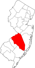
 Wrightstown highlighted in Burlington County. Inset map: Burlington County highlighted in the State of New Jersey. | |
 Census Bureau map of Wrightstown, New Jersey | |
| Coordinates: 40°02′03″N 74°37′21″W / 40.034128°N 74.622596°WCoordinates: 40°02′03″N 74°37′21″W / 40.034128°N 74.622596°W[1][2] | |
| Country |
|
| State |
|
| County | Burlington |
| Incorporated | March 26, 1918 |
| Government[3] | |
| • Type | Borough |
| • Body | Borough Council |
| • Mayor | Thomas E. Harper (R, term ends December 31, 2016)[4][5] |
| • Clerk | Freda Gorman[6][7] |
| Area[1] | |
| • Total | 1.768 sq mi (4.579 km2) |
| • Land | 1.768 sq mi (4.579 km2) |
| • Water | 0.000 sq mi (0.000 km2) 0.00% |
| Area rank |
425th of 566 in state 33rd of 40 in county[1] |
| Elevation[8] | 151 ft (46 m) |
| Population (2010 Census)[9][10][11] | |
| • Total | 802 |
| • Estimate (2015)[12] | 796 |
| • Rank |
545th of 566 in state 38th of 40 in county[13] |
| • Density | 453.6/sq mi (175.1/km2) |
| • Density rank |
449th of 566 in state 29th of 40 in county[13] |
| Time zone | Eastern (EST) (UTC-5) |
| • Summer (DST) | Eastern (EDT) (UTC-4) |
| ZIP code | 08562[14][15] |
| Area code(s) | 609 exchanges: 723, 724, 752, 758[16] |
| FIPS code | 3400582960[1][17][18] |
| GNIS feature ID | 0885453[1][19] |
| Website |
wrightstownborough |

Wrightstown is a borough in Burlington County, New Jersey, United States. As of the 2010 United States Census, the borough's population was 802[9][10][11] reflecting an increase of 54 (+7.2%) from the 748 counted in the 2000 Census, which had in turn declined by 3,095 (-80.5%) from the 3,843 counted in the 1990 Census.[20]
Wrightstown was incorporated as a borough by an act of the New Jersey Legislature on March 4, 1918, from portions of New Hanover Township and North Hanover Township, based on the results of a referendum held on March 26, 1918.[21] The borough was named for John Wright, an early settler who contributed the land that became the settlement of Wrightstown.[22][23]
Geography
According to the United States Census Bureau, Wrightstown had a total area of 1.768 square miles (4.579 km2), all of which was land.[1][2]
The borough borders New Hanover Township, North Hanover Township, Pemberton Township, Springfield Township, including McGuire AFB and Fort Dix entities of Joint Base McGuire-Dix-Lakehurst.[24]
The borough is one of 56 South Jersey municipalities that are included within the New Jersey Pinelands National Reserve, a protected natural area of unique ecology covering 1,100,000 acres (450,000 ha), that has been classified as a United States Biosphere Reserve and established by Congress in 1978 as the nation's first National Reserve.[25] Part of the borough is included in the state-designated Pinelands Area, which includes portions of Burlington County, along with areas in Atlantic, Camden, Cape May, Cumberland, Gloucester and Ocean counties.[26]
Demographics
| Historical population | |||
|---|---|---|---|
| Census | Pop. | %± | |
| 1920 | 270 | — | |
| 1930 | 176 | −34.8% | |
| 1940 | 241 | 36.9% | |
| 1950 | 1,199 | 397.5% | |
| 1960 | 4,846 | 304.2% | |
| 1970 | 2,719 | −43.9% | |
| 1980 | 3,031 | 11.5% | |
| 1990 | 3,843 | 26.8% | |
| 2000 | 746 | −80.6% | |
| 2010 | 802 | 7.5% | |
| Est. 2015 | 796 | [12][27] | −0.7% |
| Population sources: 1920-2000[28] 1920[29] 1920-1930[30] 1930-1990[31] 1960-2000[32] 2000[33][34] 2010[9][10][11] | |||
Jozsef A. Farago, a former mayor of Wrightstown, criticized the 2000 Census data that showed that the borough's population had dropped 80%, to 748 from 3,843 a decade earlier, noting that the 1990 population had been inflated and that the conversion of Fort Dix to a reserve base had caused a decrease but that the borough's master plan showed a population of 838.[35]
Census 2010
The 2010 United States Census counted 802 people, 309 households, and 189.1 families residing in the borough. The population density was 453.6 per square mile (175.1/km2). The borough contained 348 housing units at an average density of 196.8 per square mile (76.0/km2). The racial makeup of the borough was 47.38% (380) White, 21.07% (169) Black or African American, 0.75% (6) Native American, 5.99% (48) Asian, 0.37% (3) Pacific Islander, 18.70% (150) from other races, and 5.74% (46) from two or more races. Hispanics or Latinos of any race were 28.05% (225) of the population.[9]
Out of a total of 309 households, 34.3% had children under the age of 18 living with them, 28.8% were married couples living together, 21.7% had a female householder with no husband present, and 38.8% were non-families. 28.5% of all households were made up of individuals, and 5.2% had someone living alone who was 65 years of age or older. The average household size was 2.60 and the average family size was 3.17.[9]
In the borough, 26.9% of the population were under the age of 18, 14.1% from 18 to 24, 28.8% from 25 to 44, 22.3% from 45 to 64, and 7.9% who were 65 years of age or older. The median age was 29.9 years. For every 100 females the census counted 109.9 males, but for 100 females at least 18 years old, it was 110.8 males.[9]
The Census Bureau's 2006-2010 American Community Survey showed that (in 2010 inflation-adjusted dollars) median household income was $40,096 (with a margin of error of +/- $4,881) and the median family income was $38,438 (+/- $7,242). Males had a median income of $37,917 (+/- $22,280) versus $34,167 (+/- $13,020) for females. The per capita income for the borough was $24,231 (+/- $4,722). About 15.2% of families and 17.2% of the population were below the poverty line, including 31.6% of those under age 18 and 0.0% of those age 65 or over.[36]
Census 2000
As of the 2000 United States Census[17] there were 748 people, 312 households, and 181 families residing in the borough. The population density was 425.1 people per square mile (164.1/km2). There were 339 housing units at an average density of 192.7 per square mile (74.4/km2). The racial makeup of the borough was 49.87% White, 30.21% African American, 0.53% Native American, 7.22% Asian, 7.22% from other races, and 4.95% from two or more races. Hispanic or Latino of any race were 11.23% of the population.[33][34]
There were 312 households out of which 33.3% had children under the age of 18 living with them, 28.2% were married couples living together, 25.3% had a female householder with no husband present, and 41.7% were non-families. 34.6% of all households were made up of individuals and 7.4% had someone living alone who was 65 years of age or older. The average household size was 2.37 and the average family size was 3.09.[33][34]
In the borough the population was spread out with 29.7% under the age of 18, 10.2% from 18 to 24, 33.2% from 25 to 44, 18.4% from 45 to 64, and 8.6% who were 65 years of age or older. The median age was 31 years. For every 100 females there were 94.8 males. For every 100 females age 18 and over, there were 88.5 males.[33][34]
The median income for a household in the borough was $27,500, and the median income for a family was $29,375. Males had a median income of $28,889 versus $25,417 for females. The per capita income for the borough was $14,489. About 22.8% of families and 24.0% of the population were below the poverty line, including 31.8% of those under age 18 and 22.4% of those age 65 or over.[33][34]
Government
Local government
Wrightstown is governed under the Borough form of New Jersey municipal government. The governing body consists of a Mayor and a Borough Council comprising six council members, with all positions elected at-large on a partisan basis as part of the November general election. A Mayor is elected directly by the voters to a four-year term of office. The Borough Council consists of six members elected to serve three-year terms on a staggered basis, with two seats coming up for election each year in a three-year cycle.[3] The Borough form of government used by Wrightstown, the most common system used in the state, is a "weak mayor / strong council" government in which council members act as the legislative body with the mayor presiding at meetings and voting only in the event of a tie. The mayor can veto ordinances subject to an override by a two-thirds majority vote of the council. The mayor makes committee and liaison assignments for council members, and most appointments are made by the mayor with the advice and consent of the council.[37][38]
As of 2016, the Mayor of Wrightstown is Republican Thomas E. Harper, whose term of office ends December 31, 2016. Members of the Wrightstown Borough Council are Council President Costic Michael "Mike" Borsavage (R, 2016), William L. Bird, Jr. (R, 2017), Samuel A. Grove, Jr. (D, 2018), Jeanie L. Knapp (R, 2016), Laurance R. Lownds (D, 2018) and David Scott Timberman (R, 2017).[4][7][39][40][41][42][43][44]
In July 2012, following the death of Brian Sperling in the previous month, the Borough Council selected William Bird to fill Sperling's vacancy on the council and picked Costic Michael Borsavage to take over his role as council president.[45]
Jennifer Heisler, a councilmember who resigned in October 2010, was sentenced in November 2011 to five years of probation after pleading guilty to the theft of $20,000 from Wrightstown Volunteer Fire Company, of which she had been the treasurer.[46]
Federal, state and county representation
Wrightstown is located in the 3rd Congressional District[47] and is part of New Jersey's 12th state legislative district.[10][48][49] Prior to the 2011 reapportionment following the 2010 Census, Wrightstown had been in the 8th state legislative district.[50]
New Jersey's 3rd Congressional District is represented by Tom MacArthur (R, Toms River).[51] New Jersey is represented in the United States Senate by Cory Booker (D, Newark, term ends 2021)[52] and Bob Menendez (D, Paramus, 2019).[53][54]
For the 2016–2017 session (Senate, General Assembly), the 12th Legislative District of the New Jersey Legislature is represented in the State Senate by Samuel D. Thompson (R, Old Bridge Township) and in the General Assembly by Robert D. Clifton (R, Matawan) and Ronald S. Dancer (R, Plumsted Township).[55] The Governor of New Jersey is Chris Christie (R, Mendham Township).[56] The Lieutenant Governor of New Jersey is Kim Guadagno (R, Monmouth Beach).[57]
Burlington County is governed by a Board of chosen freeholders, whose five members are elected at-large in partisan elections to three-year terms of office on a staggered basis, with either one or two seats coming up for election each year.[58] The board chooses a director and deputy director from among its members at an annual reorganization meeting held in January.[58] As of 2015, Burlington County's Freeholders are Director Mary Ann O'Brien (R, Medford Township, 2017; Director of Administration and Human Services),[59] Deputy Director Bruce Garganio (R, Florence Township, 2017; Director of Public Works and Health),[60] Aimee Belgard (D, Edgewater Park Township, 2015; Director of Hospital, Medical Services and Education)[61] Joseph Donnelly (R, Cinnaminson Township, 2016; Director of Public Safety, Natural Resources, and Education)[62] and Joanne Schwartz (D, Southampton Township, 2015; Director of Health and Corrections).[63][58] Constitutional officers are County Clerk Tim Tyler,[64] Sheriff Jean E. Stanfield[65] and Surrogate George T. Kotch.[66]
Politics
As of March 23, 2011, there were a total of 293 registered voters in Wrightstown, of which 75 (25.6% vs. 33.3% countywide) were registered as Democrats, 98 (33.4% vs. 23.9%) were registered as Republicans and 120 (41.0% vs. 42.8%) were registered as Unaffiliated. There were no voters registered to other parties.[67] Among the borough's 2010 Census population, 36.5% (vs. 61.7% in Burlington County) were registered to vote, including 50.0% of those ages 18 and over (vs. 80.3% countywide).[67][68]
In the 2012 presidential election, Democrat Barack Obama received 143 votes (63.6% vs. 58.1% countywide), ahead of Republican Mitt Romney with 76 votes (33.8% vs. 40.2%) and other candidates with 3 votes (1.3% vs. 1.0%), among the 225 ballots cast by the borough's 337 registered voters, for a turnout of 66.8% (vs. 74.5% in Burlington County).[69][70] In the 2008 presidential election, Democrat Barack Obama received 118 votes (54.6% vs. 58.4% countywide), ahead of Republican John McCain with 92 votes (42.6% vs. 39.9%) and other candidates with 3 votes (1.4% vs. 1.0%), among the 216 ballots cast by the borough's 320 registered voters, for a turnout of 67.5% (vs. 80.0% in Burlington County).[71] In the 2004 presidential election, Democrat John Kerry received 99 votes (49.5% vs. 52.9% countywide), ahead of Republican George W. Bush with 93 votes (46.5% vs. 46.0%) and other candidates with 3 votes (1.5% vs. 0.8%), among the 200 ballots cast by the borough's 306 registered voters, for a turnout of 65.4% (vs. 78.8% in the whole county).[72]
In the 2013 gubernatorial election, Republican Chris Christie received 63 votes (62.4% vs. 61.4% countywide), ahead of Democrat Barbara Buono with 35 votes (34.7% vs. 35.8%) and other candidates with 1 votes (1.0% vs. 1.2%), among the 101 ballots cast by the borough's 312 registered voters, yielding a 32.4% turnout (vs. 44.5% in the county).[73][74] In the 2009 gubernatorial election, Republican Chris Christie received 62 votes (50.4% vs. 47.7% countywide), ahead of Democrat Jon Corzine with 47 votes (38.2% vs. 44.5%), Independent Chris Daggett with 3 votes (2.4% vs. 4.8%) and other candidates with 4 votes (3.3% vs. 1.2%), among the 123 ballots cast by the borough's 322 registered voters, yielding a 38.2% turnout (vs. 44.9% in the county).[75]
Education
Students in public school for grades pre-Kindergarten through eighth grade attend the New Hanover Township School District, which serves students from both New Hanover Township and Wrightstown. As of the 2013-14 school year, the district's one school had an enrollment of 194 students and 21.3 classroom teachers (on an FTE basis), for a student–teacher ratio of 9.1:1.[76]
For ninth through twelfth grades, public school students from both New Hanover Township and Wrightstown Borough attend Bordentown Regional High School as part of a sending/receiving relationship.[77] The high school is part of the Bordentown Regional School District, a regional K–12 school district that serves students from Bordentown City, Bordentown Township and Fieldsboro Borough.[78][79][80]
Students from Wrightstown, and from all of Burlington County, are eligible to attend the Burlington County Institute of Technology, a countywide public school district that serves the vocational and technical education needs of students at the high school and post-secondary level at its campuses in Medford Township and Westampton Township.[81]
Transportation
Roads and highways
As of May 2010, the borough had a total of 4.35 miles (7.00 km) of roadways, of which 2.70 miles (4.35 km) were maintained by the municipality, 1.18 miles (1.90 km) by Burlington County and 0.47 miles (0.76 km) by the New Jersey Department of Transportation.[82]
Public transportation
New Jersey Transit provides bus service in the township on the 317 route between Asbury Park and Philadelphia.[83][84]
News coverage
Wrightstown and neighboring Cookstown were put in the national spotlight when six Islamic militants, dubbed "The Fort Dix Six", were arrested while trying to carry out an attack against Fort Dix on May 7, 2007. Heightened security around the bases affected the local economy based heavily in restaurants specializing in delivery to the base.
Notable people
People who were born in, residents of, or otherwise closely associated with Wrightstown include:
- Daniel V. Asay (1847–1930), iceboat racer.[85]
- Samuel G. Wright (1781–1845), represented New Jersey's 2nd congressional district in 1845.[86]
References
- 1 2 3 4 5 6 2010 Census Gazetteer Files: New Jersey County Subdivisions, United States Census Bureau. Accessed May 21, 2015.
- 1 2 US Gazetteer files: 2010, 2000, and 1990, United States Census Bureau. Accessed September 4, 2014.
- 1 2 2012 New Jersey Legislative District Data Book, Rutgers University Edward J. Bloustein School of Planning and Public Policy, March 2013, p. 43.
- 1 2 Mayor & Council, Wrightstown, New Jersey. Accessed June 23, 2016.
- ↑ 2016 New Jersey Mayors Directory, New Jersey Department of Community Affairs. Accessed June 14, 2016. As of date accessed, Harper is listed with an incorrect term-end year of 2018.
- ↑ Clerk's Office, Wrightstown, New Jersey. Accessed June 23, 2016.
- 1 2 Staff. "Wrightstown", Burlington County Times, April 26, 2015. Accessed June 23, 2016.
- ↑ U.S. Geological Survey Geographic Names Information System: Borough of Wrightstown, Geographic Names Information System. Accessed March 14, 2013.
- 1 2 3 4 5 6 DP-1 - Profile of General Population and Housing Characteristics: 2010 for Wrightstown borough, Burlington County, New Jersey, United States Census Bureau. Accessed September 3, 2012.
- 1 2 3 4 Municipalities Grouped by 2011-2020 Legislative Districts, New Jersey Department of State, p. 7. Accessed January 6, 2013.
- 1 2 3 Profile of General Demographic Characteristics: 2010 for Wrightstown borough, New Jersey Department of Labor and Workforce Development. Accessed September 3, 2012.
- 1 2 PEPANNRES - Annual Estimates of the Resident Population: April 1, 2010 to July 1, 2015 - 2015 Population Estimates for New Jersey municipalities, United States Census Bureau. Accessed May 22, 2016.
- 1 2 GCT-PH1 Population, Housing Units, Area, and Density: 2010 - State -- County Subdivision from the 2010 Census Summary File 1 for New Jersey, United States Census Bureau. Accessed August 12, 2013.
- ↑ Look Up a ZIP Code for Wrightstown, NJ, United States Postal Service. Accessed September 3, 2012.
- ↑ Zip Codes, State of New Jersey. Accessed September 1, 2013.
- ↑ Area Code Lookup - NPA NXX for Wrightstown, NJ, Area-Codes.com. Accessed September 1, 2013.
- 1 2 American FactFinder, United States Census Bureau. Accessed September 4, 2014.
- ↑ A Cure for the Common Codes: New Jersey, Missouri Census Data Center. Accessed September 3, 2012.
- ↑ US Board on Geographic Names, United States Geological Survey. Accessed September 4, 2014.
- ↑ Table 7. Population for the Counties and Municipalities in New Jersey: 1990, 2000 and 2010, New Jersey Department of Labor and Workforce Development, February 2011. Accessed September 3, 2012.
- ↑ Snyder, John P. The Story of New Jersey's Civil Boundaries: 1606-1968, Bureau of Geology and Topography; Trenton, New Jersey; 1969. p. 100. Accessed September 3, 2012.
- ↑ Hutchinson, Viola L. The Origin of New Jersey Place Names, New Jersey Public Library Commission, May 1945. Accessed November 8, 2015.
- ↑ Comegno, Carol. "Wrightstown: Town linked to bases", Courier-Post, October 19, 2006. Accessed November 8, 2015. "1732 to 1742: John Wright, an early settler, buys a large tract of land to farm. He donates land to establish a town and it later takes his name."
- ↑ Areas touching Wrightstown, MapIt. Accessed December 29, 2014.
- ↑ The Pinelands National Reserve, New Jersey Pinelands Commission. Accessed December 1, 2013.
- ↑ Pinelands Municipalities, New Jersey Pinelands Commission, April 2003. Accessed December 1, 2013.
- ↑ Census Estimates for New Jersey April 1, 2010 to July 1, 2015, United States Census Bureau. Accessed May 22, 2016.
- ↑ Barnett, Bob. Population Data for Burlington County Municipalities, 1800 - 2000, WestJersey.org, January 6, 2011. Accessed September 3, 2012.
- ↑ Compendium of censuses 1726-1905: together with the tabulated returns of 1905, New Jersey Department of State, 1906. Accessed September 1, 2013.
- ↑ Fifteenth Census of the United States : 1930 - Population Volume I, United States Census Bureau, p. 715. Accessed September 3, 2012.
- ↑ Table 6. New Jersey Resident Population by Municipality: 1930 - 1990, New Jersey Department of Labor and Workforce Development. Accessed September 3, 2012.
- ↑ Burlington County Data Book, 2010 Edition, , Burlington County Department of Economic Development and Regional Planning. Accessed June 28, 2015.
- 1 2 3 4 5 Census 2000 Profiles of Demographic / Social / Economic / Housing Characteristics for Wrightstown borough, New Jersey, United States Census Bureau. Accessed September 3, 2012.
- 1 2 3 4 5 DP-1: Profile of General Demographic Characteristics: 2000 - Census 2000 Summary File 1 (SF 1) 100-Percent Data for Wrightstown borough, Burlington County, New Jersey, United States Census Bureau. Accessed September 3, 2012.
- ↑ Avril, Tom; and Fleming, leonard N. "Camden Feeds Towns' Diversity The Census Shows Minorities Leaving For The Inner Suburbs.", The Philadelphia Inquirer, March 12, 2001. Accessed December 2, 2013. "Former Mayor Jozsef A. Farago said Wrightstown's population couldn't possibly have dropped from 3,843 in 1990 to 748 in 2000, as the census reported. He said census officials had overestimated the Burlington County borough's population in 1990.... The borough, which borders Fort Dix, did lose some people early in the decade when the base converted to a reservist facility, Farago said."
- ↑ DP03: Selected Economic Characteristics from the 2006-2010 American Community Survey 5-Year Estimates for Wrightstown borough, Burlington County, New Jersey, United States Census Bureau. Accessed September 3, 2012.
- ↑ Cerra, Michael F. "Forms of Government: Everything You've Always Wanted to Know, But Were Afraid to Ask", New Jersey State League of Municipalities. Accessed November 30, 2014.
- ↑ "Forms of Municipal Government in New Jersey", p. 6. Rutgers University Center for Government Studies. Accessed June 3, 2015.
- ↑ 2015 Municipal User Friendly Budget, Wrightstown, New Jersey. Accessed June 23, 2016.
- ↑ A Guide to Burlington County - 2015, Burlington County, New Jersey. Accessed June 20, 2016.
- ↑ November 3, 2015 Summary Report Burlington County Official Results / Recounts Appended, Burlington County, New Jersey, November 25, 2015. Accessed June 20, 2016.
- ↑ November 4, 2014 Summary Report Burlington County Official Recounted Results, Burlington County, New Jersey, December 22, 2014. Accessed March 14, 2015.
- ↑ November 5, 2013 Summary Report Burlington County Amended Official Results, Burlington County, New Jersey. Accessed October 30, 2013.
- ↑ November 6, 2012 Summary Report Burlington County Amended Official Results, Burlington County, New Jersey. Accessed December 2, 2013.
- ↑ Zimmaro, Mark. 'Wrightstown council fills vacancies", Burlington County Times, July 13, 2012. Accessed December 2, 2013. "The Borough Council filled a vacant seat and appointed a new president after the recent death of Brian Sperling.Sperling, who was council president at the time of his death, was one of the longest-serving elected officials in Burlington County history.... On Wednesday, the five remaining council members unanimously appointed William Bird to fill Sperling's seat.... Costic Michael Borsavage was sworn in as council president Wednesday night after a unanimous vote."
- ↑ Camilli, Danielle. "Former Wrightstown councilwoman sentenced for theft from fire company", Burlington County Times, November 20, 2011. Accessed December 2, 2013. "A former Wrightstown councilwoman was ordered to serve five years on probation and pay more than $20,000 in restitution for stealing money from the borough's volunteer fire company.... Heisler, formerly Jennifer Schwager, served on the Borough Council from January 2006 until her resignation in October 2010. Council members at the time said she left office after giving birth and no longer had time to devote to the community."
- ↑ Plan Components Report, New Jersey Redistricting Commission, December 23, 2011. Accessed January 6, 2013.
- ↑ 2016 New Jersey Citizen's Guide to Government, p. 66, New Jersey League of Women Voters. Accessed July 20, 2016.
- ↑ Districts by Number for 2011-2020, New Jersey Legislature. Accessed January 6, 2013.
- ↑ 2011 New Jersey Citizen's Guide to Government, p. 66, New Jersey League of Women Voters. Accessed May 22, 2015.
- ↑ Tom MacArthur Biography, United States House of Representatives. Accessed January 7, 2015.
- ↑ About Cory Booker, United States Senate. Accessed January 26, 2015. "He now owns a home and lives in Newark's Central Ward community."
- ↑ Biography of Bob Menendez, United States Senate, January 26, 2015. "He currently lives in Paramus and has two children, Alicia and Robert."
- ↑ Senators of the 114th Congress from New Jersey. United States Senate. Accessed January 26, 2015. "Booker, Cory A. - (D - NJ) Class II; Menendez, Robert - (D - NJ) Class I"
- ↑ Legislative Roster 2016-2017 Session, New Jersey Legislature. Accessed January 17, 2016.
- ↑ "About the Governor". State of New Jersey. Retrieved 2010-01-21.
- ↑ "About the Lieutenant Governor". State of New Jersey. Retrieved 2010-01-21.
- 1 2 3 Staff. Board of Chosen Freeholders, Burlington County, New Jersey. Accessed May 12, 2015.
- ↑ Mary Ann O'Brien, Burlington County, New Jersey. Accessed May 12, 2015.
- ↑ Bruce Garganio, Burlington County, New Jersey. Accessed May 12, 2015.
- ↑ Aimee Belgard, Burlington County, New Jersey. Accessed August 4, 2014.
- ↑ Joseph B. Donnelly, Burlington County, New Jersey. Accessed May 12, 2015.
- ↑ Joanne Schwartz, Burlington County, New Jersey. Accessed May 12, 2015.
- ↑ County Clerk, Burlington County. Accessed May 12, 2015.
- ↑ Sheriff's Department, Burlington County. Accessed May 12, 2015.
- ↑ Surrogate, Burlington County. Accessed May 12, 2015.
- 1 2 Voter Registration Summary - Burlington, New Jersey Department of State Division of Elections, March 23, 2011. Accessed December 29, 2014.
- ↑ GCT-P7: Selected Age Groups: 2010 - State -- County Subdivision; 2010 Census Summary File 1 for New Jersey, United States Census Bureau. Accessed December 29, 2014.
- ↑ Presidential November 6, 2012 General Election Results - Burlington County, New Jersey Department of State Division of Elections, March 15, 2013. Accessed December 29, 2014.
- ↑ Number of Registered Voters and Ballots Cast November 6, 2012 General Election Results - Burlington County, New Jersey Department of State Division of Elections, March 15, 2013. Accessed December 29, 2014.
- ↑ 2008 Presidential General Election Results: Burlington County, New Jersey Department of State Division of Elections, December 23, 2008. Accessed December 29, 2014.
- ↑ 2004 Presidential Election: Burlington County, New Jersey Department of State Division of Elections, December 13, 2004. Accessed December 29, 2014.
- ↑ 2013 Governor: Burlington County, New Jersey Department of State Division of Elections, January 29, 2014. Accessed December 29, 2014.
- ↑ Number of Registered Voters and Ballots Cast November 5, 2013 General Election Results : Burlington County, New Jersey Department of State Division of Elections, January 29, 2014. Accessed December 29, 2014.
- ↑ 2009 Governor: Burlington County, New Jersey Department of State Division of Elections, December 31, 2009. Accessed December 29, 2014.
- ↑ District information for New Hanover Township School District, National Center for Education Statistics. Accessed June 2, 2016.
- ↑ Zimmaro, Mark. "New Hanover School to decide on middle school proposal", Burlington County Times, March 11, 2011. Accessed August 20, 2011. "The township's school district will decide on Wednesday whether to enter an agreement with the Bordentown Regional School District for a send-receive agreement for middle school children. The district which serves New Hanover and Wrightstown, already sends its high school students to Bordentown Regional High School and district officials are trying to determine whether sending sixth-, seventh- and eighth-graders to Bordentown Regional Middle School would be a feasible idea."
- ↑ Bordentown Regional School District 2015 Report Card Narrative, New Jersey Department of Education. Accessed June 2, 2016. "Bordentown Regional School District is a vibrant learning community, proudly serving the communities of Fieldsboro, Bordentown City and Bordentown Township.... In addition to the three aforementioned communities, Bordentown Regional High School also welcomes students from New Hanover into its ninth-twelfth grade population."
- ↑ Staff. "Regional School Districts", Burlington County Times, April 26, 2015. Accessed June 2, 2016. "BORDENTOWN REGIONAL - Serves: Bordentown City, Bordentown Township, Fieldsboro, New Hanover"
- ↑ High School Sending Districts, Burlington County Library System, backed up by the Internet Archive as of September 27, 2006. Accessed December 2, 2013.
- ↑ Why Choose BCIT?, Burlington County Institute of Technology. Accessed December 2, 2013.
- ↑ Burlington County Mileage by Municipality and Jurisdiction, New Jersey Department of Transportation, May 2010. Accessed December 2, 2013.
- ↑ Burlington County Bus/Rail Connections, New Jersey Transit, backed up by the Internet Archive as of January 28, 2010. Accessed December 2, 2013.
- ↑ South Jersey Transit Guide, Cross County Connection, as of April 1, 2010. Accessed December 2, 2013.
- ↑ Staff. "Death of Daniel Asay. Mr. Asay Was in His 83d Year and He Had Lived at Red Bank Nearly All His Life. Death Was Due to a General Breakdown", Red Bank Register, May 7, 1930. Accessed December 2, 2013. "Mr. Asay was born at Wrightstown, a son of the late Edward P. and Hannah Van Note Asay."
- ↑ Samuel Gardiner Wright, Biographical Directory of the United States Congress. Accessed June 22, 2008.
External links
-
 Media related to Wrightstown, New Jersey at Wikimedia Commons
 - Wrightstown Borough website
- New Hanover Township Public Schools
- New Hanover Township School District's 2014–15 School Report Card from the New Jersey Department of Education
- School Data for the New Hanover Township School, National Center for Education Statistics
- Bordentown Regional High School