Beaverville, New Jersey
| Beaverville, New Jersey | |
|---|---|
| Unincorporated community | |
 | |
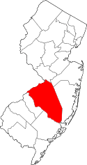
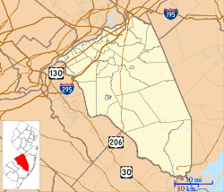 Beaverville  Beaverville  Beaverville Location of Beaverville in Burlington County (Inset: Location of county within the state of New Jersey) | |
| Coordinates: 39°54′06″N 74°44′31″W / 39.90167°N 74.74194°WCoordinates: 39°54′06″N 74°44′31″W / 39.90167°N 74.74194°W | |
| Country |
|
| State |
|
| County | Burlington |
| Township | Southampton |
| Elevation[1] | 46 ft (14 m) |
| Time zone | Eastern (EST) (UTC-5) |
| • Summer (DST) | EDT (UTC-4) |
| GNIS feature ID | 874628[1] |
Beaverville is an unincorporated community located within Southampton Township in Burlington County, New Jersey, United States.[2] The area is composed of single-family homes, small businesses and warehouses, forest, and farmland. The community is located along Red Lion Road (County Route 641) two miles (3.2 km) south of Vincentown, to the west of U.S. Route 206, and southeast of the Red Lion Airport.[3] Originally, the settlement was the site of a one-room schoolhouse.[4]
References
- 1 2 "Beaverville". Geographic Names Information System. United States Geological Survey.
- ↑ Locality Search, State of New Jersey. Accessed March 13, 2015.
- ↑ Google (September 20, 2015). "Aerial view of Beaverville" (Map). Google Maps. Google. Retrieved September 20, 2015.
- ↑ Shaw, W.H. (1885). "Southampton Township: Villages & Hamlets - Red Lion, Beaveville, & Retreat". History of Burlington and Mercer Counties, New Jersey. Woodward and Hageman. The Preservation Commission of Historic Southampton. Retrieved September 20, 2015.
This article is issued from Wikipedia - version of the 6/8/2016. The text is available under the Creative Commons Attribution/Share Alike but additional terms may apply for the media files.