Politics of Houston
Founded in 1836 and incorporated in 1837, Houston, Texas, United States is one of the fastest growing major cities in the United States and the largest without zoning laws. The city is the county seat of Harris County. A portion of southwest Houston extends into Fort Bend County and a small portion in the northeast extends into Montgomery County.
The city of Houston has a strong mayor–council government. The City's elected officials, serving four-year terms,[1] are: the mayor, the city comptroller and 16 members of the city council. Under the strong mayor-council government, the mayor serves as the executive officer of the city. As the city's chief administrator and official representative, the mayor is responsible for the general management of the city and for seeing that all laws and ordinances are enforced.

As the result of a 1991 referendum in Houston, the two-year term was amended to elected officials who can serve up to three terms until 2015 where the three term limit and two year terms were replaced with a two four-year terms - a mayor is elected for a four-year term (previously the mayor, controller, and councilmembers are elected to a two-year term prior to the November 3, 2015 city elections), and can be elected to as many as two consecutive terms. City council members, who also have a three-term limit, are elected from eleven districts in the city, along with five at-large council members, who represent the entire city. Term limits with the City of Houston are absolute - past elected officeholders are prohibited from campaigning for their former council positions (which includes the Mayor and City Controller). The current Mayor of Houston is Sylvester Turner.
The city council lineup was based on a U.S. Justice Department mandate which took effect in 1979. Under the current city charter, when the population in the Houston city limits passed 2.2 million residents, the nine-member city council districts expanded to include two more city council districts.[2] The municipal elections held on November 8, 2011 included the newly formed Districts J (located in the Greater Sharpstown area) and K (a section of Southwest Houston, Reliant Park, and Fort Bend County located within the Houston City Limits) where 2 candidates won over 50% of the vote. Houston is a home rule city and all municipal elections in the state of Texas are nonpartisan.
Many local lawmakers have been impacted by the city's term limits. Several former city officials—Anthony Hall, Rodney Ellis, Sheila Jackson-Lee, Sylvia Garcia, Martha Wong, Chris Bell, Annise Parker, Shelley Sekula-Gibbs, Adrian Garcia, Ed Gonzalez, and Mike Sullivan—, chose to run for other elected positions once their terms expired or shortly before they were due to expire.

Former mayor Lee P. Brown denounced the term limits, saying they prevented incumbents from gaining enough experience in city government. A proposal to double the current two-year term of office has been debated—as of 2005, several candidates for the city council have brought up the issue of whether term limits should be amended or eliminated. Some elected officials from the Greater Houston area within the Texas Legislature—primarily Garnet Coleman and Sylvester Turner—have also spoken out against term limits. In 2010, a term limits review commission appointed by former Mayor Bill White called for amending the city charter on extending term limits where elected officials could serve two four-year terms; the proposal failed 8.18.10 after the Houston City Council voted 7-7. The November 3, 2015 City of Houston municipal elections a referendum on the voter ballot have amended the term limit law where elected officials can serve two four year terms - this measure does not abolish term limits nor have a reeligibility provision for past elected officeholders who served their full tenure under the 1991 term limit ordinance. Incumbents who have won re-election during the 2015 election under the three-term rule - those who served 2 are granted an additional 4 years while a freshman councilmember are granted their 2 additional terms - this means that some elected officials can hold up to 10 years in office (if a freshman councilmember who served during their 2014-16 term) or 8 years in office (for those elected in 2011 and re-elected to their final term).
Houston is considered to be a politically divided city whose balance of power often sways between Republicans and Democrats. The affluent western-central portions of Houston—such as River Oaks and the Memorial/Spring Branch area, as well as master planned communities of Kingwood and Clear Lake City—consistently vote Republican, while many of the inner city areas, Neartown, and Alief—are heavily Democratic. According to the 2005 Houston Area Survey, 68 percent of non-Hispanic whites in Harris County are declared or favor Republicans while 89 percent of non-Hispanic blacks in the area are declared or favor Democrats. About 62 percent Hispanics (of any race) in the area are declared or favor Democrats.[3]
History
In 1912 the Government of Texas passed an amendment to the Texas Constitution that allowed the annexation of unincorporated areas. Since then the City of Houston annexed various properties.[4]
Municipal government
Elected officials
| Position | Name | First Elected | Areas Represented | |
|---|---|---|---|---|
| Mayor | Sylvester Turner | 2016 | City-wide | |
| City Controller | Chris B. Brown | 2016 | City-wide | |
| At-Large Position 1 | Stephen Costello | 2009 | City-wide | |
| At-Large Position 2 | David W. Robinson | 2013 | City-wide | |
| At-Large Position 3 | Michael Kubosh | 2007 | City-wide | |
| At-Large Position 4 | Clarence Bradford | 2009 | City-wide | |
| At-Large Position 5 | Jack Christie | 2011 | City-wide | |
| District A | Brenda Stardig | 2014 | District A serves areas in northwestern Houston.[5] District A includes communities north of Interstate 10 (Katy Freeway),[6] including Spring Branch.[7] As of 2012 thousands of South Korean people live within District A.[8]
As of 2012, according to Rice University political scientist Bob Stein, voters in District A tend to be older people, conservative, and White American, and many follow the Tea Party movement. The voting base is such despite the presence of large Hispanic neighborhoods within District A. In the 2011 election voters favored Tea Party candidate Helena Brown over the incumbent, Brenda Stardig, because Stardig supported a "rain tax," passed in 2010, that taxed churches.[9] | |
| District B | Jerry Davis | 2011 | District B serves areas in northern Houston and northeast Houston.[5][10] Chris Moran of the Houston Chronicle said that the district "is considered an African-American stronghold."[5] Most residents belong to racial and ethnic minorities.[10]
Areas within the district boundaries include Acres Homes, the Fifth Ward,[11][12] and George Bush Intercontinental Airport.[5] The Houston Chronicle said that District B's constituency "has been shortchanged historically on municipal services and economic development."[10] A lot of illegal dumping occurs within the district. The newspaper added that the district has "a resilient community spirit."[10] Kristen Mack of the Houston Chronicle said in 2005 that the district, prior to the 2011 redistricting, "is plagued by unkempt lots, clogged ditches and substandard streets."[12] In 1987 District B included Clinton Park, the Fifth Ward, Fontane Place, Kashmere Gardens, Scenic Woods, Settegast, Songwood, and Trinity Gardens. It also included the Lake Houston and the Bush Airport areas. In 1987 the district was 69% African American.[13] | |
| District C | Ellen Cohen | 2011 | District C extends from an area north of the 610 Loop, through the Houston Heights area, up to the Braeswood area.[14] The current District C includes most of the Houston Heights,[15][16] Montrose, the Houston Museum District,[15][17] and some communities around Rice University.[5] District C also includes the Braeswood area, Meyerland, Southampton,[18] almost all of Oak Forest.[15][18][19]
Because of the inclusion of the Montrose, Heights, and Rice University areas, it has the nickname "Hipstrict" for what Chris Moran of the Houston Chronicle refers to as its "progressive, urban ethic."[5] The Houston Chronicle editorial base described District C as a district that should be "politically dynamic."[20] Historically District C has covered areas within the "Inner Loop" (areas inside the 610 Loop) and western Houston.[21] 20 years before 2011, Montrose was moved from District C to district D to avoid putting too many minorities in a single city council district.[22] Kristen Mack of the Houston Chronicle said that District C, which "covers a diverse swath of southwest Houston", was "One of Houston's most economically diverse districts, it ranges from leafy Southampton near Rice University through more modest subdivisions and vast apartment warrens in the city's far southwest."[23] Jerry Wood, a former city planner and neighborhood expert, said that all of the regions of District C were active in terms of politics.[23] In the 1990s District C had a wedge shape. It extended from the Museum District to the Beltway 8 south side. It included Fondren Southwest, Meyerland, and Southampton.[24] As 2011 city council redistricting approached, some members of Houston's gay community and some Houston area bloggers proposed returning Montrose to District C.[22] Around 2011 an earlier plan would have combined the Heights and Montrose under a district called District J.[25] The current District C has former turf once located in District H (West End (Washington Avenue), Houston Heights, Historic Sixth Ward) while retaining the Meyerland area (the rest of District C southwest of Meyerland became part of District K). | |
| District D | Dwight Boykins | 2014 | District D extends from the northernmost area within Midtown southward to Beltway 8.[5] District D includes Sunnyside,[26][27] and it also includes the Third Ward.[26][28]
20 years before 2011, Montrose was moved from District C to district D to avoid putting too many minorities in a single city council district.[22] While Montrose was in District D, it was not able to have its own residents elected to city council where its residents usually campaigned for candidates who were GLBT friendly and/or involved with pro-HIV/AIDS awareness. Instead the district was forced to try to influence electoral contests involving candidates from other neighborhoods. In the 2011 redistricting Montrose was moved into District C.[20] | |
| District E | Dave Martin | 2012 | District E mainly consists of Kingwood and the Houston portion of Clear Lake City.[28] The City of Houston has a liaison who works with the District E representative and the residents of Kingwood. In 2006 some Kingwood residents told the Houston Chronicle that the District E representative has too little influence in city council, which had 15 seats during that year, and that the district is, in the words of Renée C. Lee of the Chronicle, territorially "spread too thin."[4] | |
| District F | Richard Nguyen | 2014 | District F serves areas in southwestern Houston.[5] District F has a significant Vietnamese American community.[29] District F includes much of the Alief, area other areas in Southwest Houston, Briarmeadow and Tanglewilde.[6]
In 1985 District F included far Southwest Houston. It included Alief, Braeburn, Braeburn Valley West, Glenshire, Gulfton, Robindell, and Sharpstown. In 1985 the district was 83% white.[30] In 2011 Briarmeadow and Tanglewilde, areas south of Westheimer Road which were previously in District G, were moved to District F, while the Bellaire Boulevard areas and Sharpstown were moved out of District F.[6] | |
| District G | Oliver Pennington | 2009 | District G serves areas in western Houston.[5] District G extends from an area inside the 610 Loop, between Interstate 10 (Katy Freeway) and Westheimer Road, westward to an area past Eldridge Road.[6] Neighborhoods in District G include the Memorial area, River Oaks and Tanglewood.[31]
Briarmeadow and Tanglewilde, two communities south of Westheimer Road, were previously in district G until 2011, when redistricting moved them into District F.[6] In 1987 District G was the wealthiest city council district in Houston. It was about 90% white. It served River Oaks and most of Memorial, two very wealthy communities, and it also served Afton Oaks, the Ashford Area, Briargrove, Briarmeadow, Carvercrest, Greenway Plaza, the Uptown area, Lamar Terrace, Park Hollow Place, Shadow Oaks, Tanglewood, and Westpark Village. In 1987 Kim Cobb said that while it includes wealthy areas, District G "also includes neighborhoods suffering from a shortage of city services because of west Houston's breakneck growth during the boom years."[32] During that year, Chris Chandler, a political candidate for District G, said, as paraphrased by Cobb, that Lamar Terrace was the "most troubled sector" of District G "and could stand a thorough cleanup by the Solid Waste Management Department."[32] | |
| District H | Ed Gonzalez | 2009 | District H includes some areas north of the 610 Loop.[5] Areas within the district include the Near Northside,[33][34] areas in the Northside region extending to Little York Road,[34][35] and some areas east of Downtown Houston.[33][34] The district also includes a portion of the Houston Heights.[5][16][34]
Before the 2011 redistricting, District H included all of the Houston Heights. At the time District H was mostly Hispanic, but because of the inclusion of the Houston Heights, it was becoming increasingly non-Hispanic White.[22] | |
| District I | Robert Gallegos | 2014 | District I includes neighborhoods in southeastern Houston,[5] including several East End communities.[28][36] It also includes most of Downtown Houston.[5][36] | |
| District J | Mike Laster | 2011 | District J includes several neighborhoods along U.S. Route 59 (Southwest Freeway), outside of the 610 Loop. District J includes Gulfton and Sharpstown.[20] The district stretches from the 610 Loop to an area south of Beltway 8.[37] District J includes territory previously in districts C and F.[38]
District J was formed as a district to allow Hispanic and Latino Americans to more easily elect representatives catering to them; as of 2010 Hispanic and Latino people have 44% of Houston's population, but two of the eleven city council members were Hispanic or Latino.[37] During the 2011 redistricting, Hispanic and Latino leaders asked Annise Parker, Mayor of Houston, to revise her proposed redistricting plan of city council areas. Instead of creating a new city council district to serve White communities within the 610 Loop, as the earlier plan had proposed, the revised plan called for making a mostly Hispanic district.[20] Robert Jara, a political consultant of the group Campaign Strategies, drew the boundaries of District J in order to ensure that Gulfton and Sharpstown were together in one area. That way, the Hispanic residents could lobby for influence with their city council representative, whether he or she is of Hispanic origin or not.[20] As of 2011, 63.1% of residents are Hispanic and Latino.[20] Significant numbers of White, Black, and Asian people live in the district. As of the same year, 17% of registered voters had family names of Spanish/Hispanic origin.[37] Many people living in the district are not U.S. citizens.[20] Jason Moran of the Houston Chronicle said that the area has been referred to as a "Hispanic opportunity district."[5] In a May 2011 editorial the Houston Chronicle editors said that they support the redistricting plan since they believed that Hispanics need more representation, but they added that the election of a Hispanic to fill the position is not guaranteed because many of the residents are not U.S. citizens and are ineligible to vote. As an example, the editors pointed to the Texas State Legislature's establishment of the 29th congressional district so that a Hispanic/Latino could be elected as a member of the United States Congress. Gene Green, a non-Hispanic White, won the first election for the district in 1992. As of 2011 he is still the incumbent in the area.[20] | |
| District K | Larry Green | 2011 | District K is in far southwestern Houston.[20] The editors of the Houston Chronicle said that it is "roughly at 7 o'clock if you pretend that our squiggly map is shaped like a circle."[39] District K's approximate boundaries are Almeda Road, South Braeswood Boulevard, Gessner Road, and Farm to Market Road 2234 in Fort Bend County.[40]
The district includes Brays Oaks, Hiram Clarke, Reliant Stadium, Westbury, and areas of Houston in Fort Bend County.[39] It also serves Willowbend.[40] District K was formed in 2011,[5] with territory taken from council districts C and D.[40] As of 2011 it has an African-American plurality,[5] and most of its residents were Black and Hispanic.[40] In a 2011 editorial the Houston Chronicle editors stated that African-American voters likely would have control of the district.[20] |
Super neighborhoods
During the administration of Lee P. Brown, starting in the year 2000 the City of Houston began grouping areas into "super neighborhoods." Communities with similar identities, infrastructures, and physical features were grouped into super neighborhoods.[41]
Parks and Recreation Department
The City of Houston Parks and Recreation Department was created by a city ordinance on March 15, 1916. When it was created it had two parks, Hermann Park and Sam Houston Park. As of 2010 the department maintains about 350 developed parks and 200 esplanades and greenspaces inside and outside of the City of Houston.[42][43]
Houston Airport System
The Houston Airport System manages three airports in the Houston city limits: George Bush Intercontinental Airport, William P. Hobby Airport, and Ellington Airport.
Office of Emergency Management
The Office of Emergency Management coordinates the city's emergency response, and maintains the city's AlertHouston notification system.
State government
The Texas Department of Transportation operates the Houston District Office in Houston.[44]
The Texas Department of Criminal Justice (TDCJ) operates the Region III Parole Division headquarters in Houston. The Houston VI district parole office is located on the grounds of the headquarters. The Houston I, Houston II, Houston III, Houston IV, and Houston VII are located in other places in Houston. The Houston V district parole office is in Pasadena.[45] The agency also operates the Joe Kegans Unit state jail facility in Downtown Houston.[46]
The Huntsville Unit in Huntsville serves as the designated regional release center for prisoners arriving in the Houston area.[47] Throughout the history of the Texas Prison System 90% of male prisoners, regardless of where they were being released, were sent to the unit for the final portions of their sentences before being released. Starting in September 2010 the TDCJ instead began to use regional release centers for male prisoners.[48] Female prisoners throughout Texas who are not state jail prisoners or substance abuse felony punishment facility residents are released from the Christina Crain Unit in Gatesville.[47]
The Texas Youth Commission (TYC) operates the Houston District Office in Greater Sharpstown, Houston.[49][50] The closest TYC correctional facility to Houston is the Al Price State Juvenile Correctional Facility in unincorporated Jefferson County, near Beaumont.[49][51] The TYC announced that the Al Price facility will close by August 31, 2011.[52]
Federal government

The United States Postal Service's main post office facility is the 16-acre (6.5 ha) Houston Post Office at 401 Franklin Street in Downtown Houston.[53] In February 2009 the U.S. Postal Service announced that it was going to sell the Houston Post Office. The party buying the facility is required to build a replacement facility.[54] The postal service operates station branches in other parts of Houston.
The U.S. Citizenship and Immigration Services Houston Field Office and the Houston office of the U.S. Immigration and Customs Enforcement (ICE) are in Greenspoint and in Houston.[55] An ICE Special Agent in Charge (SAC) principal field office is also in Houston.[56] The Houston Contract Detention Facility, operated by the Corrections Corporation of America on behalf of ICE, is located in Houston.[57]
The Federal Reserve Bank of Dallas Houston Branch is located in the Fourth Ward of Houston.[58][59]
Elected officials
Houston is represented in the United States Congress by U.S. Senators John Cornyn and Ted Cruz and U.S. Representatives Kevin Brady, John Culberson, Al Green, Gene Green, Sheila Jackson Lee, Michael McCaul, Pete Olson, Brian Babin, and Ted Poe.[60]
Gallery
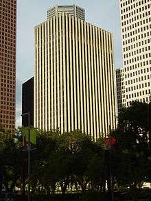
 Municipal Courts, northwest of Downtown
 Health Department, in the Northside
 Health and Human Services, south of Downtown
 Code Enforcement, located in Midtown
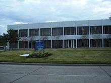 Houston Airport System Administration Building, near George Bush Intercontinental Airport
 Houston Parks and Recreation Department headquarters
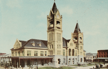 City Hall of Houston, 1913 illustration
 Post Office and Federal Building, 1913 illustration
See also
Notes
- ↑ Morris, Mike. "Houston voters lengthen term limits for city officials". Houston Chronicle. Retrieved 7 June 2016.
- ↑ City Council may grow by two seats. Houston Chronicle.
- ↑ Klineberg, Stephen. Houston Area Survey 1982–2005, Page 40.
- 1 2 Lee, Renée C. "Annexed Kingwood split on effects." Houston Chronicle. Sunday October 8, 2006. A21. Retrieved on July 6, 2011. Print version exclusively has the information cited; the information is not included in the online edition.
- 1 2 3 4 5 6 7 8 9 10 11 12 13 14 15 16 Moran, Chris. "Only 2 city incumbents lack opponents." Houston Chronicle. Thursday September 8, 2011. Retrieved on November 5, 2011.
- 1 2 3 4 5 Graham, Rusty. "Early voting underway through Nov. 4." The Memorial Examiner. Wednesday October 26, 2011. Retrieved on November 5, 2011.
- ↑ "District A incumbant [sic] Stardig faces two challengers." KTRK-TV. Tuesday November 1, 2011. Retrieved on November 5, 2011.
- ↑ McCoy, Terrence. "Helena Brown's Asian Adventures: DMZ, Fighter Jets -- But What About The Airlines?" Houston Press. Monday July 9, 2012. Retrieved on July 25, 2012.
- ↑ McCoy, Terrence. "Who's Behind Helena Brown?" Houston Press. Wednesday July 4, 2012. 2. Retrieved on July 25, 2012.
- 1 2 3 4 "Editorial: Kathy Ballard-Blueford Daniels for City Council." Houston Chronicle. Wednesday October 5, 2011. Retrieved on November 5, 2011.
- ↑ "Revised Council District B." City of Houston. Retrieved on November 5, 2011.
- 1 2 Mack, Kristen. "Small differences separate runoff candidates." Houston Chronicle. Friday December 9, 2005. 2. Retrieved on November 5, 2011.
- ↑ Rodriguez, Lori. "District B contest/Architect Reynaldo Pradia seeks to unseat Ernest McGowen." Houston Chronicle. Monday October 12, 1987. Section 1, Page 9. Retrieved on November 5, 2011.
- ↑ Moran, Chris. "City Council District C candidates target high-rises." Houston Chronicle. Monday October 10, 2011. Retrieved on November 5, 2011.
- 1 2 3 City of Houston, Council District Maps, District C." City of Houston. Retrieved on November 5, 2011.
- 1 2 "Map." Houston Heights. Retrieved on November 5, 2011.
- ↑ Connelly, Richard. "The Heights-Montrose-Museum District Council Seat: A Checklist for Potential Candidates." Houston Press. Wednesday May 11, 2011. Retrieved on November 5, 2011.
- 1 2 "Editorial: Ellen Cohen for City Council District C." Houston Chronicle. Thursday October 6, 2011. Retrieved on November 5, 2011.
- ↑ "Oak Forest Section Map." Oak Forest Homeowner's Association. Retrieved on June 16, 2009.
- 1 2 3 4 5 6 7 8 9 10 "Political challenge: Revised council redistricting plan offers Hispanics a third majority district." (editorial) Houston Chronicle. Wednesday May 18, 2011. Retrieved on November 5, 2011.
- ↑ Fountain, Ken. "Candidates square off for redrawn ‘hipstrict’ District C Houston council seat." The Bellaire Examiner. Tuesday November 1, 2011. Retrieved on November 5, 2011.
- 1 2 3 4 "Jigsaw puzzle: Creating two new Houston City Council seats poses demographic challenges." (editorial) Houston Chronicle. Wednesday January 26, 2011. Retrieved on November 5, 2011.
- 1 2 Mack, Kristen. "Council District C hopefuls push advocacy Diverse area has 7 candidates to pick from Nov. 8." Houston Chronicle. Friday October 21, 2005. Retrieved on November 4, 2011.
- ↑ Mason, Julie. "Chimney Rock issue may decide outcome of District C." Houston Chronicle. Sunday September 19, 1999. A35 MetFront. Retrieved on October 17, 2012.
- ↑ Connelly, Richard. "City Council Redistricting Map: Montrose and the Heights, (Somewhat) Together." Houston Press. April 6, 2011. Retrieved on November 5, 2011.
- 1 2 "Revised Council District D." City of Houston. Retrieved on November 5, 2011.
- ↑ Wallstin, Brian. "Situational Ethics." Houston Press. Thursday March 26, 1997. 1. Retrieved on November 5, 2011.
- 1 2 3 Mack, Kristen. "City Council hopefuls starting to make plans." Houston Chronicle. Friday January 5, 2007. Retrieved on November 5, 2011.
- ↑ Moran, Chris. "District F councilman facing both political, legal fights." Houston Chronicle. Sunday October 9, 2011. Retrieved on November 5, 2011.
- ↑ Hurst, Deborah. "Goodner stays away from focusing on gays in District F campaign." Houston Chronicle. Monday October 21, 1985. Section 1, Page 10. Retrieved on August 8, 2011.
- ↑ "Editorial: Pennington for council District G." (editorial) Houston Chronicle. Friday October 7, 2011. Retrieved on November 5, 2011.
- 1 2 Cobb, Kim. "District G candidates target area's service gaps as their first priority." Houston Chronicle. Saturday October 24, 1987. Section 1, Page 19. Retrieved on October 14, 2012.
- 1 2 Morris, Mike. "Pothole patrol looks for Houston's bumps." Houston Chronicle. Friday January 14, 2011. Retrieved on November 5, 2011.
- 1 2 3 4 "Revised Council District H." City of Houston. Retrieved on November 5, 2011.
- ↑ "Endorsement: Vote Gonzalez for District H seat." Houston Chronicle. Thursday June 4, 2009. Retrieved on November 5, 2011.
- 1 2 "Revised Council District I." City of Houston. Retrieved on November 5, 2011.
- 1 2 3 Shauk, Zain. "Hispanic-opportunity district draws three candidates." Houston Chronicle. Friday October 14, 2011. Retrieved on November 4, 2011. (Refer to image, Archive)
- ↑ Foster, Robin. "Candidates' forum offers reminder about new districts election: Fourm [sic] provides feedback Candidates' forum offers reminder about new districts." Houston Chronicle. Tuesday September 20, 2011. Retrieved on November 5, 2011.
- 1 2 "Editorial: Larry Green for council District K." (editorial) Houston Chronicle. Tuesday October 11, 2011. Retrieved on November 5, 2011.
- 1 2 3 4 Lee, Renée C. "New faces hoping to represent new District K." Houston Chronicle. Thursday October 20, 2011. Retrieved on November 5, 2011.
- ↑ Sendejas, Jesse. "Planning for the future / Super neighborhood councils try to boost community services." Houston Chronicle. Wednesday September 27, 2000. ThisWeek 1. Retrieved on February 20, 2010.
- ↑ "Our Parks." City of Houston. Retrieved on April 4, 2010.
- ↑ "Our Parks G-N." City of Houston. Retrieved on April 4, 2010. Keith-Weiss Park is operated by the City of Houston, but at 12300 Aldine-Westfield it is in an unincorporated area in Harris County, Texas.
- ↑ "Houston District Office." Texas Department of Transportation. Retrieved on January 11, 2010.
- ↑ "Parole Division Region III." Texas Department of Criminal Justice. Retrieved on May 15, 2010.
- ↑ "Kegans (HM)." Texas Department of Criminal Justice. Accessed September 12, 2008.
- 1 2 "New regional release centers now operating across state." Texas Department of Criminal Justice. September–October 2010. Retrieved on March 1, 2011.
- ↑ Schiller, Dane. "Walking free - now what?" Houston Chronicle. May 9, 2010. Retrieved on May 10, 2010.
- 1 2 "Facility Address List." Texas Youth Commission. Retrieved on May 6, 2010.
- ↑ "Map Major Roads." Greater Sharpstown Management District. Retrieved on August 15, 2009.
- ↑ Knight, Paul. "Texas' Youth Prisons Among The Worst For Sexual Abuse, Study Finds." Houston Press. Wednesday January 13, 2010. Retrieved on July 16, 2010. "And at the closest youth prison to Houston, the Al Price State Juvenile Correctional Facility in Beaumont,"
- ↑ "TYC Announces Closure of Three Facilities." Texas Youth Commission. Retrieved on July 3, 2011.
- ↑ "Post Office Location - HOUSTON." United States Postal Service. Retrieved on December 4, 2008.
- ↑ Sarnoff, Nancy. "Downtown Houston post office up for sale." Houston Chronicle. February 25, 2009. Retrieved on February 25, 2009.
- ↑ "Houston Field Office." (Archive) U.S. Citizenship and Immigration Services. Retrieved on May 7, 2010. "Local Office for Texas Street Address The USCIS office that serves your area is the: Houston Field Office. This office is located at: 126 Northpoint Drive Houston, TX 77060."
- ↑ "Investigations - Contacts." U.S. Immigration and Customs Enforcement. Retrieved on May 22, 2010.
- ↑ "Houston Contract Detention Facility." U.S. Immigration and Customs Enforcement. Retrieved on May 22, 2010.
- ↑ "Contact Us." Federal Reserve Bank of Dallas. Retrieved on May 22, 2010.
- ↑ "Boundary.png." Fourth Ward Redevelopment Authority. Retrieved on July 2, 2011.
- ↑ "Districts for Houston". Texas Legislature. Retrieved July 1, 2011.
External links
| Wikimedia Commons has media related to Government of Houston. |