Transportation in Houston
Roads and highways
 
|


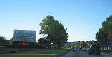
Houston’s freeway system includes 575.5 miles of freeways and expressways in the 10-county metro area.[1] The State of Texas plans to spend $5.06 billion on Houston area highways between 2002 and 2007. Houston freeways are heavily traveled and often under construction to meet the demands of continuing growth. Interstate 45 south has been in a continuous state of construction, in one portion or another, almost since the first segment, the Gulf Freeway—Texas's first freeway—was opened in 1948. Texas Department of Transportation (TxDOT) planners have sought ways to reduce rush hour congestion, primarily through High-occupancy vehicle (HOV) lanes for vans and carpools. Timed freeway entrances, which regulate the addition of cars to the freeway, are also common. Houston has an extensive network of freeway cameras linked to a traffic management center,[2] to monitor and study traffic. One characteristic of Houston's freeways (and Texas freeways in general) are its frontage roads (which locals call "feeders"). Alongside most freeways are two to four lanes in each direction parallel to the freeway permitting easy access to individual city streets. Frontage roads provide access to the freeway from businesses alongside, such as gas stations and retail stores. New landscaping projects and a longstanding ban on new billboards are ways Houston has tried to control the potential side effects of convenience.
Houston has a hub-and-spoke freeway structure with multiple loops. The innermost is Interstate 610, forming approximately a 10-mile-diameter (16 km) loop around downtown. The roughly square "Loop-610" is quartered into "North Loop," "South Loop," "West Loop," and "East Loop." The roads of Beltway 8 and their freeway core, the Sam Houston Tollway, are the next loop, at a diameter of roughly 25 miles. A proposed highway project, State Highway 99 (The Grand Parkway), would form a third loop outside of Houston, though some sections of this project have been controversial. As of June 2016, two portions of State Highway 99 have been completed: a 14.5-mile segment completed in April 2008 that runs from Interstate 10 in Mont Belvieu to Business State Highway 146 in Baytown, east of Houston; and a 71-mile segment completed between August 1994 and March 2016 that runs from Interstate 69/U.S. Highway 59 in Sugar Land, southwest of Houston, to Interstate 69/U.S. Highway 59 in New Caney, northeast of Houston. The next portions to be constructed are from the current terminus at Interstate 69/U.S. Highway 59 in Sugar Land to State Highway 288 in Brazoria County, and from the current terminus at Interstate 69/U.S. Highway 59 in New Caney to the current terminus at Interstate 10 in Mont Belvieu.
Houston also lies along the route of the proposed Interstate 69 North American Free Trade Agreement (NAFTA) superhighway that will link Canada, the U.S. industrial mid-west, Texas, and Mexico.
Mass transit


The Metropolitan Transit Authority of Harris County, Texas, or METRO, provides public transportation in the form of buses, trolleys, and lift vans.
METRO began running light rail service (METRORail) on January 1, 2004. Currently the track runs approximately 13 miles (20.8 km) from Downtown Houston to the Texas Medical Center and Reliant Park Southbound and to the Northline Mall Northbound. METRO operates an extensive park-and-ride bus system to serve many of Houston's outlying suburban areas. Most of the park-and-ride buses run in barrier-separated high-occupancy-vehicle (HOV) lanes that provide direct service from park-and-ride parking lots to major employment destinations. Prior to the opening of METRORail, Houston was the largest city in the United States without a rail transit system.
Following a successful referendum held locally in 2003, METRO is currently in the beginning design phases of a 10-year expansion plan to add five more sections to connect to the current rail system. An 8.3 mile (13.4 km) expansion has been approved to run the service from the Uptown through Texas Southern University, ending at the University of Houston campus.
In addition, Harris County Transit operates some services in the portion of Clear Lake City in Houston.[3]
Airports
Airports within the city limits

Houston is served by two commercial airports—the largest of which is the George Bush Intercontinental Airport (IAH). The airport is the 11th-busiest in the United States for total passengers, and 16th busiest worldwide. Bush Intercontinental is United Airlines largest hub, with more than 650 daily departures (more than 450 of which are United flights).[4]
Bush Intercontinental currently ranks second in the United States for non-stop domestic and international service (221 destinations), trailing only Atlanta Hartsfield with 250 destinations. In 2006, the United States Department of Transportation named Bush Intercontinental one of the top ten fastest growing airports in the United States.
The second-largest commercial airport in Houston is the William P. Hobby Airport (named Houston International Airport until 1967). The airport operates primarily small to medium-haul flights and is the only airport in Houston served by Southwest Airlines and JetBlue Airways.
The third-largest airport and former U.S. Air Force base, Ellington Airport (formerly Ellington Field[5]), is primarily used for government and private aircraft. At one point, Continental Express operated flights across the city to Bush Intercontinental primarily for residents of southeast Houston and Galveston County. Passenger flights ended on September 7, 2004.
The Federal Aviation Administration and the state of Texas selected the Houston Airport System, which manages Bush, Hobby, and Ellington, as Airport of the Year for 2005, largely because of its multi-year, $3.1 billion airport improvement program for both major airports in Houston.
Andrau Airpark, a privately owned airport, was located in Houston until 1998; it was demolished and as of 2008 contains the Royal Oaks Country Club subdivision.
Airports for fixed-wing aircraft outside the city limits
Publicly owned airports outside the city limits
The following publicly owned airports are in the Houston area:
- Harris County:
- La Porte Municipal Airport in La Porte
- Baytown Airport in unincorporated east Harris County, north of Baytown
- Fort Bend County:
- Galveston County:
- Scholes International Airport at Galveston, a general aviation and military airport, is located in Galveston
- Montgomery County:
- Brazoria County:
- Texas Gulf Coast Regional Airport between Lake Jackson and Angleton in an unincorporated area
- Liberty County:
- Liberty Municipal Airport is in Liberty.
- Cleveland Municipal Airport is in Cleveland.
- Chambers County:
- Chambers County Airport in an unincorporated area, east of Anahuac
- Chambers County-Winnie Stowell Airport in an unincorporated area, near Winnie and Stowell
Privately owned airports outside the city limits
The following privately owned airports for public use are in the Houston area:
- Harris County
- West Houston Airport is a general aviation airport located in unincorporated western Harris County, west of the Houston city limits.
- David Wayne Hooks Memorial Airport, a general aviation airport, is located outside of the Tomball city limits in unincorporated northwest Harris County.
- Weiser Air Park is in unincorporated northwest Harris County.
- Sack-O-Grande Acroport (also known as Harbican Airport) is located in an unincorporated area in western Harris County
- Fort Bend County
- Houston Southwest Airport in Arcola
- Westheimer Air Park in an unincorporated area
- Happy Landings Airport in an unincorporated area
- Brazoria County
- Skyway Manor Airport in Pearland
- Pearland Regional Airport (also known as Clover Field Airport) south of Pearland in an unincorporated area
- Flyin' B Airport in an unincorporated area
- Chambers County
- Waller County
- Houston Executive Airport is located in an unincorporated area
- Skydive Houston Airport (Skylake Airport) is located in an unincorporated area
Air traffic control center
The Houston Air Route Traffic Control Center stands on the George Bush Intercontinental Airport grounds.
Intercity rail
Amtrak, the national rail passenger system, provides service to Houston via the Sunset Limited (Los Angeles–New Orleans), which stops at the Houston Station on the north side of the Downtown area. The station saw 10,855 boardings and alightings in FY 2006.[6]
A high-speed rail line is proposed to run non-stop from Houston to Dallas by the year of 2020.
Intercity bus

Greyhound Lines operates services from five stations:
- Houston Greyhound Station at 2121 South Main Street
- Coach USA Inc. Dept. Casin (Houston Crosstimbers) at 4001 North Freeway
- The Box Store (Houston Northwest) at 1500 West Loop North Suite 117
- Americanos U.S. L.L.C. (Houston Southeast) at 7000 Harrisburg Street
- Agencia Autobuses (Houston Southwest) at 6590 Southwest Freeway
In addition, Greyhound operates services from two stops :
Greyhound also provides seamless connecting service to major cities in Mexico via Autobuses Americanos at the main bus station in midtown.
Greyhound also operates services to stops within the Greater Houston area, including:
- Alvin (Yellow Jacket Grocery-Citgo)
- Angleton (Ocampos Mexican Rest)
- Baytown (Baytown Travel Express)
- Conroe (Conroe Greyhound Station)
- Galveston (Galveston Bus Station)
- Katy (at Millers Exxon)
- Prairie View (at Unco Food Store)
- Rosenberg (at Shell-McDonalds)
- Sealy (at Mazac Muffler City-AC)
- Texas City (at McKown Air Conditioning, also serving La Marque)
Kerrville Bus Company operates from the Houston Greyhound Station in conjunction with Greyhound.
Megabus operates low-cost double-decker coaches from Houston to major cities in Texas and Louisiana.
El Expreso Bus Company operates services to a station in Houston adjacent to the Greyhound Station.
Tornado Bus Company operates services to two stations in Houston , with one along Airline Drive and one along Harrisburg.
In the 1990s various bus companies began operations in the East End, serving Mexico and other parts of the United States from East End terminals.[7]
Intercity bus to airport
VivaAerobus, a Mexican airline, operated a bus shuttle between Austin-Bergstrom International Airport South Terminal and the Omnibus Mexicanos Bus Terminal in eastern Houston for VivaAerobus passengers on flights going to and from Cancun and Monterrey.[8] On May 16, 2009, VivaAerobus stated it would cease passenger operations at Austin-Bergstrom International Airport on May 31, 2009. The airline blamed the pullout in part on the outbreak of the swine flu, which caused an unprecedented decrease in demand for service.[9]
Pedestrian travel
Texas Department of Transportation statistics said that in an eight county area including Houston, between 2003 and 2008, around 100 pedestrians died and 1,175 were injured in accidents every year. Mark Seegers, a spokesperson for Harris County commissioner Sylvia Garcia, said in 2009 that "The county does not do sidewalks; it’s not what gets cars [the predominate form of transportation in the Houston area] from point A to point B." Robin Holzer, a transportation advocate with the Citizens' Transportation Coalition, criticized the emphasis on automobiles, saying "The people on foot and bike are trying to go to the same schools and restaurants and shops as people in cars are going to."[10]
In 2005 the Houston-Galveston Area Council identified several communities in Harris County considered to be among the most hazardous to pedestrians. Many of them, including Greenspoint and Gulfton, are located outside of the 610 Loop.[11] In 2009 the lobby group Transportation for America said that the Houston area was the eighth most dangerous area for pedestrians in 2007-2008.[12]
In 2013, Mayor Annise Parker announced the "Houston Complete Street and Transportation Plan", which was an executive order calling for enhanced pedestrian and bicycling modes of transportation when planning new or reconstructing streets.[13] Combined with the "ReBuild Houston" initiative approved by Houston voters in 2010, many new streets have been redesigned using the complete street guidelines.
Houston currently has over 300 miles of City-constructed bike lanes, bike routes, shared lanes, bayou trails and rails-to-trails across a 500 square mile area of Houston.
Demographics by mode of travel
Dan Felstein and Claudia Kolker of the Houston Chronicle said in 1997 that most Houstonians who take public transportation are poor. A 1995 survey concluded that 76% of people riding on local bus lines of the Metropolitan Transit Authority of Harris County (METRO) took the buses because they had no other means of transportation. A 1993 survey concluded that of the people who had stopped riding local bus routes of METRO, 46% had acquired or repaired automobiles. 37% of the respondents said that METRO could not possibly do anything to convince them to ride the buses again.[14]
As of U.S. Census figures current as of 1997, 9% of residents in Harris County did not own automobiles. This figure does not include people who own cars, but do not have enough money to repair the automobiles. As of that year, while the average income of all residents of the county was $41,000, the average income of households without cars was $13,000.[14]
In Harris County, the average one way commute for a person using an automobile was 25 minutes, while the average commute for a person not using an automobile was 44 minutes, a 76% longer duration than the figure for commuters with cars.[14]
As of 1997 many of the lower socio-economic groups, such as the homeless or new-immigrants, rely on bicycles, family members, and neighbors for transportation. Dan Feldstein and Claudia Kolker of the Houston Chronicle said that "ironically, some of the poorest Houstonians have wider transportation options than their middle-class counterparts."[14]
References
- ↑ http://www.houston.org/economic-development/facts-figures/transportation-infrastructure/index.aspx
- ↑ http://www.HoustonTranStar.org Houston TranStar
- ↑ "Clear Lake/La Porte/Seabrook 5." Harris County Transit. Retrieved on January 15, 2010.
- ↑ http://newsroom.unitedcontinentalholdings.com/index.php?s=20306&item=29970. Missing or empty
|title=(help) - ↑ "Ellington name changes from “Field” to “Airport”." Houston Airport System. January 15, 2009. Retrieved on January 17, 2009.
- ↑ Amtrak Fact Sheet, Fiscal Year 2006. Amtrak. 2006. Retrieved on 2007-03-27.
- ↑ Berryhill, Michael. "East End Transit." Houston Press. 1.
- ↑ https://web.archive.org/web/20080922195842/http://www.vivaaerobus.com/us/shuttleservices/austinhouston.htm?. Archived from the original on September 22, 2008. Retrieved August 25, 2008. Missing or empty
|title=(help) - ↑ Eaton, Tim. "VivaAerobus to cease operations out of Austin-Bergstrom." Austin American-Statesman. Saturday May 16, 2009. Accessed May 16, 2009.
- ↑ Feibel, Carolyn. "Why walking in Houston is hazardous to your health." Houston Chronicle. November 10, 2009. Retrieved on November 10, 2009.
- ↑ Wall, Lucas, Bill Murphy, and Rosanna Ruiz. "Suburbs often are hazardous to walkers / Two recent deaths point to lack of protection for pedestrians." Houston Chronicle. March 29, 2005. A1. Retrieved on December 13, 2008.
- ↑ "Study: Houston not so good for walking." Houston Business Journal. Tuesday November 10, 2009. Retrieved on November 11, 2009.
- ↑ "Mayor Annise Parker Announces Visionary Complete Streets Policy For Houston" (Press release). October 10, 2013. Retrieved July 15, 2015.
- 1 2 3 4 Feldstein, Dan and Claudia Kolker. "Carless in Houston/Going carless/View is different from the slow lane." Houston Chronicle. June 15, 1997. Retrieved on August 8, 2011.
See also
- Houston Highway Construction